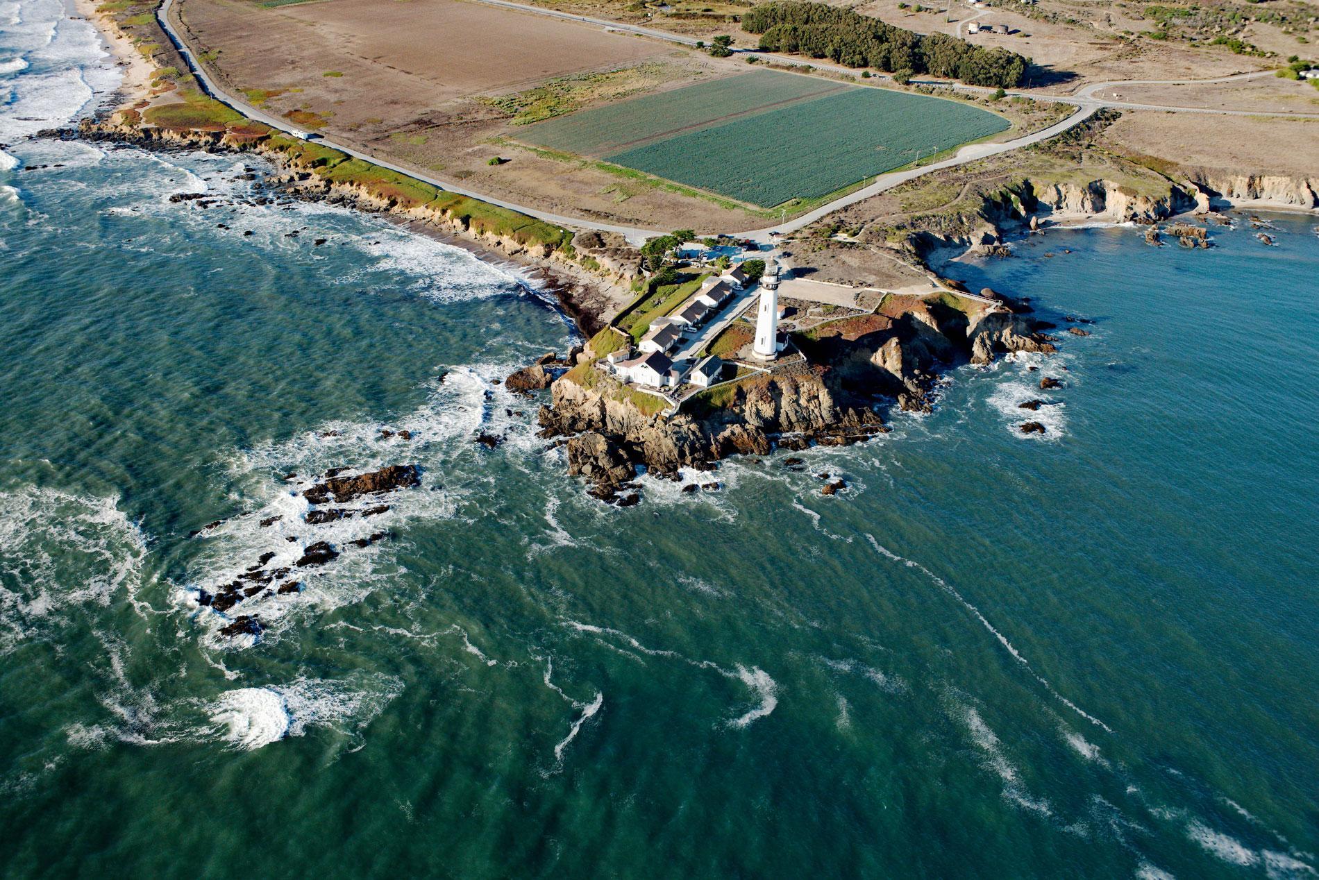
Pigeon Point is a prominent headland and the site of a historic lighthouse, situated between Bolsa Point to the north and Franklin Point to the south, about 25 miles (40 km) northwest of Santa Cruz and 5 miles (8 km) south of Pescadero, California. The point is named for Carrier Pigeon, a clipper ship 175 feet (53 m) long with a gilded pigeon as her figurehead, which was launched at Bath, Maine in the fall of 1852. Pigeon Point is formed by bedrock consisting of pebbly sandstone, and mudstone that is exposed as wave-cut platforms for 10 miles (16 km) along the coast. The rock formation developed during the Late Cretaceous as turbiditic submarine fan deposits. They are part of a geologic province known as the Salinian Block which lies west of the main trace of the San Andreas Fault system represented at Pigeon Point by the Seal Cove-San Gregorio Fault. The bedrock between Bolsa Point and Pigeon Point is covered by marine terrace deposits that emerged about 80,000 to 85,000 years ago probably by repeated slip earthquakes on the San Andreas Fault.
The first humans settled along the California coast about 14,000 years ago. In 1769, the first Spanish overland expedition under the command of Gaspar de Portolá traveled north along the coast from Baja California and were given food along the way, including by the Quiroste Ohlone people near Pigeon Point. In 1791, Franciscan priest Fermín Francisco de Lasuén established a mission at Santa Cruz and cattle were grazed on the marine terraces. After the Mexican revolution and independence from Spain in 1822, the First Mexican Republic government secularized the missions and granted large coastal properties to military veterans, influential families, and politicians. In 1842, a land grant 17,753 acres (7,184 ha) called Rancho Punta del Año Nuevo was given by Governor Juan B. Alvarado to Simeon Castro. The grant extended along the Pacific coast from Rancho Butano and Arroyo de los Frijoles to the north, past Pigeon Point, Franklin Point and Point Año Nuevo to the south. The California gold rush, and subsequent statehood in 1850, attracted droves of settlers who started row crop farms which continue to the present-day.
On January 28, 1853, Carrier Pigeon departed from Boston on her maiden voyage around Cape Horn to San Francisco. On the morning of June 6, the vessel was off Santa Cruz, but as the day progressed a thick fog developed and the captain, believing he was a good distance from land, steered shoreward but soon struck rocks and the vessel sank. At least three more ships were lost near Pigeon Point in the 1860s. In 1871, the light station at Pigeon Point was built with a white masonry tower 115 feet (35 m) high, which is one of the tallest lighthouses on the west coast of the United States and can be seen for 28 miles (44 km) at sea. Since the 1960s, the keepers’ housing is maintained as a hostel for travelers. In 2004, California State Parks and Peninsula Open Space Trust filed a joint application and were granted ownership of the lighthouse and surrounding land as the Pigeon Point Light Station State Historic Park. Read more here and here. Explore more of Pigeon Point Lighthouse and Pigeon Point here:

