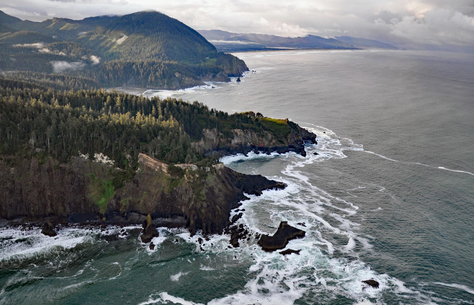
Cape Falcon is a headland situated between Short Sand Beach in Smugglers Cove to the south and Cove Beach to the north, and is part of Oswald West State Park and adjacent to Cape Falcon Marine Reserve, about 23 miles (37 km) north-northwest of Tillamook and 9 miles (14.5 km) south of Cannon Beach, Oregon. The cape was named in 1775 by Spanish explorer Bruno de Heceta after Santa Clara de Montefalco, but was also known by other names until 1887 when George Davidson, the chief cartographer for the U.S. Coast Survey published the name Cape Falcon on official charts. Cape Falcon with a summit elevation of about 1,010 feet (308 m) and neighboring Neahkahnie Mountain with an elevation of 1,680 feet (512 m) are prominent headlands that are part of the Coast Range. The rocks of the Coast Range were formed in the ocean during Eocene, Oligocene, and Miocene times. Fairly early in the Miocene, the Coast Range was elevated, and the older rocks were folded and faulted. Sediments eroded from the uplifted land were deposited in bays along with shells of mollusks and other marine animals. These beds have been named the Astoria Formation after the town where the formation was first described. While the Astoria Formation was being deposited, basalt was extruded onto the sea floor from a group of submarine volcanic vents. This volcanism was happening at approximately the same time as the outpourings of Columbia River basalt in the Columbia River Gorge region. The rock formations were subsequently uplifted and exposed to wave erosion resulting in a narrow coastal plain of marine terraces interrupted by basalt headlands such as Cape Falcon which is more resistant to erosion than the surrounding sedimentary rocks of the Astoria Formation.
Cape Falcon lies within the traditional territory of the Tillamook people that extended from Tillamook Head in the north to Cape Foulweather in the south and inland to the crest of the Coast Range. The Tillamook people are the most southern branch of the Coast Salish and are separated from the northern Coast Salish by the Clatsop people and other tribes that speak Chinookan languages. The name Tillamook is of Chinook origin and means the people of Nehalem. The first documented encounter with Euro-Americans was in 1788 when Captain Robert Gray on the Lady Washington entered Tillamook Bay and went ashore for supplies. Fighting erupted with the local Tillamook people, and Marcus Lopez, Gray’s cabin boy and cook from West Africa’s Cape Verde Islands, was killed. The second encounter was in late 1805 when a group from the Lewis and Clark Expedition, who were wintering at Fort Clatsop, ventured south to where a whale had washed ashore near present-day Ecola Head, and traded with the Tillamook for some blubber that could be rendered for oil. In 1824, and 1829, the tribe suffered high mortality from smallpox introduced by Europeans. The arrival of Oregon Trail settlers in 1841 and resulting conflicts over land and resources caused further population losses. In 1856, the federal government forced the Tillamook and more than twenty other coastal tribes to the Siletz Reservation. In 1911, Oregon Governor Oswald West sought to preserve the state’s beaches for public use and declared them public highways. In 1929, Samuel Boardman became Oregon’s first director of state parks and received a proposal from Helen Drollinger, who together with Sam Reed would contribute land. During the next ten years Boardman acquired 2,474 acres (1,001 ha) along 5 miles (8 km) of coastline from the north slope of Arch Cape to the south slope of Neahkahnie Mountain. The park was originally named Short Sand Beach State Park, and in 1956, the name was changed to honor Oswald West.
Marine protected areas are places in the sea designed to protect marine species and ecosystems, while sometimes allowing for sustainable uses of marine resources within their boundaries. The main goal of this management tool is to preserve or restore the abundance and diversity of marine life. Scientific monitoring of marine protected areas can guide management to find a balance between the level of protection required and the needs of local communities affected. Marine protected areas can provide either partial protection, where some uses are prohibited but some extractive activities are allowed and regulated, or provide full protection, where all extractive and destructive activities are forbidden, except as needed for scientific monitoring. Fully protected areas are also called no-take areas. Cape Falcon Marine Reserve was designated in 2016 and is the second largest of five marine reserves on the Oregon coast with 7,936 acres (3,212 ha) in the marine reserve with the highest degree of protection. The marine reserve prohibits ocean development and the removal of any marine life from just north of Manzanita to the north end of Cape Falcon at Falcon Cove. Safe passage and anchoring of boats are allowed as long as fishing gear is not deployed. Another 4,864 acres (1,968 ha) were designated as additional marine protected areas with more limited protection. In the Cape Falcon Shoreside Marine Protected Area only fishing from the beach is allowed. In the West Marine Protected Area, only salmon fishing by troll, and crabbing, are allowed. Read more here and here. Explore more of Cape Falcon and Oswald West State Park here:

