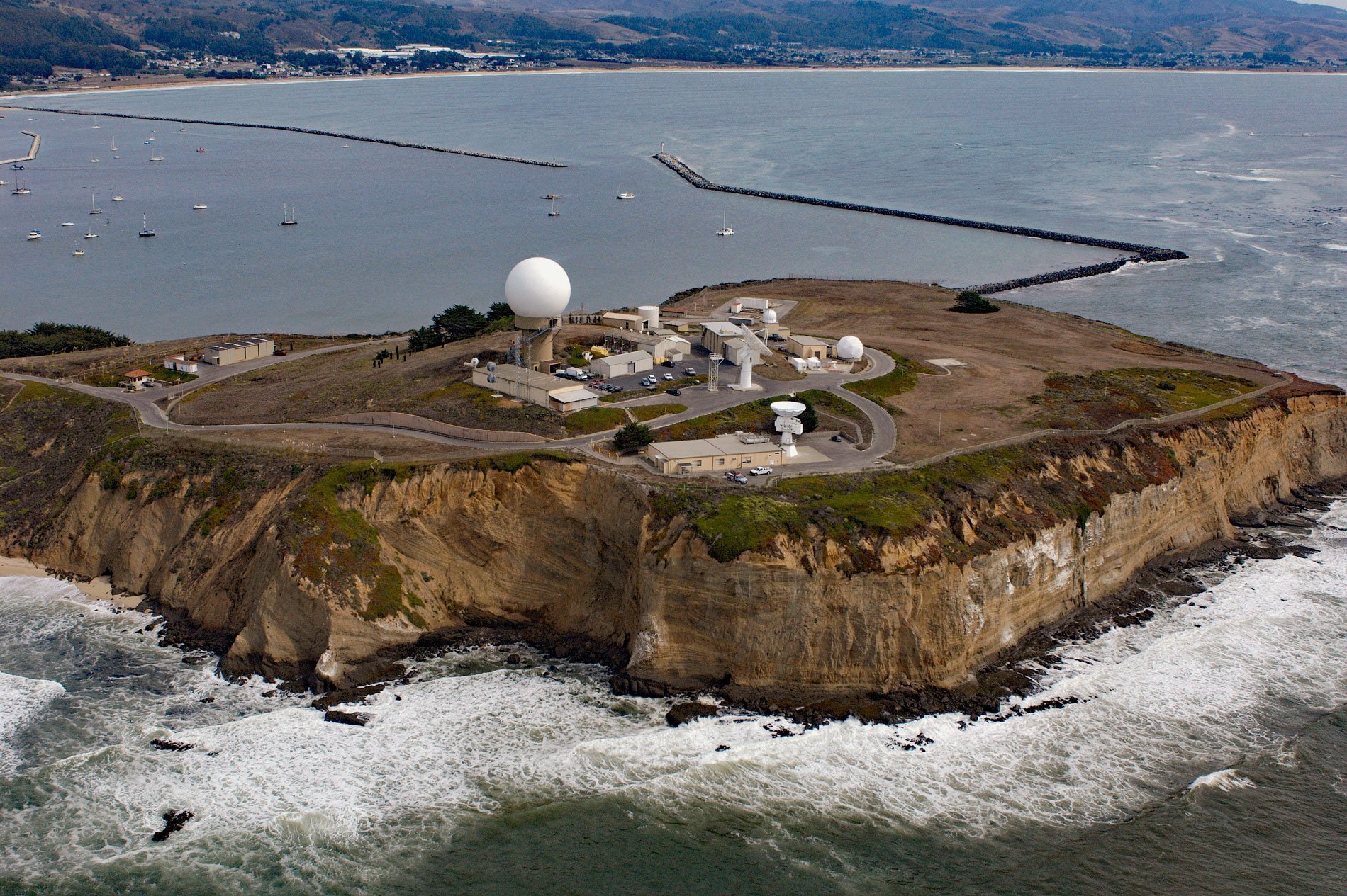
Pillar Point is a prominent headland forming the northwestern shore of Half Moon Bay and providing partial protection for Pillar Point Harbor, and the site of Pillar Point Air Force Station and a famous surf location called Mavericks, about 20 miles (32 km) south-southwest of San Francisco and 4 miles (6.5 km) northwest of the community of Half Moon Bay, California. A settlement called Pilares was shown on Spanish maps from 1830 at the present-day town of Half Moon Bay. It was probably named for a rocky formation at the nearby point that once resembled a pillar. The point was originally named Miramontes on the U.S. Coast Survey chart of 1854 but was also known as Point Corral de Tierra in 1859. When Half Moon Bay was charted in 1862 by the U.S. Coast Survey, the point was renamed Pillar Point. The rock forming the point consists of poorly lithified sand and gravel that were deposited over mudstone during the Pleistocene and subsequently uplifted as a marine terrace with cliffs up to 130 feet (40 m) high. The cliffs at Pillar Point have one of the highest erosion rates in the region south of Half Moon Bay, where the dominant geomorphic features are elevated marine terraces, and the processes of retreat are erosion slumps and block falls rather than large deep-seated slides more characteristic of the coast north of Half Moon Bay. The cliffs on the north side of Pillar Point have retreated about 690 feet (210 m) over the last 70 years, or about 10 feet (3 m) per year.
Half Moon Bay is the traditional territory of the Chiguan Ohlone people who inhabited the coast since about 500 AD, possibly displacing or assimilating an earlier Hokan-speaking population that inhabited the area from at least 5,800 years ago. The Ohlone were a hunter-gatherer culture with a staple diet consisting of crushed acorns, nuts, grass seeds, and berries. Evidence suggests that plants from Pillar Point Marsh were an important source of food. They also hunted and trapped game and caught fish and shellfish. The Portolá Expedition from 1769 to 1770 was the first Spanish overland exploration of California and followed the coast from San Diego to the San Francisco Peninsula routing around Half Moon Bay. The diary of Father Juan Crespí provides detailed descriptions of the landscape, vegetation, and activities of Chiguan Ohlone people. The rocky coast likely discouraged European sailors from landing in the area before 1776 when Mission San Francisco de Asís was established and the marine terraces surrounding Half Moon Bay were subsequently developed as an agricultural outpost. The Chiguan Ohlone people were conscripted for labor and baptized, but introduced diseases decimated their population. After the Mexican War of Independence from Spain in 1821, the missions were secularized, and huge land grants were made by the Mexican government to prominent citizens and military veterans. In 1839, a land grant of 4,436 acres (1,795 ha) called Rancho Corral de Tierra Vasquez which included Pillar Point was given by Governor Pro-Tem Manuel Jimeno Casarín to Tiburcio Vasquez.
Mexico ceded Alta California to the United States in 1848 and California became a state in 1850, and shortly thereafter, part of the land grant was in the hands of James G. Denniston, a state assemblyman who was farming and grazing cattle on portions of the marine terraces. He built a deep-water landing for schooners at Pillar Point, and it was for many years the key shipping point for north coast lumber, hay and produce being sent to San Francisco, as well as a shore whaling station. From 1905 to 1920, the harbor was one of the main stops on San Francisco & Ocean Shore Railroad. In 1940, property on the point was purchased by the U.S. Army for an observation post during World War II. In 1958, the U.S. Navy took over and used the station as a control site for missile testing. Ownership of the site was transferred to the U.S. Air Force in 1964 as the Pillar Point Air Force Station to support ballistic missile test launches out of Vandenberg Air Force Base. In 2004, San Mateo County adopted the Fitzgerald Marine Reserve Master Plan. The marine reserve is 32 acres (13 ha) and extends from Montara in the north to Pillar Point in the south. The reserve consists of 3 miles (5 km) of beach, tidepool habitat, marsh, and coastal bluffs with a section of the California Coastal Trail. The property is owned by the State of California and managed by San Mateo County as a county park and nature preserve. Montara State Marine Reserve & Pillar Point State Marine Conservation Area extends the protection offshore for ocean wildlife and marine ecosystems. Read more here and here. Explore more of Pillar Point and Half Moon Bay here:

