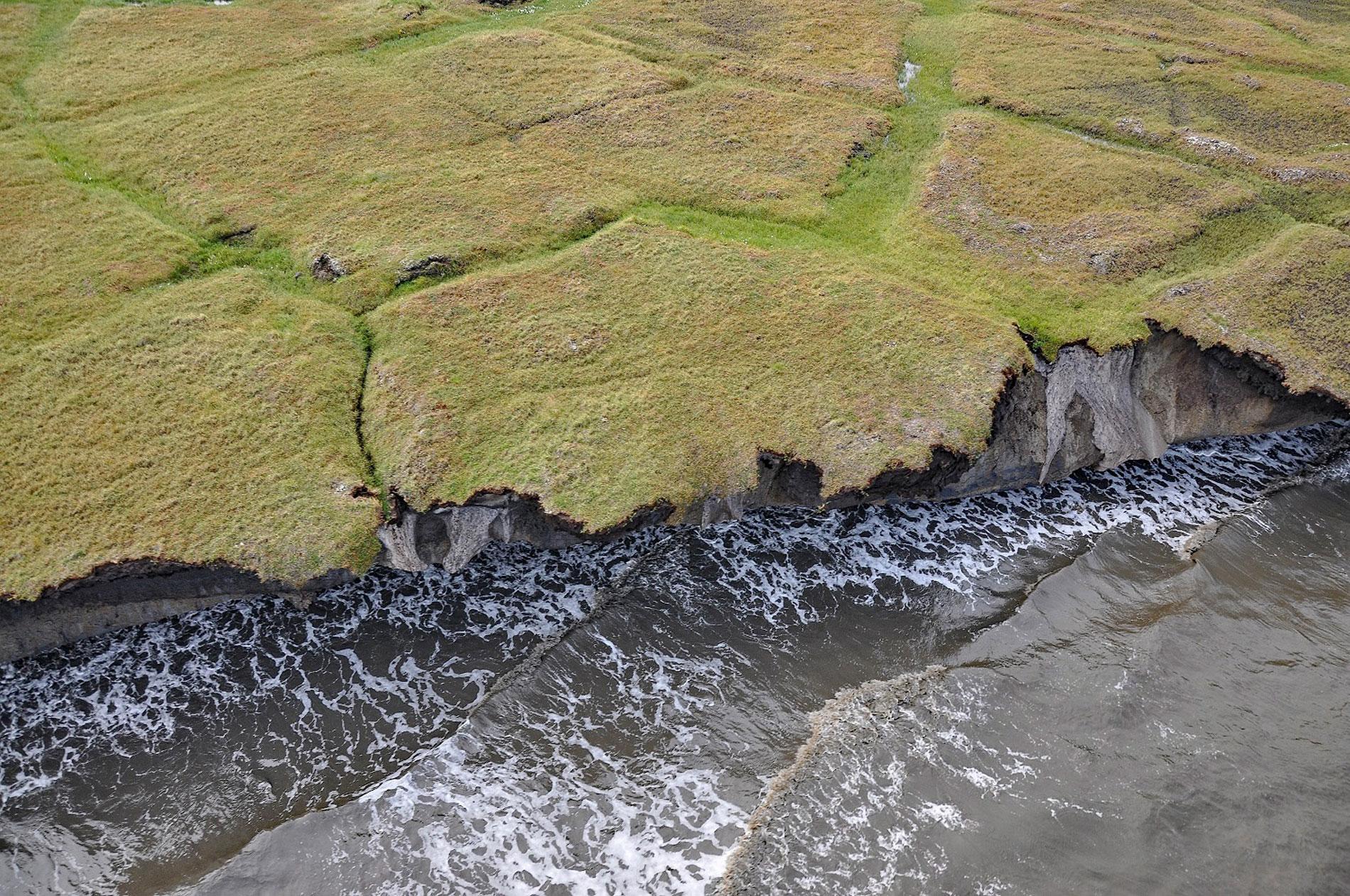
Drew Point is located at the eastern entrance to Smith Bay on the Beaufort Sea and is formed by rapidly eroding permafrost and ice wedges at the edge of the Arctic Coastal Plain, about 81 miles (131 km) northwest of Nuiqsut and 70 miles (113 km) southeast of Utqiaġvik, Alaska. Smith Bay and Drew Point were named in 1837 by Thomas Simpson after Edward Smith and Richard Drew who were employees of the Hudson’s Bay Company at the Fort Chipewyan trading post on Lake Athabasca. The underlying bedrock represents the Sagavanirktok Formation that developed during the early Cenozoic about 65 million to 2 million years ago. The rock consists of poorly lithified siltstone, shale, and sandstone with local ash beds about 525 feet (160 m) thick. The Arctic Coastal Plain is mostly permafrost, ground that has remained frozen for a minimum of two years but most permafrost at high latitudes is many thousands of years old. Permafrost usually consists of a combination of ice, frozen soil, rock, and organic materials and in some places can be over 2,000 feet (650 m) thick. Permafrost absorbs the impact of ocean waves and protects against coastal erosion along with sea ice that blocks waves from reaching the shore. The rate of coastal erosion is accelerating along the coastal plain and the main mechanisms are the melting of permafrost and the increased wave attack caused by more frequent and intense storms on an ice-free ocean.
Approximately 4,500 years ago a group of terrestrial mammal hunters spread eastward from Beringia to Greenland, forming small settlements along the Alaskan and Canadian coasts. These people are known collectively as the Paleo-Eskimos, and they inhabited the northern Arctic coast for 3,000 years, developing regional cultural variants in Canada and Greenland. Between 800 and 750 years ago, a new cultural tradition called the Neo-Eskimo Thule and economically centered around whale hunting rapidly spread eastward through Paleo-Eskimo territories, reaching Greenland in only a few centuries. These Neo-Eskimos are the inhabitants encountered at European contact and become the present-day Alaskan Inupiat, Canadian and Greenlandic Inuit, and Siberian Eskimo. In 1825, Captain Frederick W. Beechey was appointed to command HMS Blossom. His task was to explore the Bering Strait and attempt to rendezvous with Sir John Franklin who was exploring westward from the mouth of the MacKenzie River. Beechey reached Point Barrow and was blocked by ice, and Franklin stopped at Return Reef leaving a gap of uncharted coast about 180 miles long. From 1836 to 1839, Thomas Simpson was involved in an expedition to chart the gaps left by other expeditions in search of the Northwest Passage. The party was headed by Peter W. Dease and left Fort Chipewyan in June and reached the Arctic at the MacKenzie River mouth in July. They then travelled west along the coast, passing Franklin’s Return Reef until they were blocked by ice at a place called Boat Extreme, about 50 miles (80 km) east of Point Barrow. Simpson and five men then continued on foot and reached Point Barrow in August, successfully completing their task.
For thousands of years, the rate of coastal erosion has been buffered by sea ice and permafrost, and without it, coastal erosion is accelerating and now threatens critical infrastructure. Drew Point is characterized by coastal bluffs consisting of sand and clay 10 to 16 feet (3-5 m) tall with an ice content typically greater than 30 percent and as high as 70 percent. The coastal bluffs retreat when wave erosion cuts a notch into the base of the bluff, which subsequently collapses. Erosion rates along 37 miles (60 km) of the Beaufort Sea coast between Drew Point to the west and Cape Halkett to the east, doubled from 22 feet (6.8 m) per year from 1955 to 1979, to 45 feet (13.6 m) per year from 2002 to 2007, with some local observations as high as 98 feet (30 m) per year. Notch incision occurs when water rises to the base of the bluff, typically during a storm surge. Nearshore sea ice now disappears earlier in the beginning of the open-water season, and open-water conditions persist longer into the autumn. Very little coastal erosion occurs in the fall when water temperatures are cooler. However, as most projections for the future Arctic include increased sea levels, warmer ocean waters, and lengthened sea ice-free seasons, this coastline is expected to experience some of the greatest future changes due to coastal erosion. Existing petroleum and military infrastructure along the Alaskan Beaufort Sea coast, such as oil exploration wells and Northern Warning System sites, are increasingly in jeopardy, and several structures have already been destroyed or removed due to land loss. Read more here and here. Explore more of Drew Point and Smith Bay here:

