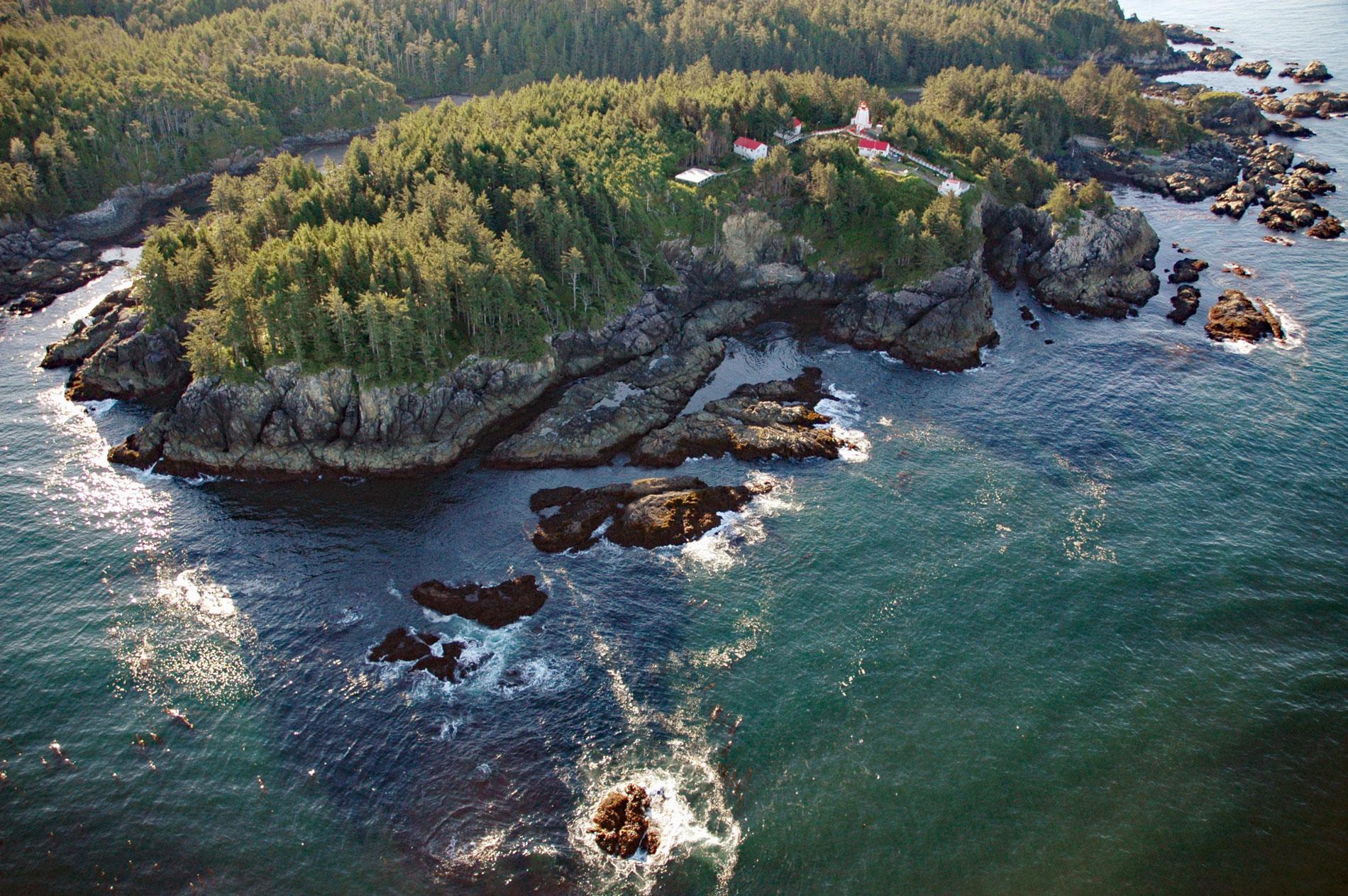
Cape Beale is the site of a historic lighthouse marking the southern entrance to Barkley Sound on the west coast of Vancouver Island in Pacific Rim National Park Reserve, about 89 miles (143 km) west-northwest of Victoria and 4.7 miles (7.6 km) southwest of Bamfield, British Columbia. The cape was named in 1787 by Captain Charles W. Barkley on the Imperial Eagle who was on a fur trading expedition sponsored by several East India Company directors and organized by Daniel Beale with the Macao partnership of John H. Cox and John Reid. Beale’s cousin, John Beale, sailed on the Imperial Eagle as purser, but was killed in a confrontation with the Quileute or Quinault on the Washington mainland near Destruction Island. Cape Beale is formed by mixed plutonic rocks called the Westcoast Crystalline Complex which consists of diorite, gneiss, and metamorphosed calcareous rocks. These rocks are exposed intermittently in a zone 6 to 9 miles (10-15 km) wide along the west coast of Vancouver Island for 174 miles (280 km) from the San Juan Fault near Port Renfrew in the south to the Brooks Peninsula in the north. Vancouver Island is mostly formed by Wrangellia, a large composite terrane that includes the Alexander terrane, which is part of the Insular Belt of the western Canadian Cordillera. The terrane developed during the Triassic age and was intruded in the Early Jurassic by magmatic activity, and in the mid-Cretaceous it was accreted to North America.
The eastern shore of Barkley Sound was the traditional territory of seven historically autonomous Huu-ay-aht First Nations. Their territories were relatively small and constrained by the presence of neighboring groups, requiring only limited movement from each group’s major village to hunt, fish, and gather food. Four of these groups gave rise to the modern Huu-ay-aht through amalgamation, whereas the remaining three went extinct and the Huu-ay-aht acquired their lands. The Ch’imaataksulh were the people of Cape Beale, described in 1913 as a large tribe that was considered wealthy in terms of having access to grey whales. Whaling appears to have been central to their economy and was their principal occupation. The Ch’imaataksulh were well placed for such an activity since the grey whales, in their annual movement along the coast, hugged the shore until they rounded Cape Beale. Ch’imaataksulh territory extended from a rocky point just inside Barkley Sound to a rocky point on the outer coast east of Keeha Beach. Their main village was at Cape Beale and they had a summer village called Kixaa. Since their territory was without salmon rivers, they acquired access to the Sarita River, about 12 miles (19 km) inside Barkley Sound, either by force or through marriage or by a social or military cooperative arrangement. The decades immediately following contact with Europeans in the late 18th century were characterized by tribal amalgamations due to dramatically declining populations, generally resulting from introduced diseases and intensified internecine warfare.
The first lighthouse established in British Columbia by the Canadian government was built in 1874 at Cape Beale. The light is 167 feet (51 m) above the sea and visible for 19 miles (30 km) and serves as a major landmark and coastal aid to navigation. Several light keepers at Cape Beale and their families are famously known for aiding in significant rescues. On December 7, 1906, the American bark Coloma was bound for Australia from Seattle with a general cargo consisting mainly of lumber. On clearing Cape Flattery, Coloma was engulfed in a southeasterly gale that swept her towards the Vancouver Island shore. The distressed vessel was sighted by the lightkeeper at Cape Beale, but the telegraph line to Bamfield was broken due to the storm. The keeper was unable to abandon the foghorn by day or the light by night to seek help, so his young wife, and a mother of four, set out for Bamfield via a primitive 6 mile (10 km) overland trail to seek help. The CGS Quadra under the command of Captain Charles Hackett, was sent to rescue the crew. Today, the Cape Beale station participates in daily sea surface temperature and salinity observations that have been carried out on the coast of British Columbia since the early part of the 20th century. Observations started in 1914 and 11 stations were added in the mid-1930s and several more in the 1960s. The number of stations has varied as sampling has been discontinued at some stations and started or resumed at others. The program is presently called the British Columbia Shore Station Oceanographic Program and most of the stations are at lighthouses staffed by Fisheries and Oceans Canada. Read more here and here. Explore more of Cape Beale and Barkley Sound here:

