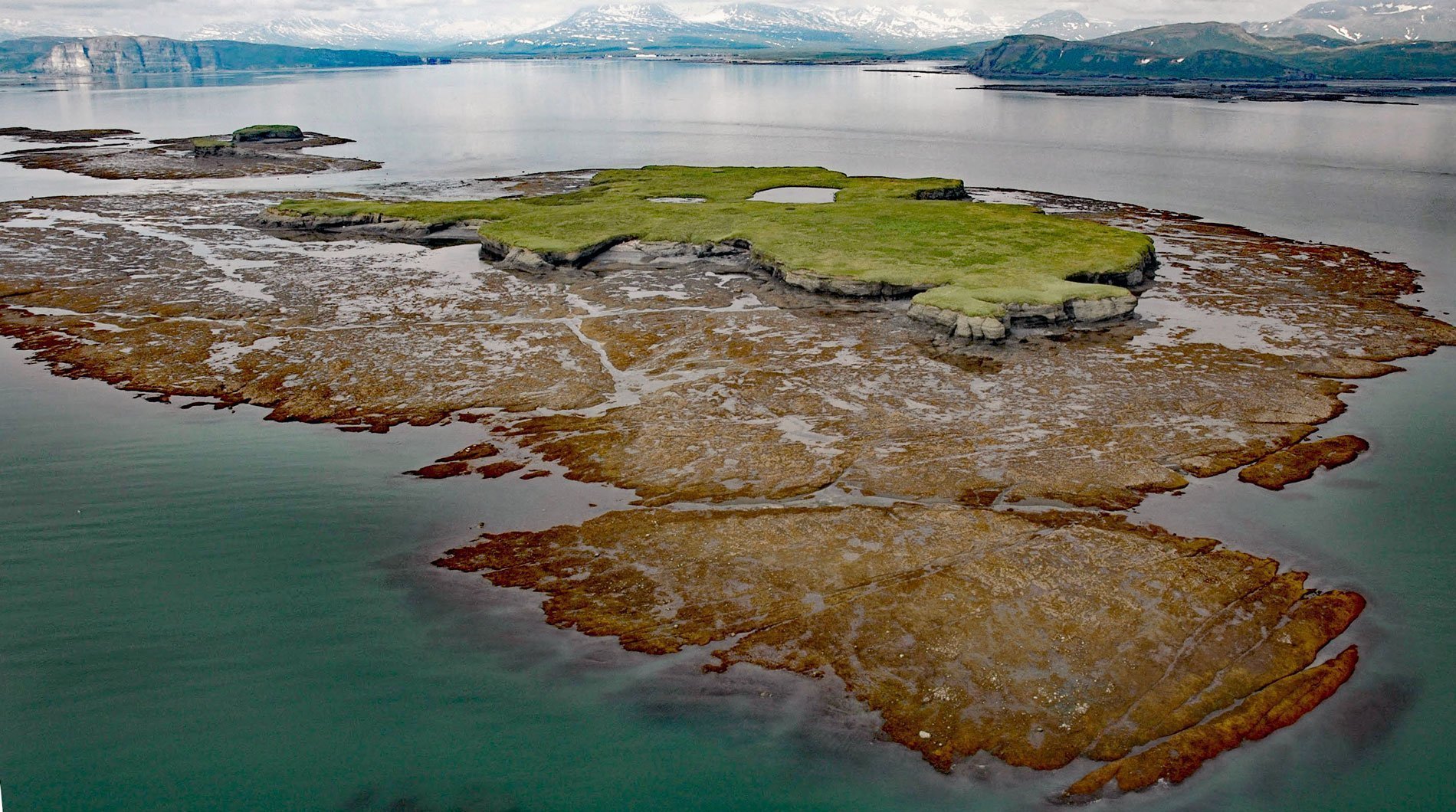
Nordyke Island is about 35 feet (11 m) high, flat topped and grass covered, and located in Kamishak Bay, about 115 miles (186 km) northwest of Kodiak and 96 miles (155 km) southwest of Homer, Alaska. Two smaller flat grass-topped islands are southwest of Nordyke Island, and a series of reefs and rock ledges are exposed at low tide between Nordyke Island and McNeil Head on the southern shore of Kamishak Bay. The island was first mentioned in a report on Kamishak Bay by Kirtley F. Mather published in 1927 by the U.S. Geological Survey. Nordyke Island and most of Kamishak Bay are underlain by sedimentary rocks at least 6,000 feet (1,829 m) thick represented by the Naknek Formation that consists of sandstone, conglomerate, and siltstone. This rock unit is widespread in southern Alaska, ranging from Southcentral Alaska to the southwest end of the Alaska Peninsula, including the northwestern flank of the Aleutian Range in Katmai National Park and Preserve. These rocks are exposed at low tides as wave-cut platforms that extend up to 2 miles (3.2 km) from shore. Macrofossils, particularly the pelecypod Buchia, are common, and the fauna, which also includes ammonites, indicate a Late Jurassic age, or about 161 to 146 million years old.
Kamishak Bay is a broad indentation at the northern end of the Alaska Peninsula, about 20 miles (32 km) northwest of Cape Douglas near the mouth of Cook Inlet. The bay has numerous reefs rising to within a few feet of the water surface that combined with a tidal range of over 24 feet (7.3 m) make navigation hazardous. Winds in Cook Inlet are largely driven by the strength and position of the Aleutian Low and the surrounding mountainous terrain. In the winter, the winds are generally from the north and northeast, and during the summer the winds are more often from the south and southwest, driven in part by the temperature gradient from land to the ocean. During strong northwest to west winds, which are common after mid-August, the bay experiences stronger winds due to the funnel effect of the mountains in the Aleutian Range to the west. These topographic gap winds are often accompanied by a short, high, choppy sea on flooding currents creating dangerous conditions for small vessels. Kamishak Bay is shallow and larger vessels generally stay within charted channels, although there is a good anchorage in the lee of Nordyke Island.
The southern portion of Kamishak Bay is the traditional territory of the Central Yup’ik people, and the portion of the bay north of Augustine Volcano is Dena’ina territory. Iliamna Lake villages, and sometimes people from as far west as Togiak in Bristol Bay, would historically come to Kamishak Bay to hunt sea otters and possibly other marine mammals such as beluga whales from seasonal camps at Amakdedori and Chenik. In 1880, Ivan Petrof conducted a census that shows a village called Ashivak on Kamishak Bay near the mouth of the Kamishak River, which was likely an Alutiiq sea otter hunting camp for the trading post at Douglas. Pacific herring were first commercially harvested in lower Cook Inlet in 1914; however, not until 1973 did spotter pilots and pioneering fishermen first locate and exploit herring in Kamishak Bay. Frequent storms, treacherous reefs, and the relatively remote location were responsible for the late development of the Kamishak Bay fishery. These same characteristics created challenges for assessing and managing the fishery. In 1973, the herring sac roe fishery harvested 243 short tons by 8 permit holders and rapidly developed to nearly 4,400 tons landed by 66 permit holders in 1976. The following year a limited entry of 73 permits was established to control further expansion of the fishery. However, harvests rapidly declined from 4,393 tons in 1976 to 376 tons in 1979, and the fishery was closed from 1980 through 1984 to allow stock rebuilding. The fishery reopened from 1985 to 1998 with an average annual harvest of 2,878 tons before being closed again beginning with the 1999 season due to low abundances. Read more here and here. Explore more of Nordyke Island and Kamishak Bay here:

