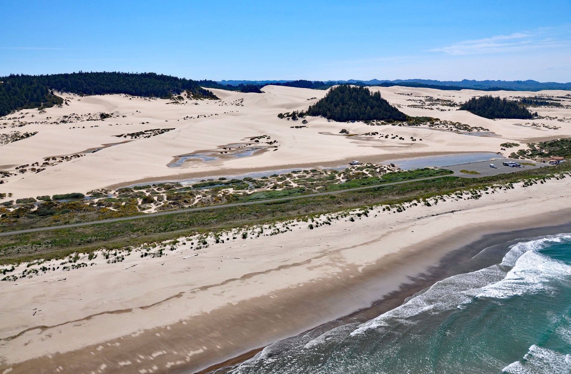
Umpqua Beach is an off-highway vehicle staging area south of the Umpqua River mouth in the Oregon Dunes National Recreation Area that extends for about 35 miles (56 km) along the coast from the Siuslaw River at Florence in the north to the Coos River at North Bend, Oregon. These are the largest expanse of coastal aeolian dunes in North America with some reaching an elevation of 500 feet (150 m) above sea level. The sand comes from the erosion of bedrock in the Coast Range, which is mostly sedimentary rock that developed in the ocean and was uplifted 12 million years ago and began weathering. Rock fragments are moved downhill by gravity eventually reaching rivers where particles are broken down by tumbling and abrasion into sand which is transported to the coast and deposited in the ocean. Coastal dunes form where the shoreline is flat and wide, where there is a large and consistent sand supply, and prevailing onshore winds. Ocean waves transport suspended sand onshore in energetic surf zones. Waves elevated by tides run up the beach slope, lose energy, and deposit the sand. Onshore winds then continue transporting the finer sand grains up the beach face and inland. Obstacles such as vegetation, fences, or other structures tend to slow down the wind and this leads to sand grain deposition. The height of coastal dunes is a function of wind velocity that contributes to dune building as well as dune erosion during severe storm events. The present shoreline stabilized about 6,000 years ago.
The Central Oregon Coast is the traditional territory of the Siuslaw and Kuitsh people, closely related tribes whose ancestors have inhabited the area for thousands of years, possibly as long as 10,000 years. The Siuslaw lived mainly around the estuary of the Siuslaw River, leaving during summer to travel upriver and into the hills of the Coast Range. The Kuitsh had their winter villages around Winchester Bay, at the mouth of the Umpqua River. Villages consisted of semi-subterranean plank houses up to 50 feet (15 m) long, built of split and smoothed cedar planks. The roof was gabled with a single ridge pole. Racks along the ceiling stored dried food, baskets, tools, and personal possessions. The interiors were lined with woven tule or cattail mats. Sweat houses were sometimes above ground and sometimes below ground. Basketry was made with a twining technique. They used tightly woven conifer roots for cooking and water baskets, and made open weave clam baskets, and conical fishing trap baskets. Fishing weirs were also woven and installed in bays, estuaries and rivers to trap fish. In the late 18th century, British, Russian, and American traders appeared along the coast in increasing numbers, introducing iron and textiles, but also several waves of epidemics. The first smallpox appeared on the Oregon Coast in 1775, probably introduced by Spanish sailors. Another smallpox epidemic broke out in 1801, and then measles, whooping cough, influenza, syphilis, and dysentery infected the Indigenous Peoples with deadly consequences. In 1830, a sickness now believed to be malaria killed thousands. Today, descendants of the Siuslaw and Kuitsh peoples are represented by several federally recognized tribes such as the Confederated Tribes of Coos, Lower Umpqua, and Siuslaw, and the Confederated Tribes of Siletz Indians.
In 1972, President Richard M. Nixon established the Oregon Dunes National Recreation Area with 31,566 acres (12,774 ha) under U.S. Forest Service management. The area is now among the most popular U.S. Forest Service sites for off-highway vehicle use. Until the first management plan was adopted in 1979, 91 percent of the area was available for use by offroad vehicles. In 1994, a revised plan restricted offroad vehicle use to 31 percent of the total area; however, it has become increasingly difficult to limit offroad vehicle use to designated trails. One of the most significant challenges in managing the area is the loss of open sand areas to encroaching invasive vegetation. The rapid expansion of vegetation has been caused by European beach grass and Scotch Broom. European beach grass was first introduced to the Oregon coast in the late 19th century to stabilize drifting beach sands near houses, river mouths, and roads. The non-native grass quickly expanded its range in the absence of natural biological controls threatening the nesting habitat of the western snowy plover. Scotch broom is a deciduous shrub native to western and central Europe that was widely planted in western Oregon for dune stabilization and as an ornamental along highway corridors. It is now the most extensive forest weed species. Read more here and here. Explore more of Umpqua Beach and Oregon Dunes National Recreation Area here:

