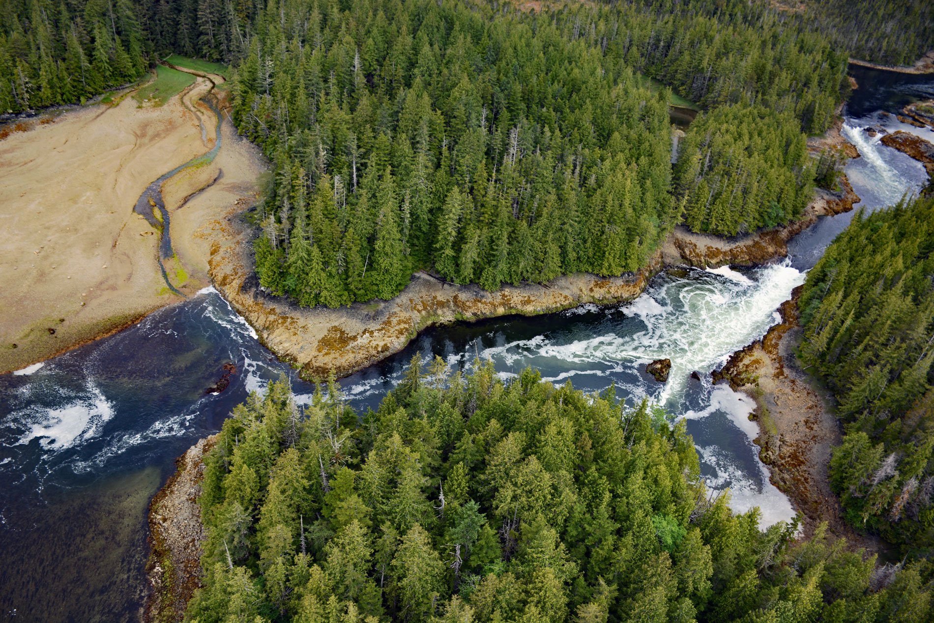
Salt Lagoon is situated at the southwestern base of the Spiller Range on Porcher Island and is connected by a tidal channel 1.8 miles (2.9 km) long to Porcher Inlet that extends 11 miles (81 km) from the south and nearly bisects the island, about 15 miles (24 km) north-northeast of Kitkatla and 5 miles (8 km) northwest of Oona River, British Columbia. Porcher Island was named after Commander Edwin A. Porcher, who was on HMS Sparrowhawk based at the Pacific Station in Esquimalt from 1865 to 1868 was sent north to investigate instances of unrest on the Nass River. The tidal range here can exceed 20 feet (6 m) and the outlet of Salt Lagoon has a tidal rapid or skookumchuck. The island is generally flat but framed by the Spiller Range along the northeast coast and Chismore Range along the southeast coast, with the latter including Egeria Mountain, named after HMS Egeria, with a summit elevation of 2,915 feet (889 m). These mountains are considered part of the Kitimat Ranges. The complex geology of Porcher Island helps explain the intricate landscape. The North American Cordillera is an accretionary orogen that has been active as a convergent margin since the Devonian period. Porcher Island is part of the Alexander terrane, in a composite terrane called Wrangellia that accreted to North America during the Middle Jurassic. The Coast Range Batholith subsequently intruded this region and is exposed along most of the west coast of British Columbia. The batholith consists mostly of granodiorite and quartz diorite but contains many inclusions of the older rocks into which the batholith was injected.
Porcher Island is the traditional territory of the Kitkatla or Gitxaala Nation. Archaeological research has identified prehistorical evidence of occupation by a cluster of shell middens at the western end of Kitkatla Inlet, with 6 more surrounding the inlet, and 5 rock fish traps. The Kitkatla are one of the 14 bands of the Tsimshian people that today inhabit the village of Kitkatla on Dolphin Island on the south coast of Porcher Island separated by Kitkatla Inlet. Early Euro-American explores and fur traders called this band the Sebassa tribe, for their chief Ts’ibasaa. The name Kitkatla is from the Tsimshian name Gitkxaała meaning people of the open sea, or people of the saltwater, since they are the farthest from the mainland of the Tsimshian tribes. When the terminus of the Grand Trunk Railway was announced to be built at the new port city of Prince Rupert, people came from all over the continent to settle on preempted land and by 1907 there were dozens of homesteaders on the islands off the mouth of the Skeena River. Porcher Island was first settled by Swedish and Norwegian pioneers who grew fruits and vegetables and raised sheep. But Porcher Island has always remained sparsely populated due to the isolation and severe maritime climate. Three small settlements were established during the 20th century at Hunts Inlet, Humpback Bay, and Oona River which currently has the largest permanent population.
Salmon and herring are the most important fish harvested in Kitkatla territory and constitute close to two-thirds of identifiable fish bones recovered from archaeological sites. Salmon sites were owned and managed by ranking hereditary leaders and the fish were caught by gaffing and spearing, using stone traps and wooden weirs, and using a range of net and hook and line gear types. Herring were caught for their flesh and roe was collected on seaweed, kelp, and hemlock branches. Over the last 100 years, overharvesting has depleted the herring population and commercial herring fisheries have been closed for several years and need many more years to recover. Halibut and other bottom fish, such as rock cod, gray cod, black cod, and lingcod, were a persistent and significant component of traditional diets. Halibut was cut into thin slices and dried and stored for later consumption. Fish were also traded with mainland people who either do not fish or do not have access to fishing grounds. In 2010, the Kitkatla participated in the Pacific North Coast Integrated Management Area marine planning process to identify management strategies that address threats to existing marine resources and how to manage them. A network of marine protected areas will be designed along with areas designated for other specific uses that contribute to the rebuilding of the ocean’s health while minimizing economic impacts on fishermen. Read more here and here. Explore more of Salt Lagoon and Porcher Island here:

