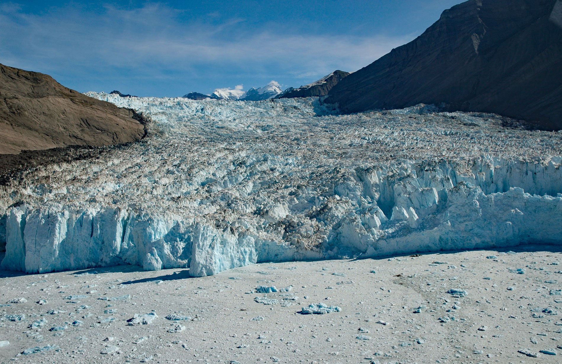
Yahtse Glacier starts from the south flank of Mount Miller in Barkley Ridge at an elevation of 8,200 feet (2,500 m) and flows generally southeast for 40 miles (65 km) through Wrangell-Saint Elias National Park and Preserve to a tidewater terminus between Guyot Hills to the west and Karr Hills to the east in Icy Bay, about 152 miles (245 km) east-southeast of Cordova and 71 miles (115 km) northwest of Yakutat, Alaska. The name for the glacier was proposed in 1963 by Austin Post of the U.S. Geological Survey, because of the relatively recent retreat of Guyot Glacier that formed a separate ice stream on the west side of the Guyot Hills. The name is derived from the Yahtse River which may have once flowed into Icy Bay in this area. The few exposures of bedrock in the ice stream represent the Yakutaga Formation of the Yakutat terrane, which originated as an active margin basin filled with 16,000 feet (5,000 m) of glacial sediment that was thrust and uplifted because of continuing compression between the underlying Pacific and North American plates. The Yakataga Formation is the best exposed and most complete late Cenozoic record of cool temperate and glacially influenced marine sedimentation in the world. Glacial marine sedimentation is represented by deep basin turbidites, glacial debris flows, diamictites, and shallow marine sandstones.
Harold W. Topham was a mountaineer with the Alpine Club of England who in 1886 made a summit attempt via the Tyndall Glacier on Mount Saint Elias, elevation of 18,008 feet (5,486 m), and later made a presentation to the Royal Geographical Society. At that time, the climbing party traveled from London to Montreal by ship, then overland to British Columbia, another ship to Victoria on Vancouver Island, and on to Sitka which was then the capital of the District of Alaska. In Sitka, a schooner was taken to Alsek, and canoes to Yakutat where they hired Tlingit guides and proceeded by canoe to Icy Bay. They landed on the delta of what Topham called the Yahtse-Tah River meaning muddy river. The Yahtse-Tah River formerly served as a primary outlet stream for the western portion of the Malaspina Glacier. Oral traditions of the Tlingit tell of a large bay running up from the sea to the base of Mount Saint Elias. A village was situated at the head of the bay surrounded by swampy or muddy ground called Yahtse. Mount Saint Elias was called Yahtse-tah-shah, tah meaning harbor, and shah meaning peak. A river flowed into the bay from large glaciers to the northwest and the bay was full of ice. At the mouth of the bay a few Tlingit families inhabited a fish camp or small village. One day a cry sounded, and ice was seen rapidly advancing down the bay. The people escaped as the ice came across the bay and struck the shore, turned, and continued down the bay to the sea, obliterating the village in its course. Following the retreat of the Icy Bay glaciers in the 20th century, the outlet of the Malaspina shifted to the Caetani River draining into Icy Bay, and the Yahtse River channel was almost abandoned by the early 21st century.
When the explorer George Vancouver visited the area in 1794, a glacier front was present on the outer coast and the ‘Icy Bay’ seen by Vancouver was actually a small bay formed between two lobes of the Malaspina Glacier now near the modern Yahtse River delta. The modern Icy Bay and its tributary fjords were exposed by over 25 miles (40 km) of tidewater glacier retreat during the 20th century. Remnants of ancient shoreline forests were found in the deglaciated areas, and radiocarbon ages of these organics indicate that the glaciers of this system made two major expansions during the past 2,000 years. Dominant tree species around outer Icy Bay are western hemlock, mountain hemlock, and Sitka spruce. Sitka spruce is also found around inner Icy Bay together with black cottonwood and Sitka alder, and the latter alone forms dense thickets along the shores of the tributary fiords. This distribution of tree species is a seral sequence, with faster colonizers such as alders pioneering areas that have been deglaciated more recently. This suggests the vegetation represents an ecological succession in an ecosystem advancing from bare ground towards its climax community. Read more here and here. Explore more of Yahtse Glacier and Icy Bay here:

