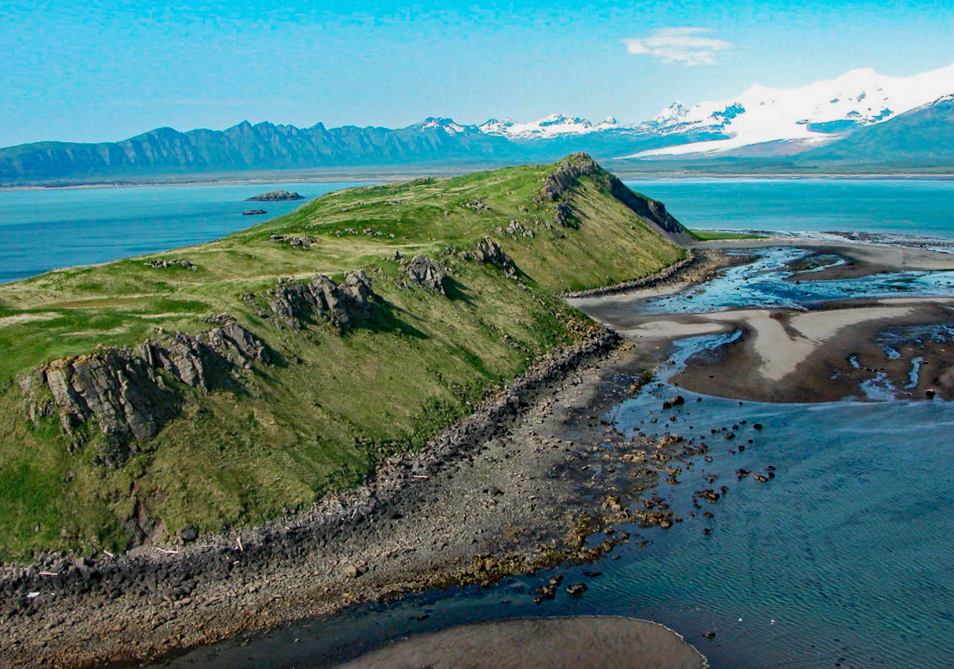
Ninagiak Island is about 1.2 miles (2 km) long and 0.2 miles wide, located in Hallo Bay near the mouth of the Ninagiak River on the south coast of the Alaska Peninsula in Shelikof Strait, about 122 miles (197 km) southwest of Homer and 75 miles (121 km) northwest of Kodiak, Alaska. The Koniag Alutiiq name was first published in 1852 by Captain Mikhail Tebenkov of the Imperial Russian Navy. The Ninagiak River starts from a terminus of the Hook Glacier on the northern flank of Kukak Volcano and flows generally southeast for about 11 miles (18 km) through Katmai National Park and Preserve to Hallo Bay on the western shore of Shelikof Strait. The river was historically a major Alutiiq trade route that connected with the Savonoski River and Bristol Bay. The river supports a population of about 10,000 spawning chum salmon that are an important food source for coastal brown bears.
The Katmai coast is known for the high numbers of brown bears that congregate to feed on salmon. The bears also scavenge on marine mammal carcasses that wash ashore, and they have developed the unique skill of digging for razor clams. They have also been observed swimming relatively long distances to gain access to ground-nesting birds. For example, in Hallo Bay, observers have seen brown bears swimming 2 miles (3.2 km) from the mainland to Ninagiak Island to feed on the eggs and chicks of glaucous-winged gulls and puffins. These bears are most often young males or sows and their cubs. It is advantageous for a mother bear to take her offspring to islands, not only because of the ready supply of food but also the islands are likely safe refuge from adult males. It is likely that cubs that are taken to an island by their mother, will later return again on their own.
Puffins often nest in colonies and each nesting pair will dig a burrow about 3 to 4 feet (1-1.2 m) deep. In some areas, like on Ninagiak Island, the burrows are dug on hillsides among scattered rocks and boulders. Brown bears use their long claws and massive shoulder muscles to displace rocks and earth in order to reach the nesting chamber. The glaucous-winged gull, which is also targeted by brown bears on Ninagiak Island, usually scrapes its nest in the ground and fills it with bits of grass, moss, or seaweed. Glaucous-winged gulls form nesting colonies which can number from 10 to as many as 10,000 pairs. Eggs and young birds are available as bear food from at least June to August or September. Read more here and here. Explore more of Ninagiak Island and Hallo Bay here:

