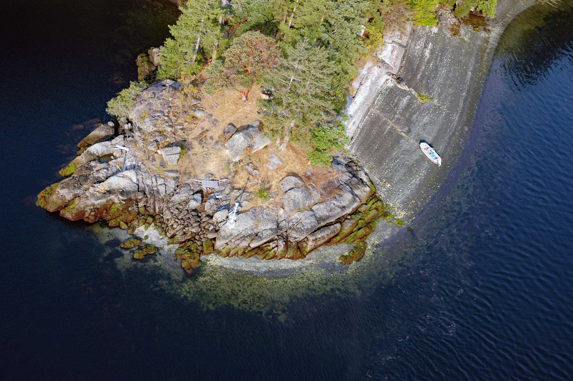
Octopus Point is a headland on the western shore of Sansum Narrows between Maple Bay on Vancouver Island to the west and Burgoyne Bay on Saltspring Island to the east, about 27 miles (44 km) north-northwest of Victoria and 2.5 miles (4 km) southeast of Maple Bay, British Columbia. In 1858, this point was named Burial Point, reputedly for a First Nations burial ground, by Captain George H. Richards who was then in command of HMS Plumper and hydrographer on the coast of British Columbia from 1857 to 1862. Canadian Hydrographic Charts have shown this as Octopus Point since 1926, likely named for the Pacific octopus that inhabits the area. The geology of Vancouver Island is mostly comprised of the Wrangellia terrane, a main component of the Insular Belt, the westernmost major tectonic subdivision of the Canadian Cordillera. The Wrangellia terrane is represented by three thick volcanic-sedimentary cycles overlain by sediments that developed between the Carboniferous and Cretaceous periods, or from about 300 to 100 million years ago. Octopus Point is an outcropping of conglomerate and sandstone of the Nanaimo Group that formed during the Late Cretaceous.
The narrow passages between the islands combined with strong tidal currents create dangerous swirls and eddies. Coast Salish folklore has a story about a legendary creature called Sheshuq’um that lived at Octopus Point. The creature had an enormous head with a large-toothed mouth and a long unfurling tongue, some elders even translated the name to mean ‘open mouth’. It is said that anyone who traveled too close to Sheshuq’um would be pulled under the water and eaten or drowned, leaving only the shattered remains of their canoes. The creature was vanquished by a legendary man known as Smakw’uts, said to be one of the strongest men ever to live. Smakw’uts lived at what is now known as Point Roberts in Washington State. Smakw’uts hurled huge stones at the creature and one stone struck and broke the mouth of Sheshuq’um. Sheshuq’um was defeated and turned into stone to serve as a reminder to all who pass of the monster that once lived in Sansum Narrows.
In 1948, Lauri and Rosa May Newman brought their nine children to live at Octopus Point. Lauri had worked on steamships and tugboats as an engineer and decided to try the fishing lifestyle with his family. He first built a boat called Elrose that was 34 feet (10 m) long and powered by a steam engine. The fuel was wood gathered from the beaches. He caught mostly ling cod that were kept alive in specially designed tanks with circulating sea water. The fish were delivered to Sidney and sold to markets in Victoria. Five more boats were built in the boathouse at Octopus Point and launched down the ways to fish Sansum Narrows. The boats had signature varnished wheelhouses that were a Newman family tradition. Their abandoned home and boathouse still stand on the property. Read more here and here. Explore more of Octopus Point and Sansum Narrows here:

