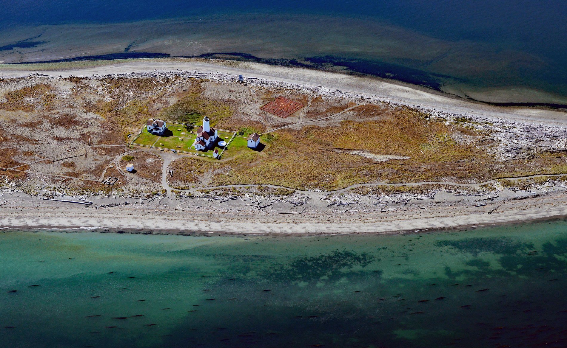
New Dungeness Light Station is located on Dungeness Spit in Dungeness National Wildlife Refuge on the southern coast of the Strait of Juan de Fuca, about 17 miles (27 km) west-northwest of Port Townsend and 7 miles (11 km) north of Sequim, Washington. Dungeness Spit is a sandbar barely visible from a distance and about 6 miles (10 km) long. It is one of the longest natural spits in the world. Captain George Vancouver named it New Dungeness Spit in 1792 because it reminded him of Dungeness Point on England’s southeast coast where a light has guided mariners since around 1600. The spit is a geomorphic system composed of features including the main and outer Dungeness Spit, doubly recurved Graveyard Spit, and Cline Spit. The system includes mainland features such as the Dungeness River delta, and the lagoons of east and west New Dungeness Bay. The predominant waves are from the west through the Strait of Juan de Fuca which drive the sediment transport to the east and northeast along the outer shore. Different wave and fetch orientations within the two segments of Dungeness Bay are evidently the forcing factors behind the many other complicated sediment drift directions.
From the sea, the low-lying sandy shoal of Dungeness Spit is barely visible, making it an extreme hazard to shipping and was known to mariners as Shipwreck Spit. In 1849, the spit was designated as a site for a lighthouse, and on December 14, 1857, a light from New Dungeness Light Station was exhibited for the first time using a fixed third-order Fresnel lens. The original lighthouse was a one-and-a-half-story stone duplex, built with sandstone blocks shipped from Bellingham, with a brick tower rising from its pitched roof. The original tower was 92 feet (28 m) high and equipped with a wooden stairway with five landings. The lighthouse was located near the end of the spit, and an open-frame fog bell tower was erected on the extreme outer end of the spit where a 1,100-pound (499 kg) bell was sounded every ten seconds during foggy weather. In September 1868, eighteen Tsimshian were camped near the lighthouse on their return trip to British Columbia by canoe after earning wages picking hops in the Puyallup Valley. In the dead of night, a band of S’Klallam attacked and killed the entire party except one. The dead were buried on the long sandbar extending south from the main spit and it became locally known as Graveyard Spit.
In 1875, a wooden tramway was constructed to connect the station’s boathouse with the dwelling and a steam fog signal building. A handcar ran along the tramway and facilitated the transport of supplies, including the roughly 30 tons of coal that were consumed by the fog signal each year. In 1927, severe cracks in the tower required that it be lowered to its current height of 63 feet (19 m). In March 1994, the U.S. Coast Guard fully automated the station and removed the last lighthouse keeper. Within a few months, the United States Lighthouse Society was able to secure a lease from the Coast Guard, and since September 1994, members of the New Dungeness Light Station Association have continuously manned the light. In 1915, President Woodrow Wilson declared the New Dungeness Spit a wild bird reservation with limited public access. Today, the Dungeness National Wildlife Refuge, under the management and protection of the U.S. Fish and Wildlife Service, provides a habitat for hundreds of species of birds as well as land and marine mammals. Portions of the refuge, including Graveyard Spit, are closed to provide sanctuary for wildlife during critical feeding, resting, and nesting times. Read more here and here. Explore more of New Dungeness Light Station and Dungeness Spit here:

