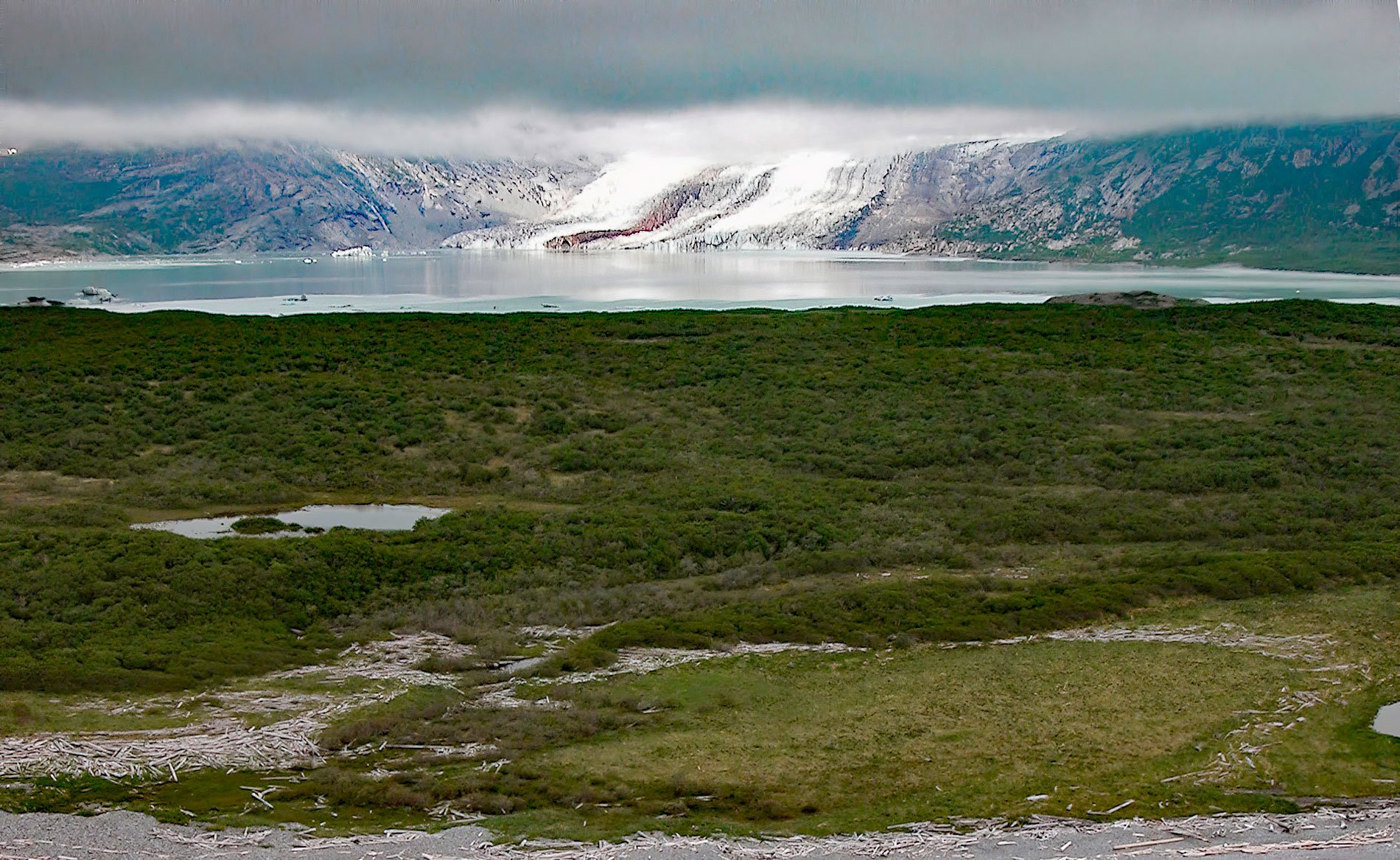
Fourpeaked Glacier starts from the eastern flank of Fourpeaked Mountain with a summit elevation of 6771 feet (2,064 m) and flows generally east for 6 miles (10 km) to a proglacial lake about 2.5 miles (4 km) long that is drained by a river that flows another 0.8 miles (1.3 km) to Shelikof Strait in Katmai National Park and Preserve, about 90 miles (145 km) southwest of Homer and 77 miles (124 km) northwest of Kodiak, Alaska. The glacier is named after the mountain which was translated from the Russian ‘Gora Chetyrekhglavaya’, meaning ‘mountain of four heads’, by George Davidson of the U.S. Coast and Geodetic Survey in 1869. Fourpeaked Mountain is part of the Aleutian Range on the Alaska Peninsula and is an active stratovolcano. Glacier outwash deposits of gravel and sand surround the proglacial lake and extend to the shore of Shelikof Strait. The bedrock underlying the toe of the glacier is sedimentary Copper Lake Formation that developed during the early Eocene and consists of nonmarine deposits of volcanic conglomerate, sandstone, and siltstone. Exposed bedrock on the eastern flank of Fourpeaked Mountain is granodiorite and quartz diorite that intruded during the Pliocene.
The Katmai volcanoes have been mostly dormant, punctuated only sporadically by short periods of eruptive activity. Fumaroles, steaming craters, earthquakes, and the occasional eruption all indicate that molten rock is still present under the crest of the Aleutian Range. Volcanic eruptions occurred from Novarupta-Katmai in 1912, Mount Trident between 1953 and 1974, and Fourpeaked volcano that last erupted on September 17, 2006, after being dormant for over 10,000 years. At the time, Fourpeaked was an unmonitored volcano with no recent known activity based on limited fieldwork. Airborne gas sampling began within days of the eruption and a network of seismic instruments was installed. Vigorous steaming continued for months; however, there were no further eruptions. The initial eruption was followed by several months of sustained seismic activity and sulfur dioxide emissions exceeding 1,000 tons per day. Fourpeaked volcano remained active for several months and by early 2007 declining seismicity and gas emissions signaled an end to the event.
Fourpeaked Mountain is almost entirely covered by Fourpeaked Glacier, although the ice is rapidly retreating. In 1951, Fourpeaked Glacier likely became buoyant when it retreated from its terminal moraine at Shelikof Strait. This resulted in a dramatic retreat of 312 feet (95 m) per year between 1951 and 1986. Satellite images from 1981 indicate that much of the glacial lake was filled with ice, but much of this was floating icebergs detached from the glacier. By 2000, the ice floating in the lake was gone, and the glacier terminus had retreated into a narrower inlet. The terminus retreated 1.2 miles (1.9 km) from 1986 to 2014, a rate of 223 feet (68 m) per year. This glacier behaves like other glaciers in Southcentral Alaska where 19 of 20 glaciers are retreating, and the retreating terminus led to the formation and expansion of a large proglacial lake. Read more here and here. Explore more of Fourpeaked Glacier and Shelikof Strait here:

