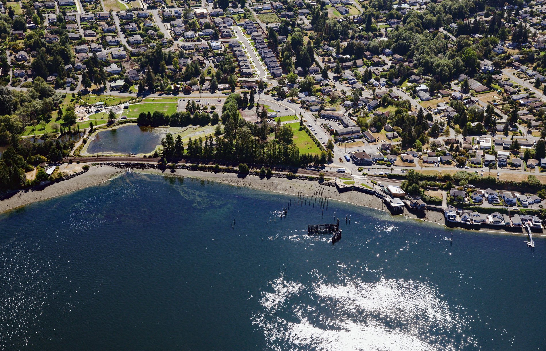
Titlow Beach is an urban neighborhood on the eastern shore of the Tacoma Narrows at the site of a historical fish camp used by the Puyallup and Nisqually tribes situated on a tidal wetland now called Titlow Lagoon, about 5.8 miles (9.4 km) south-southeast of Gig Harbor and 5.3 miles (8.5 km) west of downtown Tacoma, Washington. Tacoma Narrows forms the boundary between the South and Central Puget Sound basins. In 1871, the lagoon was part of a homestead filed as the William B. Wilton Land Claim. In 1903, Aaron R. Titlow purchased the northern half of the Wilton Claim, about 30 acres (12 ha), and began constructing a beach resort that included the Hotel Hesperidos and a boat dock. The neighborhood of Titlow quickly developed and is mostly built on Pleistocene glacial deposits. The sediments at lower elevations consist of silt, clay, sand, and gravel deposited by meltwater from a receding glacier, sand and gravel deposited by streams, or sand and silt deposited in proglacial lakes. The higher elevations are formed by Vashon Till and consist of clay, silt, sand, and gravel deposited directly by glacial ice.
In 1871, the Northern Pacific Railway formed a division based in Tacoma and began building a rail line in the Washington Territory from Kalama, on the Columbia River outside of Portland, Oregon, north towards Puget Sound. In 1873, the company formed a subsidiary to develop the city and sell the town lots. As the railroad expanded, immigrants, families, and single men moved to the Pacific Northwest and the population of Tacoma grew rapidly from 1,098 residents in 1880 to 36,000 in 1889. From the Nisqually River delta north to Point Defiance, the railroad followed the shoreline which often required the construction of artificial stone walls to support the tracks. Rivers were crossed with bridges and tidal wetlands were crossed either on trestles or more commonly by a dike constructed to support the heavy train traffic. The tidal salt marsh and lagoon at Titlow were diked and a tide gate was installed to control the flow. In 1928, a car ferry was built to cross The Narrows between Titlow and Point Fosdick on the Kitsap Peninsula. The ferry was built by the Skansie Brothers in Gig Harbor and operated by the Washington Navigation Company under contract with the State of Washington. The ferry operated until the first Narrows Bridge was opened in July 1940, but when that bridge collapsed, the ferry was put back into service and operated until 1950 when the new bridge was completed. Remnants of the old ferry dock are still visible at Titlow Beach.
Today, the railroad dike still separates the brackish main basin of the lagoon from the tidal inlet on The Narrows. Over the years of encroaching development, fill and riprap were added to intertidal areas around the lagoon and the total acreage was reduced from its historic size. For many years the lagoon at Titlow was used as a swimming hole, but by the 1930s, development resulted in severely polluted water and the lagoon became unsuitable for swimming. In 1955, an Olympic-sized swimming pool opened at Titlow Park adjacent to the lagoon and served the community for over 50 years. In 2005, a bond measure was passed to replace the pool, but in 2011 the pool was shut and in 2013 it was filled creating a lawn on the east side of the lagoon. Today, the railroad is owned by BNSF Railway, and the outlet to the lagoon is impounded by a pipe culvert beneath the railroad grade. A tide gate still controls lagoon circulation. The Titlow Shoreline and Estuary Restoration Project is now restoring Titlow Lagoon and Titlow Beach as a functional fish habitat and the Titlow Beach Marine Preserve is included as one of 110 officially designated marine protected areas in Puget Sound. The project will eventually restore natural estuarine circulation and nearshore sediment transport processes at Titlow Lagoon to increase the quantity and quality of fish habitat. These efforts are expected to benefit Pacific salmon, forage fish, and seabirds. Read more here and here. Explore more of Titlow Beach and Tacoma Narrows here:

