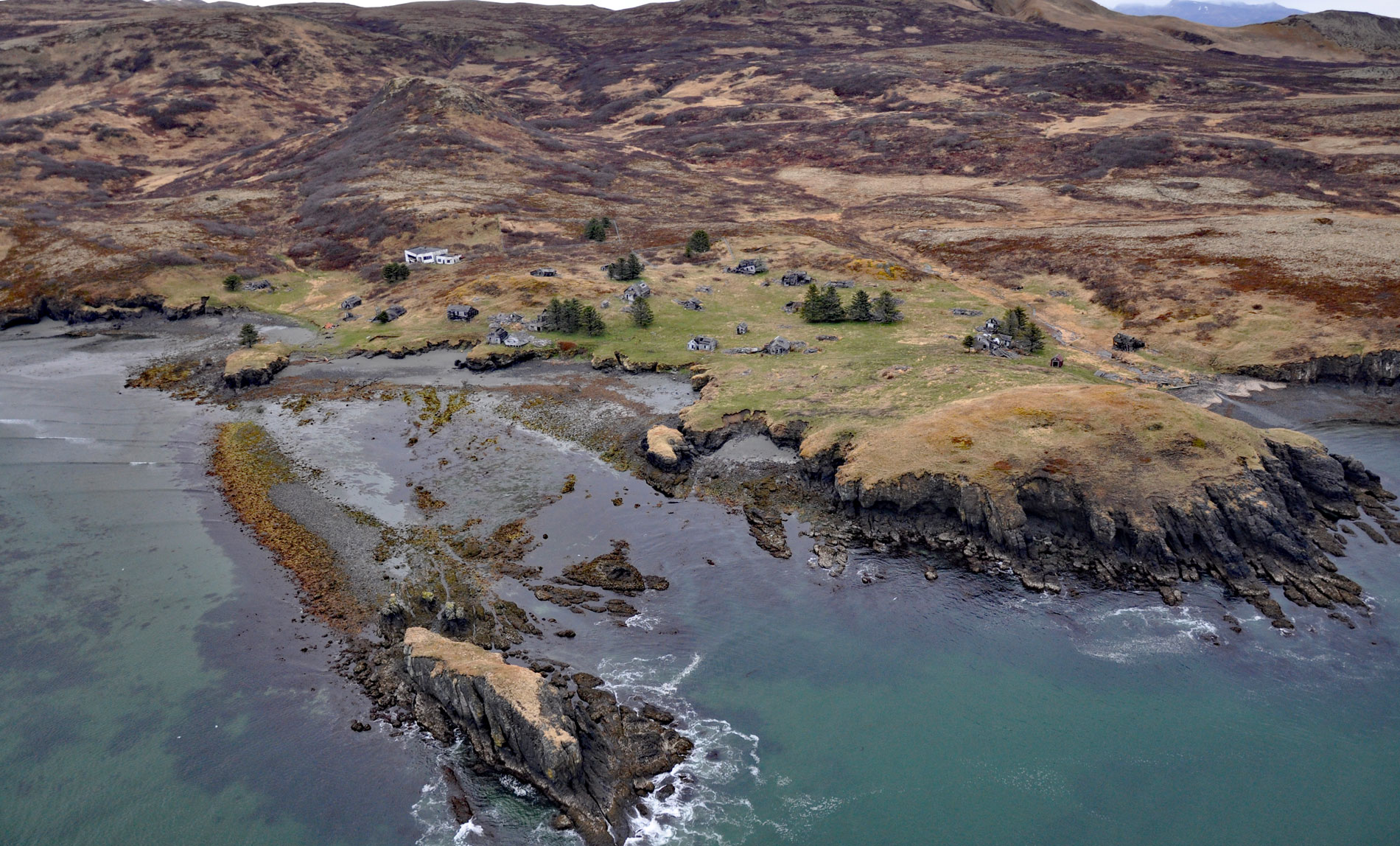
Delarof Harbor is an embayment and the site of the historical village of Unga on the southeast coast of Unga Island, the largest of the Shumagin Islands, about 73 miles (118 km) southwest of Perryville and 9.5 miles (15 km) south of Sand Point, Alaska. The harbor was named in 1852 by Captain Mikhail Tebenkov of the Imperial Russian Navy probably for the Greek-born Eustrate I. Delarov, who was director of the Russian-American Company from 1784 to 1791. The Shumagin Islands are a group of 20 islands south of the Alaska Peninsula in the Gulf of Alaska that were named after Nikita Shumagin, one of the sailors on Vitus Bering‘s 1741 expedition to North America who died of scurvy and was buried on Nagai Island. Delarof Harbor, and much of the eastern half of Unga Island and the adjacent Popof Island, are formed by Popof volcanic rocks that consist of lava lows, lahar deposits, debris-flow deposits, ash-flow tuff, and tuff. There is evidence that volcanism began with eruption of submarine lava flows in depositional sediments during the late Eocene or early Oligocene time, with volcanic dikes intruding sandstone containing fossils and petrified wood.
The earliest humans in this region arrived from the Alaskan Peninsula about 7,000 years ago. In the 18th century, Russian fur traders gave the name Aleut to the Unangan people who were distributed throughout the Aleutian Islands, the Shumagin Islands, and the far western part of the Alaska Peninsula, with an estimated population of around 25,000. In the 1820s, the Russian-American Company conscripted many of the Aleut males to hunt sea otters and resettled many families to the Commander Islands in Russia and to the Pribilof Islands in Alaska, which disrupted their traditional lifestyles. The number of Aleuts declined rapidly from Eurasian infectious diseases to which they had no immunity. While the number of Russian occupiers were relatively low, cultural subjugation and assimilation resulted in few full-blooded Aleuts remaining by 1910. In 1971, when Alaska Natives enrolled in their regional corporations under the terms of the Alaska Native Claims Settlement Act, the Aleut Corporation attracted only about 2,000 enrollees who could prove a genetic lineage of one-fourth or more Aleut; however, over 11,000 people identified as being Aleut and nearly 17,000 said Aleuts were among their ancestors. Today, most Unangan Aleut remain devout members of the Russian Orthodox Church.
Unga village was initially a fur trading post settled by Unangan sea otter hunters in 1833. Following the Alaska Purchase in 1867, a post office was established with the name ‘Ounga’, and changed its name to Unga in 1894. Unga became a boom town with the discovery of gold in the late 19th century, and the Apollo gold mines employed about 150 people. In the 1930s, Unga had many impressive wood-frame houses designed by a San Francisco architect, community water and power systems, both Protestant and Russian Orthodox churches, a dance hall, jail, monthly mail service, and the first school in the Shumagin Island. The economy was augmented by fox farming and cod fishing, and Unga remained the largest and most viable village in the Shumagins until the 1940s. Salmon fishing became economically dominant in the 1930s, but Delarof Harbor was inadequate to handle the larger fishing vessels then coming into use, such as the gill netters and increasingly larger purse seiners that could not be beached at Unga during the winter. The nearest cannery was at Squaw Harbor, so Unga village residents were limited to small boats, had no local buyer for their fish, and no fish processing jobs. In 1958, the school was discontinued after most residents moved to nearby Sand Point, and in 1969, the last family left Unga, and today the area is only a subsistence use site for residents of Sand Point. Read more here and here. Explore more of Delarof Harbor and Unga Island here:

