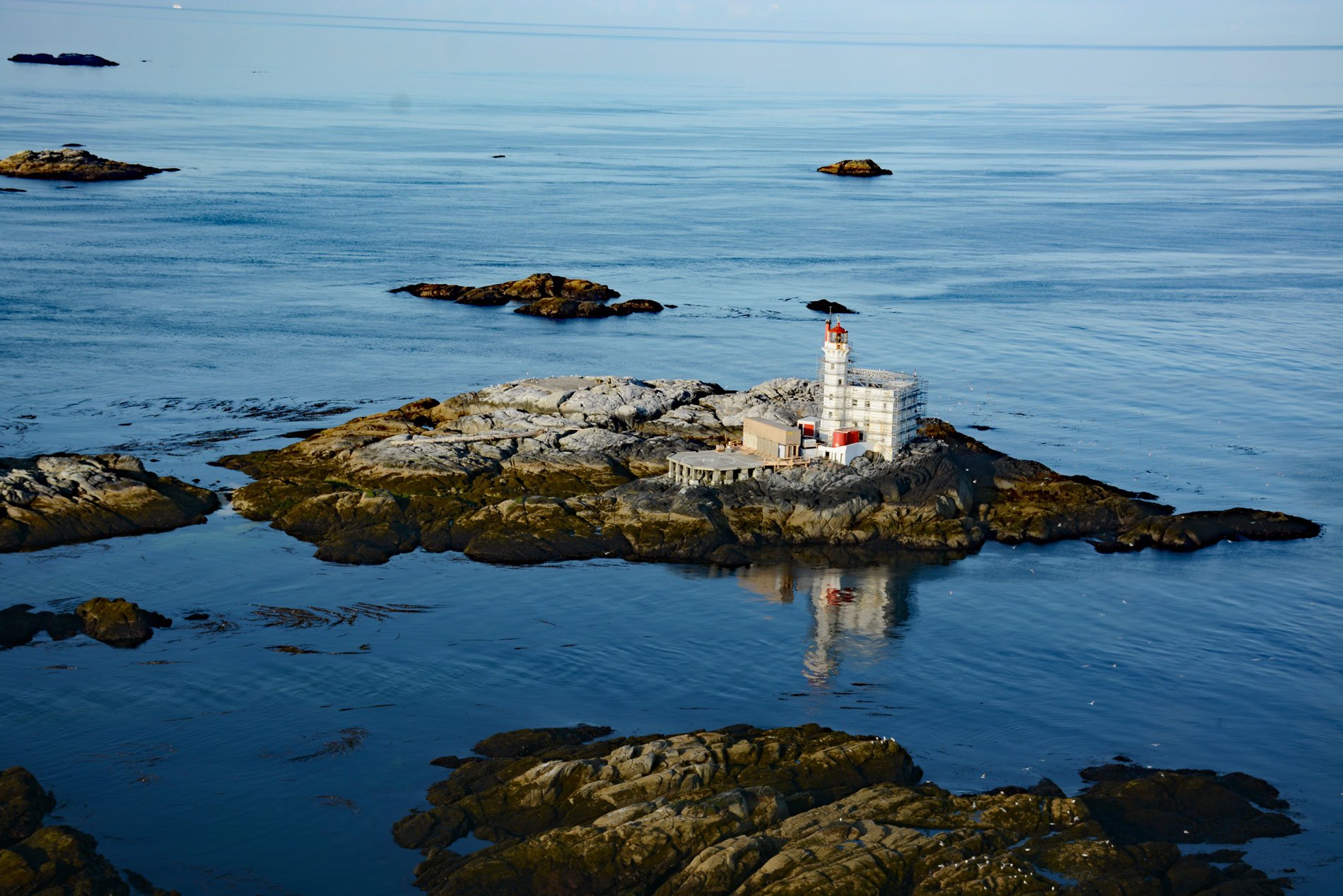
Triple Island Light is a large manned light station in Brown Passage, about 83 miles (134 km) south-southeast of Ketchikan and 22 miles (35 km) west-southwest of Prince Rupert, British Columbia. Brown Passage is a deep ocean channel connecting the western offshore waters of Hecate Strait with the eastern inland waters. The channel is bounded by Dundas Island to the north, and to the south by the Tree Nob Group of islets and rocks off the north end of Stephens Island.
While underway from Masset to Prince Rupert on August 18, 1914, the Grand Trunk Pacific Steamship Company SS Prince Albert ran aground in dense fog on Butterworth Rocks, 3 miles (4.8 km) southwest of Triple Island. Passengers and crew from Prince Albert were put off in lifeboats and picked up by SS Prince John; however, a baby fell overboard and drowned during the transfer. This tragedy resulted in the building of a lighthouse in 1920 at Triple Island. Prince Albert was salvaged and later converted to the tug J.R. Morgan, but was eventually broken up in Vancouver in 1949.
The Triple Island Light took over four years to construct. The reinforced concrete station features a tower 72 feet (21.9 m) tall attached to a rectangular concrete structure that houses the keepers’ quarters and machinery. The construction of the lighthouse was a unique challenge due to the treacherous conditions on the exposed rock, leading to thousands of dollars worth of material being lost. The construction is recognized nationally as one of the most hazardous construction projects in Canadian maritime history, which led to its designation as a National Historic Site in 1974. Triple Islands Lighthouse contributed to the socio-economic development of the region and Prince Rupert becoming a major international port. The maritime community of fishing vessels, commercial transport vessels, tourist cruise ships, and pleasure craft all rely on the lighthouse for safe travel through the hazardous Brown Passage and Hecate Strait. Read more here and here. Explore more of Triple Island here:

