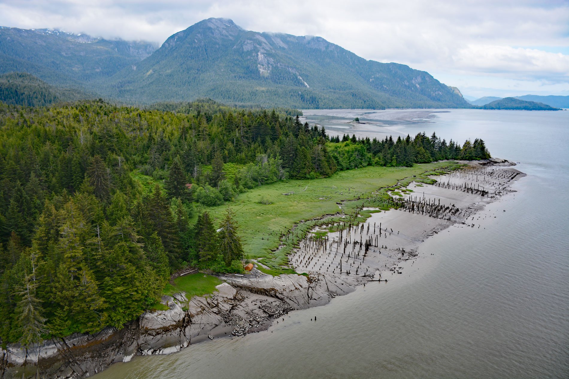
Port Essington is an abandoned cannery town on the south bank of the Skeena River estuary at the confluence of the Ecstall River, about 61 miles (98 km) southwest of Terrace and 18 miles (29 km) southeast of Prince Rupert, British Columbia. It is located on the traditional territory of the Gitzaxłaał tribe, one of the nine Tsimshian tribes based at Lax Kw’alaams. The Tsimshian called this place “Spokshute” meaning ‘the autumn campground”, and historically they camped here while traveling from the Nass River to the ice-free Metlakatla Channel. In 1793, Captain George Vancouver named the mouth of the Skeena River after his friend Captain William Essington. The community of Port Essington was founded by Robert Cunningham and for a short time was the largest coastal settlement in the region. It was home to an ethnic mix of cannery workers including European-Canadians, Japanese-Canadians, and especially Tsimshians from the Kitselas and Kitsumkalum tribes.
By 1870, the Skeena River was proven to be navigable by steamboats and quickly became a preferred gold rush route to the interior for miners heading to the Omineca River. In 1871, Robert Cunningham and Thomas Hankin acquired land through pre-emption on the south bank of the Skeena. They set aside a portion of the property for use by the Tsimshians First Nation and subdivided the rest into lots that were sold to settlers. They built a trading post and called the settlement Port Essington. Cunningham built a sawmill that supplied the demands for lumber on the north coast. In 1876, the first salmon cannery was built on Inverness Passage, and by 1890, there were seven canneries near the estuary including Claxton, North Pacific, Cassiar, Aberdeen, Balmoral, and two canneries at Port Essington, one owned by Cunningham, and the Boston Cannery owned by ABC Packing Company. Peter Herman would later build a third cannery in town that later became Wadham’s Cannery. The Hudson’s Bay Company built a store in 1891 that became known as the Skeena Post and operated a succession of steamboats between Port Essington and Hazelton for the next two decades. The town was laid out along the shore and centered at the confluence of the Skeena and Ecstall Rivers. Most of the buildings were on piles for protection against flooding. In 1899, a fire swept through and destroyed all but one building, but the community was quickly rebuilt.
The Grand Trunk Pacific Railway was built along the north bank of the Skeena in 1914, but bypassed Port Essington and instead terminated at Prince Rupert. With the completion of the railway, Port Essington’s importance in the river trade quickly declined. With modern fishing techniques, the supply of fish diminished, and the fishing boundaries were steadily shifted down the river to give the salmon a better chance of survival. The up-river canneries closed one by one and the three at Port Essington slowly disintegrated from neglect. A few families and fishermen occupied scattered homes until World War II when Japanese-Canadians were forcibly removed to internment camps. By 1950, all the canneries had closed. What remained of the town succumbed to fires in 1961 and 1965. Read more here and here. Explore more of Port Essington and the Skeena River here:

