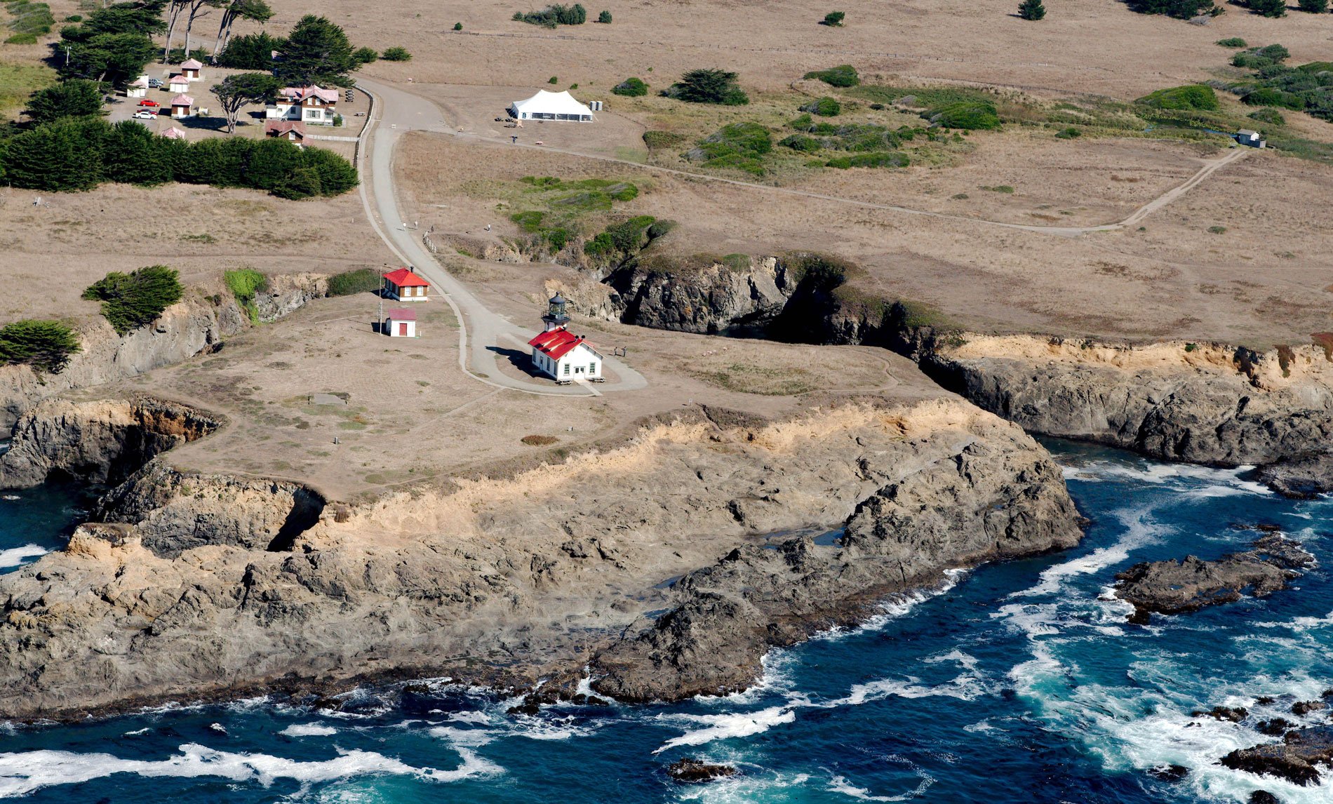
Point Cabrillo is a sandstone headland marked with a lighthouse, between Point Arena and Cape Mendocino, about 6.7 miles (11 km) south of Fort Bragg and 1.3 miles (2 km) southwest of Caspar, California. The point was named in 1870 by the U.S. Geological Survey for the Portuguese explorer João Rodrigues Cabrillo. In 1542–1543, Cabrillo was commissioned by the Viceroy of New Spain, Antonio de Mendoza, to lead an expedition up the Pacific coast of North America in search of trade opportunities. Cabrillo proceeded north until autumn storms forced the expedition to turn around and head south at a vaguely described river. It is uncertain which northern river the expedition sighted, but they likely reached at least as far north as the Russian River. Reports of the expedition were lost, and Cabrillo’s discoveries went largely unnoticed at the time, so none of his place names were permanently adopted. Despite this, Cabrillo is now remembered as the first European to travel the California coast, and several geographic features, parks, schools, and streets in California bear his name.
On July 25, 1850, the sailing brig Frolic ran aground and was abandoned in the cove just north of the point. The brig had been employed in opium trafficking from China but on this trip was loaded with household goods bound for San Francisco to capitalize on the gold rush boom. Henry Meiggs was an entrepreneur who owned one of California’s first sawmills near Bodega. After that sawmill had converted nearby forests to lumber for the booming city of San Francisco, Meiggs investigated reports of coastal forests to the north. He sent agents to investigate the Frolic shipwreck which led to the discovery of the redwood forests of the Mendocino coast. Meiggs shipped a boiler and steam-powered gang sawmill around Cape Horn to be erected on the navigable Big River estuary which was the first sawmill in Mendocino County, and this was the start of the Mendocino Lumber Company. Others followed, and soon the Mendocino coast was home to hundreds of sawmills that would drive the local economy for decades.
In 1873, Point Cabrillo was surveyed as a potential site for a lighthouse, and the U.S. Lighthouse Service recommended construction of the light in 1904 but it wasn’t funded until 1906. The Lindgren Company began construction in 1908, and operations began in 1909 with a third-order Fresnel lens, manufactured in England by Chance Brothers. The combination lighthouse and fog-signal building have an attached octagonal light tower 47 feet (14 m) tall. In 1960, a series of massive storms coming out of the Gulf of Alaska battered the coast with swells of 50 feet (15 m) that surged up the bluffs in front of Point Cabrillo. The lighthouse building sustained major damage caused by waves that crested above the light and flooded the building with mud. The U.S. Coast Guard occupied the station until 1973 when the lens was covered and a modern rotating beacon was mounted on a metal stand on the roof west of the lantern room. The California Coastal Conservancy purchased the land and light station in 1991 and partnered with the North Coast Interpretive Association to restore the buildings and manage the preserve which is now part of the California State Parks system. Read more here and here. Explore more of Point Cabrillo and the Mendocino coast here:

