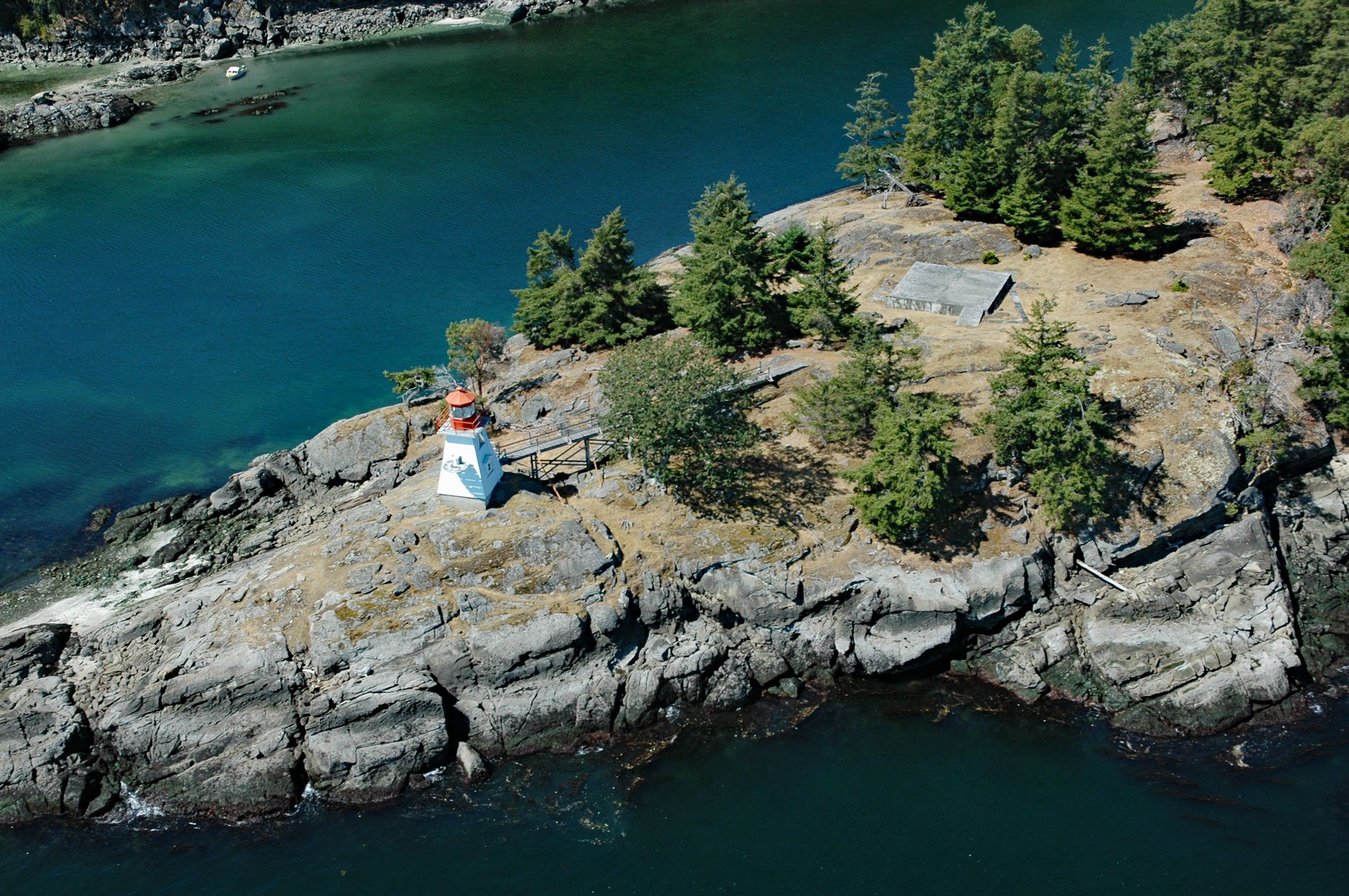
Portlock Point is part of a larger peninsula that forms the eastern extremity of Prevost Island and is part of the Gulf Islands National Park Reserve, about 33 miles (53 km) south-southwest of Vancouver and 13 miles (21 km) north-northeast of Sydney, British Columbia. Prevost Island is located between Salt Spring and Galiano Islands of the Southern Gulf Islands in the Salish Sea. Prevost Island is named after James Charles Prevost, who was the captain of HMS Satellite, commanding officer for the Northwest Boundary Survey from 1857 to 1862, and the British Commissioner for the San Juan Island boundary dispute of 1859-1870. The dispute was caused by ambiguity in the language of the Oregon Treaty of June 15, 1846, which was based on vague charts that divided the Oregon Territory between the United States and Britain “along the forty-ninth parallel of north latitude to the middle of the channel which separates the continent from Vancouver Island, and thence southerly through the middle of the said channel, and of the Strait of Juan de Fuca, to the Pacific Ocean“. However, there are actually two straits that could be called the middle of the channel, Haro Strait, along the west side of the San Juan Islands, and Rosario Strait along the east side. The Americans wanted Haro Strait to be the boundary and the British wanted Rosario Strait to be the boundary. The issue was eventually settled in favor of the U.S. by international arbitration with German Emperor Wilhelm I chosen to act as arbitrator.
Portlock Point was named in 1861 by Captain George Henry Richardson on the survey ship HMS Plumper for Joseph Ellison Portlock who was a captain in the Royal Navy, and later a major general in the Royal Engineers. He was also a respected geologist and a contemporary of Prevost and Richardson. He was the only son of Captain Nathaniel Portlock, who served on the third voyage of Captain James Cook from 1776-1780. Nathaniel Portlock realized the potential of the fur trade and after returning to England, formed a business partnership called the King George’s Sound Company with Richard Cadman Etches and partners, to develop the fur trade. Although both Nathaniel Portlock and Joseph Portlock served in Canada, neither is known to have visited Puget Sound, so there is ambiguity about which Portlock is commemorated with the named point. In the late 1800s, Prevost Island was a hunting preserve for the exclusive use of the Prevost Island Club. In the 1920s, most of Prevost Island was bought as a farm by Digby de Burgh, an Irishman from County Limerick, who used it to raise sheep, goats, and cattle. His descendants still own much of the island, which is still primarily a sheep and cattle farm. In the 1980s, waterfront homes began to appear along the northwest side of Prevost Island near James Bay which is also in the Gulf Islands National Park Reserve.
Portlock Point is an important landmark for vessels transiting between Vancouver and Victoria using Active Pass, a water passage between Galiano Island and Mayne Island. Currently, the pass is used by BC Ferries between Tsawwassen Ferry Terminal on the lower mainland and Swartz Bay Ferry Terminal on Vancouver Island. In 1890, an unmanned light was mounted on a post at Portlock Point to help vessels transition between Swanson Channel and Trincomali Channel on their way to or from Active Pass. Five years later a square pyramidal wooden tower was built that stood 48 feet (14.6 m) tall and exhibited a fixed white light with a red sector to cover Enterprise Reef. In 1896, a fog bell was suspended in a small wooden tower, painted white and located 900 feet (274 m) southeast of the lighthouse. In 1949, a new lightkeepers residence was built detached from the light tower. On Sunday, March 1, 1964, eye-witnesses on Galiano and Pender Island, reported a tremendous explosion and a large fireball from the keeper’s dwelling on Prevost Island. Two ferries interrupted their regular runs to send crew ashore and the Canadian Coast Guard tender Sir James Douglas soon arrived with a portable pump. But the fire had engulfed the residence and all they could do was keep the fire from spreading to other buildings at the station. The Portlock Point Light was fully automated in 1964 and rebuilt with a shorter tower in 1987. A wooden footbridge provides access to the tower from a nearby helicopter landing pad. In 2006, the lighthouse was transferred to Parks Canada and added to the Gulf Islands National Park Reserve. Read more here and here. Explore Portlock Point and Prevost Island here:

