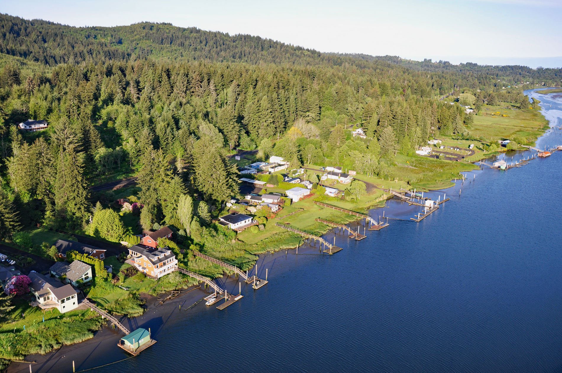
Drift Creek Landing is a community on the south bank of the Alsea River, opposite the confluence of Drift Creek, a major Coast Range tributary joining the Alsea about 3.4 miles (5.5 km) east of Waldport, about 16 miles (26 km) south-southeast of Newport and 9 miles (15 km) northeast of Yachats, Oregon. The Alsea River takes its name from the historical Alsi people who lived around the extensive estuary. The river flows west-northwesterly in a winding course through the Siuslaw National Forest. The main stem of the river begins at the confluence of the North and South forks near the community of Alsea and from there flows approximately 43 miles (69 km) to the coast at Waldport. The total watershed area is about 470 square miles (1217 sq km). The river has historically supported major fisheries with important runs of salmonids including sea-run cutthroat trout, Chinook salmon, and steelhead trout. Since the decline in timber cutting in the 1990s, sports fishing provides modest support for businesses along the river. A variety of factors have contributed to significant declines in the wild fish populations of the watershed. These include human settlement, historical logging, road construction, hatchery management, ocean conditions, and fishing. Drift Creek was named for the accumulations of driftwood on its banks. The creek flows generally southwest for approximately 22 miles (36 km) draining a watershed of 43,160 acres (17,466 ha), mostly owned by Georgia-Pacific and the U.S. Forst Service. The watershed starts at an elevation of 2820 feet (859 m) and descends to the Alsea River estuary where the tidal range is about 7 feet (2 m).
Humans have inhabited the central Oregon coast for at least 3,000 years. This is relatively recent compared to 10,000 years documented at other sites in Oregon; however, evidence of earlier occupation may have been lost through a rise in post-glacial sea levels or alluvium deposits from flooded river valleys. The Alsi-Yaquina people occupied the Drift Creek watershed as part of their traditional tribal lands. By all accounts, the Alsi people were never numerous. Villages were composed of kin-groups, established in relatively isolated enclaves. With no records of identified permanent village sites, the main villages probably developed around Alsea Bay and along the Alsea River. The first contact with Europeans probably occurred in the late 1700s. Euro-American settlement in the Alsea valley began between 1852 and 1855. The more attractive agricultural lands were close to the Alsea River and were claimed first. In 1855, the U.S. government utilized a treaty to take native lands primarily to support additional Euro-American settlement, and this forced the relocation of the Alsi and Yaquina people to the Coast Indian Reservation. Traditional practices were discouraged, while European practices of agriculture and livestock grazing were introduced. Additional interest in claiming land was spurred by passage of the Homestead Act of 1862. In 1865, under pressure from entrepreneurs to develop a rail line to Yaquina Bay, and open more land for settlement by Euro-Americans, the Coast Indian Reservation was moved to the Siletz Reservation. By the 1930s, the original homesteaders were starting to retire to the larger coastal communities. The New Deal implemented a resettlement program, purchasing marginal agricultural lands, relocating families and many of the original homesteads were added to the Siuslaw National forest or acquired by logging companies. Georgia-Pacific acquired significant land holdings within the watershed in 1956, and large-scale commercial logging began between 1954 and 1959. The U.S. Forest Service began significant logging activities in the 1960s. In 1984, the Drift Creek Wilderness was established with an area of 5,798 acres (2,346 ha) in the upper Drift Creek watershed. In 2003, the U.S. Forest Service purchased the Lower Drift Creek area and is working with several partners including the Confederated Tribes of the Siletz to plan and implement an ecosystem restoration project that will enhance salmon habitat.
Natural lowland habitats on the Oregon Coast have been compromised by historical land use such as clearcutting, loss of old-growth forests and associated habitats, road building, culverts that block natural streamflow and fish passage, river channel modifications, soil discing for tree plantations, monoculture forest regeneration, hillside slumping and erosion resulting from vegetation loss, invasive non-native plants, and construction of levees to convert marshes into pastures. The freshwater wetlands of Lower Drift Creek are rarely found along the Oregon Coast and provide additional off-channel habitat for juvenile salmonids. An emerging body of research has identified off-channel habitat as a limiting factor in coho and other salmonid life-cycle development. A complex range of over-wintering and nursery behaviors is showing a variation within the populations as to which lowland aquatic habitats are used to develop body mass and how salmonids reside in these locations. The saltwater wetlands of Lower Drift Creek are affected by tidal water levels fluctuations that flood the marsh with cooler water bringing food and nutrients and removing pollutants. Read more here and here. Explore more of Drift Creek and the Alsea River here:

