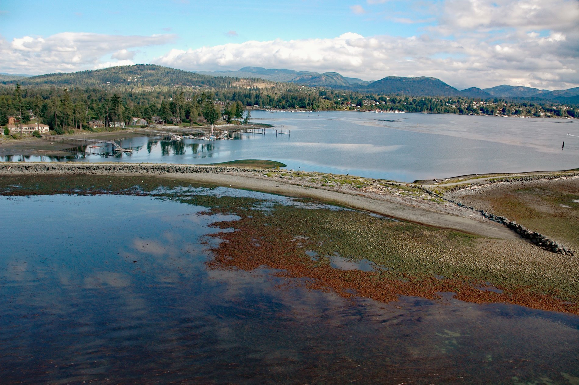
Sooke is a community on the western shore of Sooke Harbour, a narrow natural embayment separated from the Strait of Juan de Fuca by Whiffin Spit, about 35 miles (56 km) southwest of Port Renfrew and 17 miles (27 km) west-southwest of Victoria, British Columbia. Sooke is named for the T’sou-ke First Nation of the Coast Salish people, the Native inhabitants who had a thriving community and are believed to have been living in the general area for several thousand years before the arrival of Europeans. The name T’sou-ke is reputedly after the stickleback fish that live in the estuary of the Sooke River. The Spanish explorer Manuel Quimper became the first known European to enter Sooke Harbour with the Princesa Real. He first learned of the protected bay from the local T’sou-ke, but contrary winds and currents prevented him from entering the inlet for three days. On June 19, 1790, weather conditions settled, and the ship was able to anchor at the entrance of Sooke Harbour. Quimper found two Native settlements at Sooke and they traded fresh food for copper. While doing a reconnaissance of the area, the Spanish spent a few days creating a detailed chart of the harbour. When the chart was completed, Quimper performed an Act of Possession for the Spanish empire on June 23, 1790, naming Sooke Inlet ‘Puerto de Revilla Gigedo’ in honor of Juan Vicente de Güemes, 2nd Count of Revillagigedo, the viceroy of New Spain (Mexico). Because of constant fog and less than ideal winds, four days passed before the Spanish were able to depart. On June 28, 1790, Quimper, his officers, and the crew boarded the Princesa Real and left Sooke to continue the exploration of the Strait of Juan de Fuca.
In 1843, the Hudson’s Bay Company sent Chief Factor James Douglas from Fort Vancouver to build a new fort and company headquarters for the Columbia District, a large fur trading area now part of British Columbia and Washington State. In 1846, the Oregon Treaty prompted the British colonial office to designate the territory a crown colony, and on January 13, 1849, the Colony of Vancouver Island was established and leased to the Hudson’s Bay Company. Douglas was charged with encouraging British settlement and as the colony expanded, the company started buying up lands First Nations people for colonial settlement and industry. For four years the governor, James Douglas, made a series of fourteen land purchases, called the Douglas Treaties. The Douglas Treaties cover approximately 230,400 acres (93,240 ha) of land around Victoria, Saanich, Sooke, Nanaimo, and Port Hardy, all on Vancouver Island that was exchanged for cash, clothing, and blankets. The terms of the treaties promised that they would be able to retain existing village lands and fields for their use, and also would be allowed to hunt and fish on the surrendered lands. The T’sou-ke people were signatories to the Douglas Treaties but remain the results are highly controversial given that it is unclear whether the First Nations signatories knew exactly what they were signing over. In 1849, the first independent immigrant to purchase land in the new colony of Vancouver’s Island was Captain Walter Colqohoun Grant of the Royal Scots Greys. The Hudson’s Bay Company at Fort Victoria owned all the good land around Victoria, so Grant established his farm at Sooke and built a water-powered sawmill. In 1853, admitting failure, he returned to England. John Muir arrived on Vancouver Island with his wife Anne and four sons in 1849. He worked first worked in the coalfields at Fort Rupert and Nanaimo for the Hudson’s Bay Company, then moved to Sooke in 1853 where he acquired the estate of Captain Grant.
The Muirs had a steam-powered sawmill operating by 1855, established a productive farm, and built a number of ocean-going vessels. In 1884, the Muir sons built three stately homes, two of which still stand, called Woodside and Burnside. People from the T’sou-ke village worked at the sawmill, at the barrel stave production, and at gathering bark for the tanning industry. It had been the developing of a forest industry that had stirred both Grant and Muir, and the Muir family succeeded by establishing lumber markets ranging from nearby San Francisco to South America, the Sandwich Islands (Hawaii), and Australia. The Muir forest enterprise was to reign until 1890. Other prominent settlers in Sooke’s early history were the Brule and Poirer families. As a youth, French-speaking Joseph Poirier set off with others from his Quebec village to join the fur traders heading west, eventually reaching Fort Vancouver on the Columbia River. A French Canadian community had developed south of the fur-trading fort in the wide fertile valley of the Willamette River. When the Oregon Treaty of 1846 declared this area as a part of the U.S., many of the French Canadians moved north to Fort Victoria. Joseph Poirier joined a wagon train traveling north along with Jean Baptiste Brule. Brule and his family settled on the east bank of the Sooke River, and Joseph Poirier worked falling timber for Captain Grant’s sawmill. In 1864, the Vancouver Island Exploring Expedition discovered gold on a tributary of the Sooke River, and Poirier and Brule rafted in sheep and cattle to provide mutton and beef for sale to the miners en route to the goldfields. Early in the 1900s a series of commercial fish traps, with piles driven into the ocean floor and webbing designed to intercept the salmon, became the economic mainstay for Sooke. At about the same time, the vast rainforests in the area watersheds attracted the interest of industrial loggers, and the cutting of Douglas fir, western red cedar, Sitka spruce, and western hemlock began in earnest, at first with horse teams and later with a logging railroad running along the Sooke River to Leechtown, which became the Galloping Goose Regional Trail in 1987. Read more here and here. Explore more of Sooke here:

