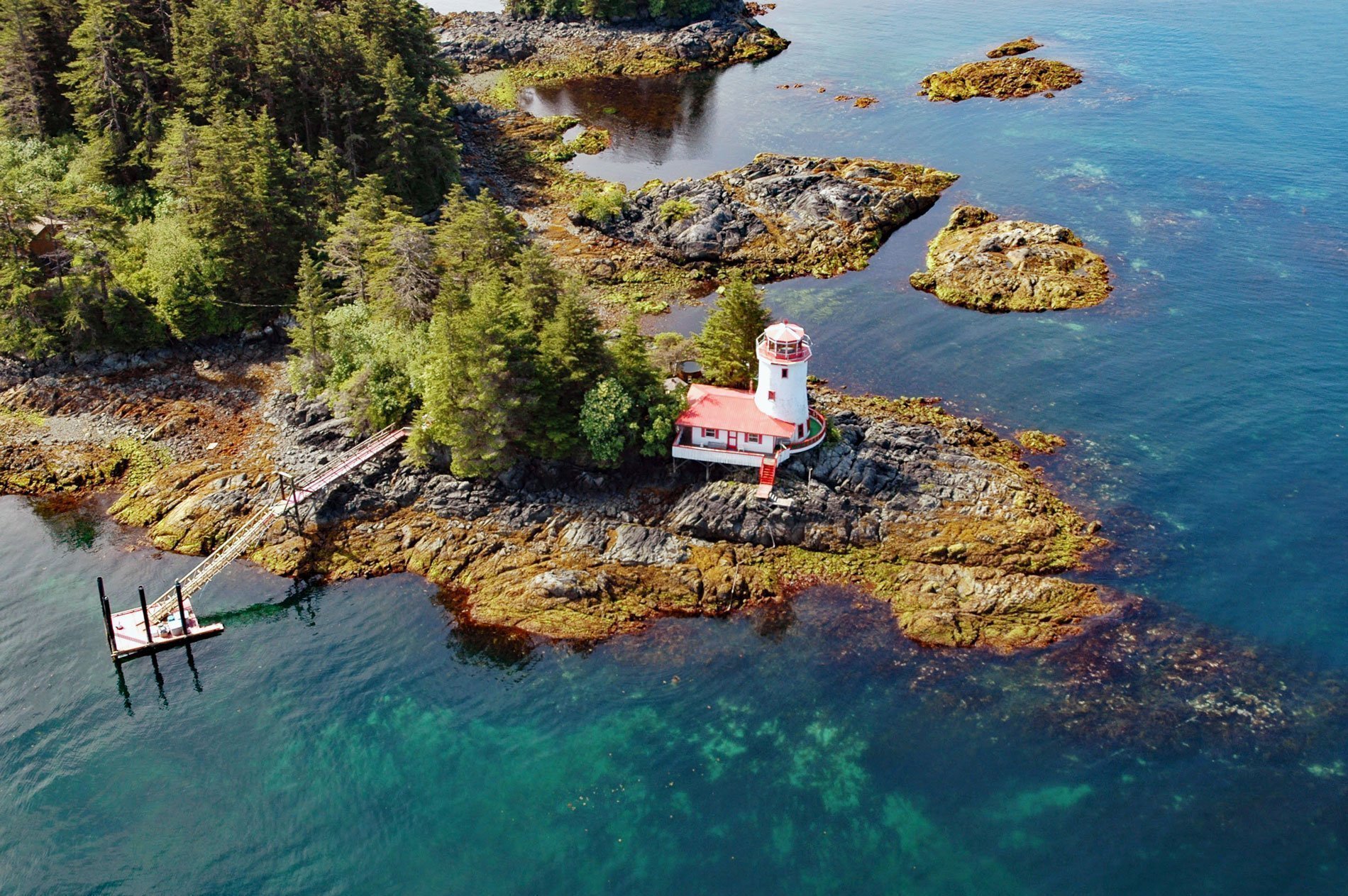
Sitka Lighthouse is privately owned and located at the northwestern end of Galankin Island in Sitka Sound between the Beardslee Islands to the west and Ball Islets to the east, about 43 miles (69 km) southwest of Angoon and 1 mile (1.6 km) south-southwest of Sitka, Alaska. The lighthouse was built in 1983 by Burgess Bauder, a local veterinarian who spent 18 months hauling the building materials and constructing the lighthouse on the high point of a one-acre (0.4 ha) private island. The lighthouse is registered with the U.S. Coast Guard as an active aid to navigation. The islands along this portion of Sitka Sound comprise a rock formation called Sitka greywacke, a sequence of thin-bedded and massive sandstones that originally formed as turbidites in a deep ocean trench. These rocks were partially metamorphosed and uplifted when the Chugach terrane accreted to the west coast of North America.
Galankin Island is 0.8 miles (1.3 km) long and was first named ‘Ostrov Peschanyy’ meaning ‘Sandy Island’ in 1809 by the Russian navigator Ivan Vasiliev. In 1850, the island was renamed ‘Ostrov Galankin’ by Captain Mikhail D. Tebenkov of the Imperial Russian Navy who derived the name from ‘galanka’ meaning ‘brick stove’. In 1880, Captain Lester A. Beardslee of the U.S. Navy, who commanded the USS Jamestown, named it ‘Thompson Island’ for Richard W. Thompson, who was Secretary of the Navy under President Rutherford B. Hayes in 1877-1880. In 1883, William H. Dall of the U.S. Coast and Geodetic Survey applied the name Galankin Islands to a larger group of islands that includes Bamdoroshni, Galankin, and Whale Island, with many surrounding smaller islands including the Gilmore Islands, the McClellan Group, Ball Islets, Beardslee Islands, Sheep, Katz, Rockwell, Breast, and Kutkan Islands. The Ball Islets form the eastern part of the Galankin Group and were named in 1879 after Colonel Mottrom D. Ball, the Collector of Customs at Sitka, who presided over the HMS Osprey Incident.
The first lighthouse in Alaska operated in Sitka in 1834 when a small whale-oil lantern was placed in the cupola atop Baranof’s Castle by the Russian-American Company. After the Alaska Purchase in 1867, George Davidson of the U.S. Coastal Survey made an extensive survey and recommended that two lighthouses be built in Sitka. Congress did not take action on Davidson’s report, but the federal Lighthouse Board continued to investigate the navigational hazards in Alaska and primarily used the buoys and other non-lit markers that the Russians had left behind. Jurisdiction of the light at Sitka was transferred to the Lighthouse Board and maintained by a lone keeper who earned 40 cents per day. Baranof’s Castle burned down in 1894 and the light was never replaced. Read more here and here. Explore more of the Galankin Islands here:

