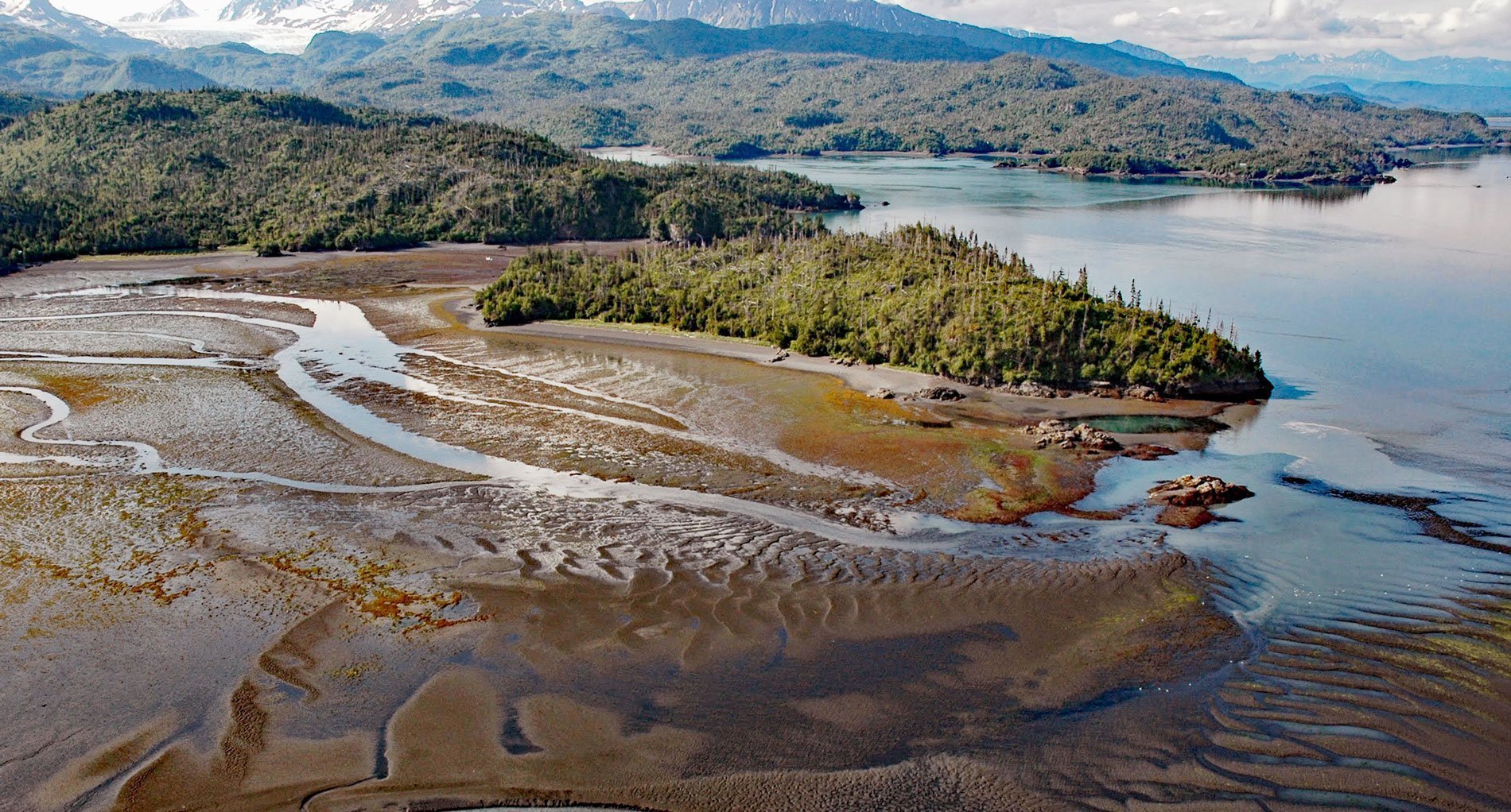
Chugachik Island is situated about 800 feet (244 m) off the eastern shore and near the head of Kachemak Bay, between Bear Cove to the south and Martin River to the north, on the Kenai Peninsula in Kachemak Bay State Park, about 18 miles (29 km) northeast of Homer and 3.3 miles (5.3 km) south-southeast of Kachemak Selo, Alaska. The island is about 0.25 miles (0.4 km) wide and 0.45 miles (0.7 km) long, and the name was first reported in 1848 by Captain Mikhail Tebenkov of the Imperial Russian Navy. The island comprises partially metamorphosed rocks of the McHugh Complex that formed during the Late Jurassic or Early Cretaceous, or about 145 million years ago, from turbiditic deposits in a deep ocean trench. The rocks are conglomerate and massive greywacke consisting primarily of chert and volcanic rock fragments. The McHugh Complex is part of the larger metasedimentary greywacke, siltstone, and shale of the Valdez Group which in turn is part of the Southern Margin composite terrane, an accretionary wedge that is exposed along much of the continental margin along the Gulf of Alaska coastline.
The island is of archaeological interest, with at least two sites that have been excavated and studied. One site is a midden over 6 feet (2 m) deep in which the remains of plants and animals have been recovered among human artifacts, including stone and bone tools, and a cradle made of birch bark. The site was excavated in 1974 and 1977, with radiocarbon dating suggesting the island was inhabited for about 800 years. The majority of artifacts included small projectile points and other chipped stone implements that are more numerous than those of ground stone. Bone tools were also in abundance, including several carved figurines. Over 1,000 small notched stones were recovered. The best determination of the age of the oldest artifacts was taken from sewn birch bark found in a shell layer near the bottom of the pit directly above the peat layer that was dated to 306 BC. The middle of the occupation period was dated from mid-level samples taken from different areas of the midden with an age from 245 AD to 10 AD. One sample taken from near the top of the midden was dated to 475 AD. The second site was excavated in 1982, including three layers of occupation, dating from 100 BC to a Dena’ina Athabascan occupation estimated to date to the late 19th century. The latter find represents the first known evidence of Dena’ina occupation of Kachemak Bay.
In addition to human skeletal remains, the middens indicated the importance of birds, terrestrial mammals, marine mammals, fish, and shellfish to the people prehistorically and historically inhabiting Kachemak Bay. Kachemak Bay lacks major salmon spawning streams; however, halibut, cod, and flounder were important resources. Before being depleted in the 20th century, Kachemak Bay also supported major spring spawning runs of Pacific herring. Shellfish such as blue mussels and clams were significant in traditional economies and Kachemak Bay’s extreme tidal ranges provided easy access to them. Shells of whelks, clams, cockles, periwinkles, limpets, moon snails, mussels, barnacles, and urchins were all present in the middens, but crabs and shrimp were not significant prehistorically. Waterfowl and seabirds were also major resources in prehistoric times. Kachemak Bay is the most important waterbird habitat in lower Cook Inlet, with over 100,000 waterfowl wintering in the bay. Resident birds are joined by a major fall influx and a lesser spring influx of migrants who use the bay as a staging area. Based on evidence found in the middens of Chugachik island and elsewhere, these were hunted prehistorically by the early Kachemak people and historically by the Dena’ina. Read more here and here. Explore more of Chugachik Island and Kachemak Bay here:

