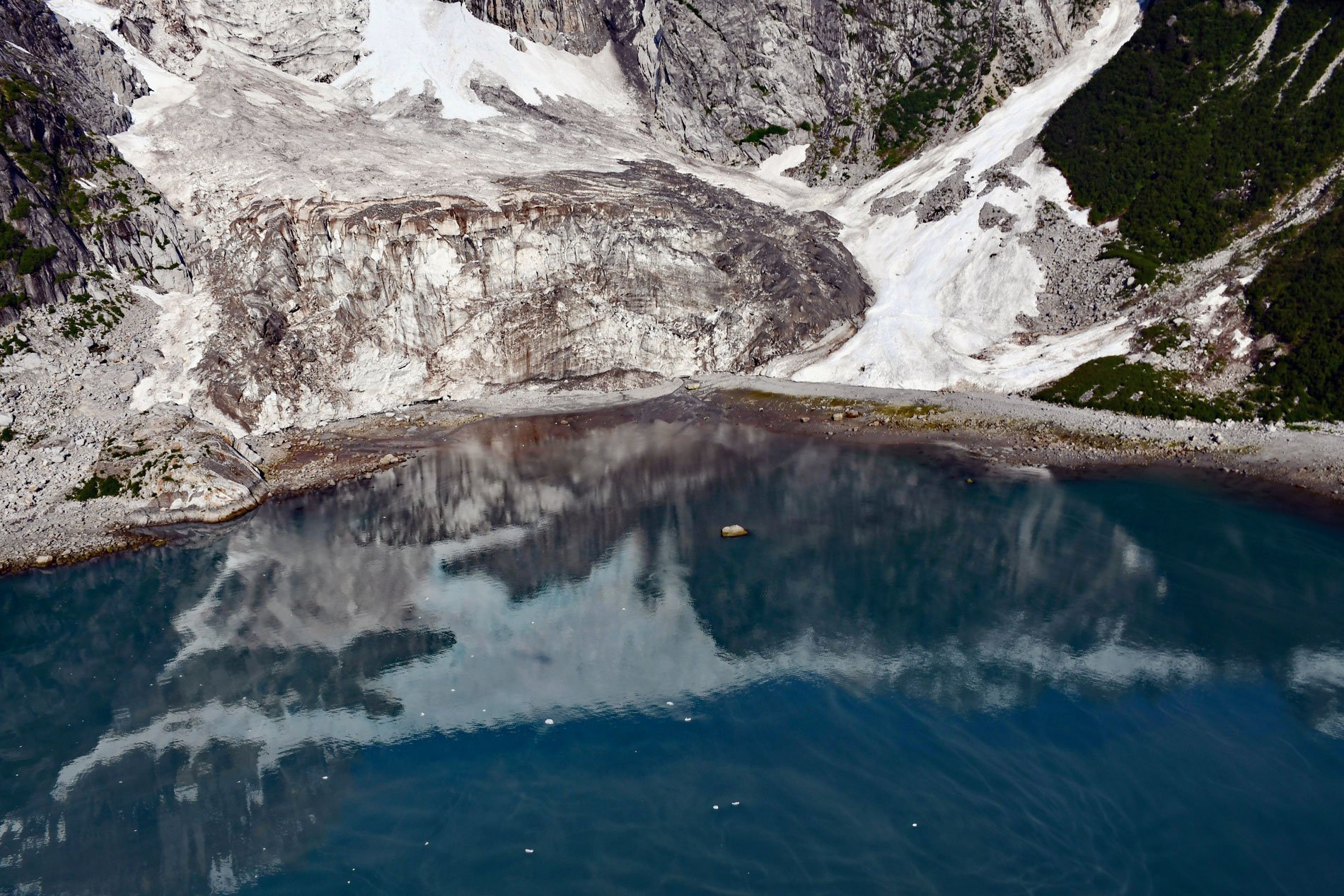
Anchor Glacier starts from an elevation of about 5,700 feet (1,737 m) on the eastern flank of McCarty Ridge in the Kenai Mountains and cascades east for 3 miles (5 km) to Northwestern Fjord, about 52 miles (84 km) east-northeast of Homer and 32 miles (52 km) southwest of Seward, Alaska. Northwestern Fjord extends north for 10 miles (16 km) from Harris Bay on the Gulf of Alaska coast in Kenai Fjords National Park. The fjord was named in 1909 for Northwestern University by Ulysses S. Grant and Daniel F. Higgins of the U.S. Geological Survey. Harris Bay was named for Abram W. Harris who was president of Northwestern University between 1906 and 1916. As late as 1900, Northwestern Glacier completely filled the fjord, ending on a terminal moraine that partially encloses the inlet at the head of Harris Bay. Between 1894 and 1960, the glacier made a drastic retreat of 9.4 miles (15 km), exposing bedrock comprising granite and granodiorite of a large batholith that formed from an igneous intrusion during the Paleocene and Eocene, or about 60 to 40 million years ago. The batholith extends from Nuka Bay in the west to Aialik Bay in the east including offshore islands and extends north under the Harding Icefield where it is represented by many nunataks.
When observed in 1909 by Grant and Higgins, Northwestern Glacier had retreated to about 1200 feet (365 m) from the terminal moraine. In 1928, a U.S. Coast and Geodetic Survey hydrographic survey shows the glacier ending about 0.5 miles (0.8 km) from the moraine shoal at a point where the water presently has a maximum depth of 400 feet (122 m). By 1942, when photographed by the Army Air Force for reconnaissance mapping, the glacier had retreated about 4 miles (6.4 km) and terminated as a high, irregular ice cliff with a deep, concave embayment near the northern side where the fjord now has a maximum depth of 965 feet (294 m). The retreat continued and by 1950, when the U.S. Geological Survey photographed the area for topographic mapping, the glacier ended in a long, concave front extending from rocks west of Erratic Island to Striation Island, and as a high ice cliff blocking Polished Passage north of the island. By 1960, the glacier had retreated an additional 2.5 miles (4 km), and it then terminated at a retracted, stable position near the head of tidewater.
The retreat of Northwestern Glacier exposed two tributary glaciers on the western shore of the fjord that were named Anchor Glacier and Ogive Glacier by Austin S. Post of the U.S. Geological Survey in 1980. Post was a world-renown mountaineer, glacier photographer, and scientist. He was one of the first to propose that water depth at the glacier calving margin strongly affects the rate of iceberg calving, which contributed to a better understanding of the tidewater glacier cycle. The continuing retreat of Ogive and Anchor Glaciers has separated their termini, and today, Anchor Glacier reaches tidewater about 4 miles (6.5 km) south of the present position of the Northwestern Glacier terminus. Many other glaciers that were tributaries to the lower part of Northwestern Glacier at the turn of the 20th century are now small relict ice patches stranded high above the fjord. Read more here and here. Explore more of Anchor Glacier and Northwestern Fjord here (map may take a few seconds to load):

