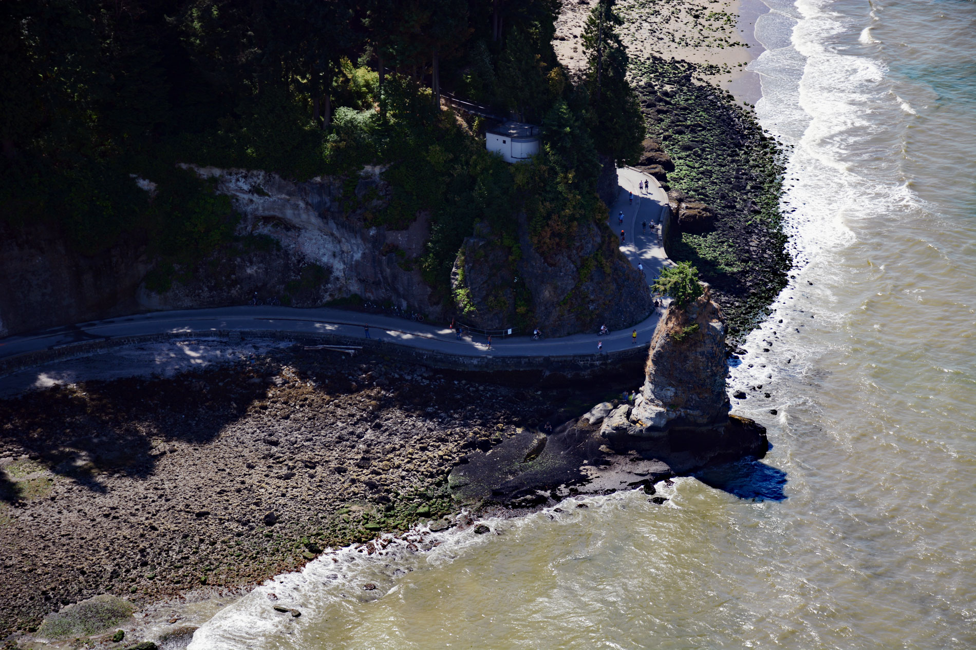
Siwash Rock is a sea stack on the western shoreline of Stanley Park in Burrard Inlet, between English Bay to the south and the entrance to Vancouver Harbour to the north, about 3 miles (5 km) northwest of downtown Vancouver, British Columbia. The formation is about 50 feet (15 m) tall and was formed about 32 million years ago as a volcanic dike that intruded the sedimentary rock underlying most of this area. The softer sedimentary rock gradually eroded away leaving the basalt column. The legendary rock is also known by the historical Squamish name Skalsh or Slhx̱í7lsh. The Squamish name for the rock refers to the story of a man transformed by X̱aays, the complete story is related in the Legends of Vancouver. Siwash Rock stands as a monument to “clean fatherhood”, one who kept his own life clean so that cleanliness might be the heritage of the generations to come. A plaque near the rock states that it is “Skalsh the unselfish” who was transformed by “Q’uas the transformer” as a reward for unselfishness.
The Squamish people are a distinct group of the larger Coast Salish cultural-linguistic group. Prior to contact with Europeans, the Squamish population might have amounted to several thousand. Howe Sound was the demographic center of Squamish society, but they had several seasonal villages in Burrard Inlet, particularly on the North Shore, in Stanley Park, and False Creek. The Squamish visited Burrard Inlet primarily in the spring and early summer to hunt, fish, and trade with other aboriginal communities. First contact with Europeans likely occurred in 1792 when ships under the command of Captain George Vancouver encountered several dozen canoes of aboriginal people in Burrard Inlet. By the mid-nineteenth century, the Squamish numbered between 300 and 600 individuals.
Siwash Rock Battery was established in 1914 as a temporary defense installation. The battery included two 4″ naval guns to protect the entrance to Vancouver Harbor. During World War II a concrete searchlight shelter was built into the cliff face behind Siwash Rock. The shelter was one of ten built to illuminate enemy ships. These shelters were each fitted with a remotely operated 60-inch (152 cm) searchlight of 800 million candle power along with a generator. The concrete searchlight shelter still remains, and the top of the shelter now serves as the base of an observation deck overlooking Siwash Rock. Read more here and here. Explore more of Siwash Rock here:

