Canneries
Recent Articles
More Articles
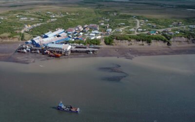
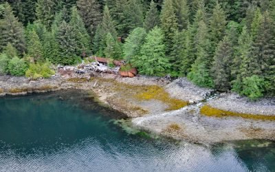
Diamond NN Cannery, South Naknek
Diamond NN is a historic cannery in South Naknek at the mouth of the Naknek River that flows into Kvichak Bay, an arm of Bristol Bay, about 56 miles (90 km) southeast of Dillingham and 13 miles (21 km) west of King Salmon, Alaska.
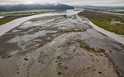
Kasilof River, Kenai Peninsula
Kasilof River starts at the outlet of Tustumena Lake on the Kenai Peninsula and flows generally northwest for 17 miles (27 km) through the Kenai Lowland to Cook Inlet, draining a watershed of 93,275 acres (37,747 ha), about 51 miles (82 km) north-northeast of Homer and 13 miles (21 km) south-southwest of Kenai, Alaska.
Bering River, Controller Bay
Bering River starts from a series of ice-marginal lakes and streams draining from the Martin River, Steller, and Bering glaciers, and flows generally south-southwest for 18 miles ( km) to Controller Bay on the Gulf of Alaska, about 63 miles (102 km) west of Cape Yakutaga and 58 miles (94 km) southeast of Cordova, Alaska.
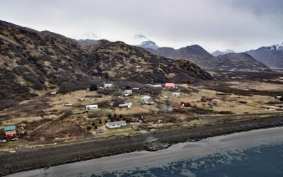
Ivanof Bay, Alaska Peninsula
Ivanof Bay is a community on the Alaska Peninsula at the head of Ivanof Bay, an estuary of the Ivanof River that starts at an elevation of roughly 1000 feet (305 m) on the south flank of the Alaska Peninsula and flows generally southwest for 9 miles (15 km) draining a watershed of 15,545 acres (6,291 ha), about 57 miles (92 km) northeast of Sand Point and 13 miles (21 km) west of Perryville, Alaska.
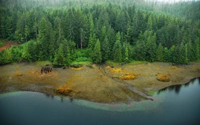
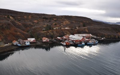
Washington Bay, Kuiu Island
Washington Bay trends east for 2 miles (3.2 km) on the northwest coast of Kuiu Island and is the site of a historical herring reduction facility near the head of the bay that is flanked by steep mountains rising abruptly to 2,800 feet (853 m) on the north and 2,200 feet (671 m) on the south, about 143 miles (230 km) northwest of Ketchikan and 24 miles (39 km) southwest of Kake, Alaska.
Ikatan Peninsula, Unimak Island
Ikatan Peninsula is connected to the northeastern tip of Unimak Island by a sand spit or tombolo separating Ikatan Bay to the north from Otter Cove to the south and is the site of the historical community of Ikatan, about 143 miles (230 km) northeast of Unalaska and 8 miles (13 km) south-southeast of False Pass, Alaska.
Hunter Bay, Prince of Wales Island
Hunter Bay is the estuary for several watersheds that support important sockeyes salmon populations and the site of a historical salmon cannery on the west coast of Prince of Wales Island near the abandoned village of Klinkwan, about 89 miles (143 km) northwest of Prince Rupert, British Columbia, and 42 miles (68 km) southwest of Ketchikan, Alaska.
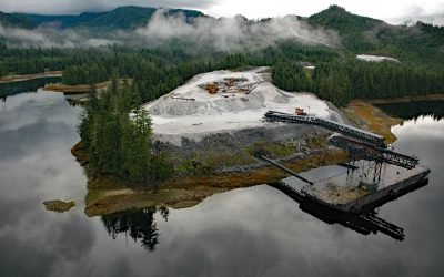
Calder, Shakan Strait
Calder is a mining camp for a historic marble quarry and present-day limestone mine situated at the mouth of Marble Creek on Shakan Strait near the entrance to El Capitan Passage on Prince of Wales Island, about 92 miles (148 km) northwest of Ketchikan and 12 miles (19 km) south-southeast of Port Protection, Alaska.
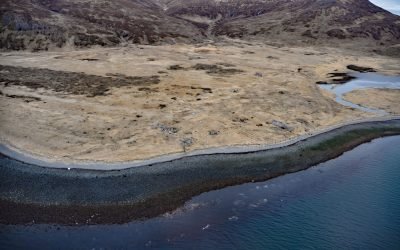
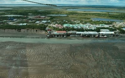
Squaw Harbor, Unga Island
Squaw Harbor is a historical cannery and fishing village situated on the north shore of Baralof Bay on the east coast of Unga Island in the Shumagin Islands, about 258 miles (415 km) east-northeast of Unalaska and 7 miles (11 km) south-southwest of Sand Point, Alaska.
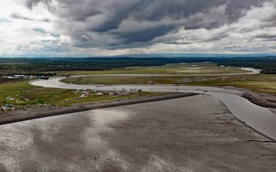
Naknek, Kvichak Bay
Naknek is a community situated on a bluff overlooking the northern bank of the mouth of the Naknek River, at Kvichak Bay which forms the northeastern arm of Bristol Bay, about 56 miles (90 km) southeast of Dillingham and 13 miles (21 km) west-northwest of King Salmon, Alaska.
About the background graphic
This ‘warming stripe’ graphic is a visual representation of the change in global temperature from 1850 (top) to 2019 (bottom). Each stripe represents the average global temperature for one year. The average temperature from 1971-2000 is set as the boundary between blue and red. The colour scale goes from -0.7°C to +0.7°C. The data are from the UK Met Office HadCRUT4.6 dataset.
Click here for more information about the #warmingstripes.