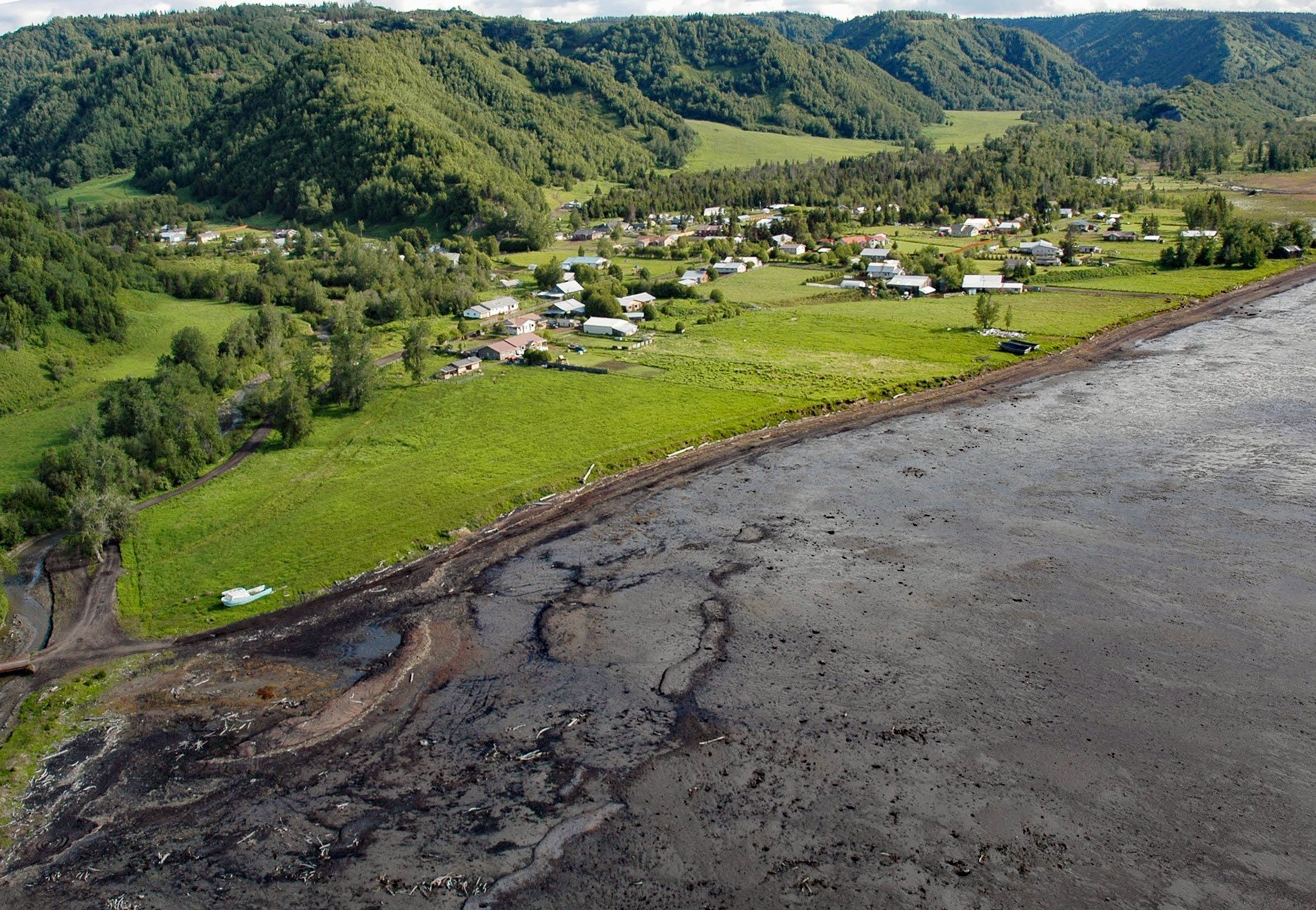
Kachemak Selo is a small community at the head of Kachemak Bay adjacent to the Fox River Flats on the Kenai Peninsula, about 27 miles (44 km) southeast of Ninilchik and 20 miles (32 km) northeast of Homer, Alaska. The community is one of several settlements of Russian Old Believers in the Fox River area including Voznesenka, Razdolna, and Dolina. The only land access to the village is by driving east from Homer to Voznesenka and descending a steep switchback trail to the beach, then traveling about 0.6 miles (1 km) northeast along the beach to reach Kachemak Selo.
The Fox River drains a watershed of about 124,856 acres (50,527 ha) and flows generally southwest for 23 miles (37 km) from the terminus of Chernof Glacier to the head of Kachemak Bay. The river name was first reported in 1895 by William H. Dall of the U.S. Geological Survey. The name may have been for Theodore Fox, Vice President of the North Pacific Mining and Transportation Co., which was operating in the Kachemak Bay area in 1894. The Chernof Glacier starts in the Harding Icefield and was named in 1913 by Alfred H. Brooks for Ivan Chernof of the Russian-American Company who explored part of the west coast of the Kenai Peninsula in 1834.
Russian Old Believers are Eastern Orthodox Christians who maintain the liturgical and ritual practices as they existed prior to the church reforms of Patriarch Nikon of Moscow between 1652 and 1666. Old Believers were persecuted in Tsarist Russia after the Revolution of 1917, many fled the country. Several groups immigrated to the United States and settled near the town of Woodburn in the Willamette Valley of Oregon. By 1968, American culture began to dominate their children’s values and lifestyles, and five families left Oregon and settled in Alberta and Alaska. Existing communities in Alaska in addition to those in Kachemak Bay include the villages of Nikolaevsk near Anchor Point, Beryozovka near Willow, and communities near Delta Junction and Kodiak in the Larsen Bay area and on Raspberry Island. Read more about Kachemak Selo and Fox River Flats here and here. Explore more of Kachemak Selo and Fox River Flats here:

