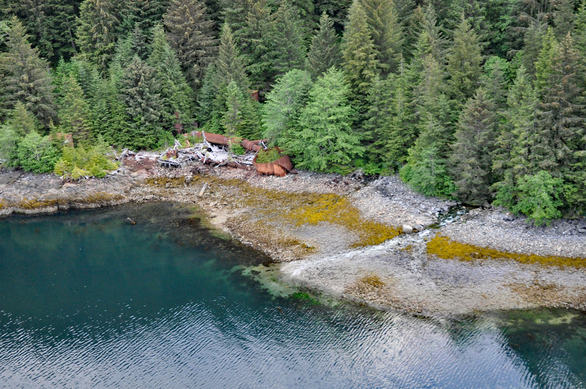
Washington Bay trends east for 2 miles (3.2 km) on the northwest coast of Kuiu Island and is the site of a historical herring reduction facility near the head of the bay that is flanked by steep mountains rising abruptly to 2,800 feet (853 m) on the north and 2,200 feet (671 m) on the south, about 143 miles (230 km) northwest of Ketchikan and 24 miles (39 km) southwest of Kake, Alaska. The name was reputedly used by local fishermen and was first published in 1899 on charts by the U.S. Coast and Geodetic Survey. A small creek at the head of the bay rises over 1,000 feet (305 m) in less than 1.5 miles (2.4 km). The mountains are the result of a localized magmatic intrusion that developed between the Oligocene and Miocene and consists of granite, quartz monzonite, and some granodiorite and diorite. The pluton intruded sedimentary rocks of the Bay of Pillars Formation that developed during the Silurian and consists of greywacke and mudstone turbidites with some layers of limestone, and conglomerate.
The western shore of Kuiu Island, and the eastern shore of Baranof Island across Chatham Strait, are the traditional lands or kwaan of the Kuiu or Kooyu Tlingit people. Their main villages were in Tebenkof Bay, about 20 miles (32 km) to the south of Washington Bay, where 148 archaeological sites were found including four large village sites spanning 4,000 years of occupation. These included house depressions, shell middens, cache pits, gardens, stone alignments, intertidal stakes, camps, and fox farming structures. The middens contained fish remains indicating that the primary species important to the Tlingit were salmon, Pacific cod, and herring. Pacific herring have a crucial role in ocean food webs because they feed on phytoplankton and zooplankton near the bottom of the food chain and convert this energy into biomass that feeds other fish, seabirds, marine mammals, and humans. Although relatively small, herring compensate by forming immense schools that move along the coastline and migrate across open water. The appearance of herring in the spring signals the start of the seasonal round of subsistence for Tlingit and other Native peoples after a long winter, historically when stored foods were likely depleted.
Since prehistorical times, herring have been eaten as fresh food, dried and smoked, rendered for their oil, and used as bait. When Alaska was purchased by the United States from Russia in 1867, herring was one of the first species targeted by commercial fisheries. In Southeast Alaska, the North West Trading Company began the first herring reduction plant to produce oil at an abandoned whaling station on Killisnoo Island near Angoon in 1878. Between 1883 and 1910, between 2,000 and 10,000 tons of herring were caught annually to supply the Killisnoo plant. The herring reduction industry expanded in the 1920s and peaked in 1929 when over 80,000 tons of herring were processed. Although the Killisnoo plant closed in 1928, production shifted to several other reduction operations, most located at Chatham Strait on Baranof and Kuiu islands including Washington Bay. In 1939, the yield dropped sharply, but especially large catches of 45,000 and 50,000 tons were made in 1947 and 1959, respectively. Widespread declines in abundance and yearly fluctuations led to weakened demand, and when Peruvian anchovies could be obtained more cheaply and reliably, the last herring reduction plant at Washington Bay closed after the 1966 season. Read more here and here. Explore more of Washington Bay and Kuiu Island here:

