Beaches
Recent Articles
More Articles
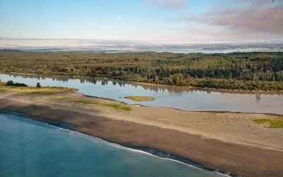
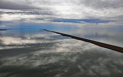
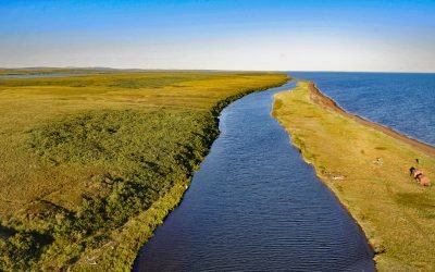
Sudden Stream, Malaspina Coastal Plain
Sudden Stream drains the Malaspina Coastal Plain, flowing generally south for 2 miles (3.2 km) from the outlet of Malaspina Lake, a proglacial lake at the terminus of the Malaspina Glacier, to a lagoon formed by a barrier spit called Schooner Beach on Yakutat Bay, about 207 miles (333 km) east-southeast of Cordova and 18 miles (29 km) northwest of Yakutat, Alaska.

Blake Island, Puget Sound
Blake Island is a Washington State Marine Park in Puget Sound situated between Bainbridge Island to the north and Vashon Island to the south, about 8 miles (13 km) southwest of downtown Seattle and 7 miles (11 km) east of Port Orchard, Washington.
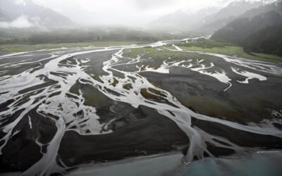
Nuka River, Beauty Bay
Nuka River starts from Bradley Pass in the Kenai Mountains at an elevation of roughly 1400 feet (427 m) and flows generally south for 10 miles (16 km), draining a watershed of 34,503 acres (13,963 ha), to Beauty Bay between Storm Mountain to the north and Mount Diablo to the south in West Arm Nuka Bay, about 57 miles (92 km) southwest of Seward and 32 miles (52 km) east-southeast of Homer, Alaska.
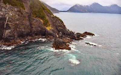
Gore Point, Kenai Peninsula
Gore Point is a major headland with a summit elevation of 1411 feet (430 m) on the outer coast of the Kenai Peninsula that extends 2.5 miles (4 km) into the Gulf of Alaska, about 83 miles (134 km) south-southwest of Seward and 37 miles (60 km) south-southeast of Homer, Alaska.
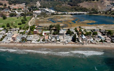
Malibu Lagoon, Santa Monica Bay
Malibu Lagoon is an estuary formed by a spit on the north shore of Santa Monica Bay that partially encloses the mouth of Malibu Creek, about 26 miles (42 km) west of downtown Los Angeles and in the community of Malibu, California.
Point Lay, Kasegaluk Lagoon
Point Lay is a delta of the Kokolik River that flows into Kasegaluk Lagoon, a massive embayment separated from the Chukchi Sea by a series of unnamed barrier islands, about 143 miles (231 km) northeast of Point Hope and 96 miles (155 km) southwest of Wainwright, Alaska.
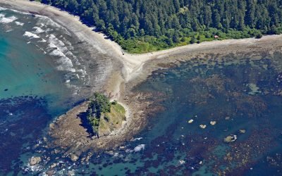
Cape Alava, Olympic National Park
Cape Alava is a point of land on the outer coast of the Olympic Peninsula in Olympic National Park, and bordering the Olympic Coast National Marine Sanctuary, about 22 miles (35 km) northwest of Forks and 15 miles (24 km) southwest of Neah Bay, Washington.
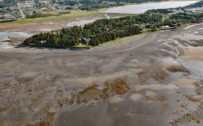
Munson Point, Kachemak Bay
Munson Point is a peninsula formed by an ancient lateral moraine located on the northern shore of Kachemak Bay between Beluga Slough to the west and Mariner Lagoon to the east, about 15 miles (24 km) northeast of Seldovia and 1 mile (1.6 km) south of Homer, Alaska.
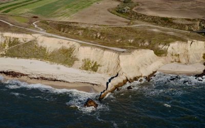
Cowell Ranch Beach, Half Moon Bay
Cowell Ranch Beach is at the southern end of Half Moon Bay near the ghost town of Purissima, and the northern boundary of the historical Cowell Ranch, about 38 miles (61 km) northwest of Santa Cruz and 2.8 miles (4.5 km) south of the community of Half Moon Bay, California.
Tukrok River, Cape Krusenstern
Tukrok River flows generally east-southeast for 7 miles (11 km) from Krusenstern Lagoon to Kotzebue Sound in Cape Krusenstern National Monument, about 166 miles (268 km) northeast of Wales and 23 miles (37 km) northwest of Kotzebue, Alaska.
About the background graphic
This ‘warming stripe’ graphic is a visual representation of the change in global temperature from 1850 (top) to 2019 (bottom). Each stripe represents the average global temperature for one year. The average temperature from 1971-2000 is set as the boundary between blue and red. The colour scale goes from -0.7°C to +0.7°C. The data are from the UK Met Office HadCRUT4.6 dataset.
Click here for more information about the #warmingstripes.