Beaches
Recent Articles
More Articles
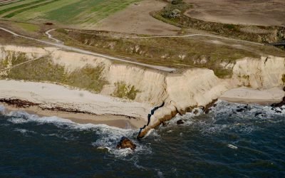
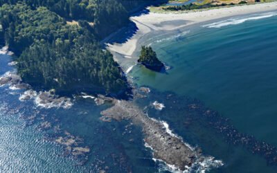
Cowell Ranch Beach, Half Moon Bay
Cowell Ranch Beach is at the southern end of Half Moon Bay near the ghost town of Purissima, and the northern boundary of the historical Cowell Ranch, about 38 miles (61 km) northwest of Santa Cruz and 2.8 miles (4.5 km) south of the community of Half Moon Bay, California.
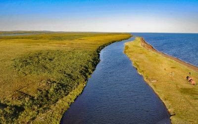
Tukrok River, Cape Krusenstern
Tukrok River flows generally east-southeast for 7 miles (11 km) from Krusenstern Lagoon to Kotzebue Sound in Cape Krusenstern National Monument, about 166 miles (268 km) northeast of Wales and 23 miles (37 km) northwest of Kotzebue, Alaska.
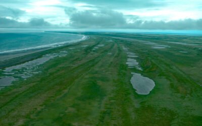
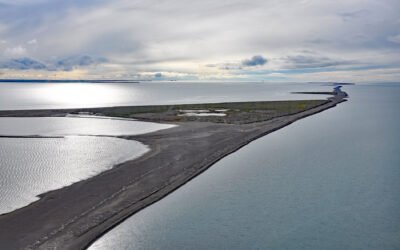
Tugidak Island, Trinity Island Group
Tugidak Island is the westernmost of the Trinity Island Group, which includes Sitkinak Island, and is part of the Kodiak Archipelago situated off the southern tip of Kodiak Island in the Gulf of Alaska, about 145 miles (233 km) east of Chignik and 124 miles (200 km) south-southwest of Kodiak, Alaska.
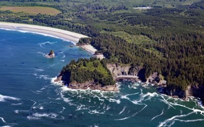
Portage Head, Makah Bay
Portage Head is a prominent headland south of Cape Flattery on the Olympic Peninsula that separates Makah Bay Beach from Shi Shi Beach, about 58 miles (94 km) west-northwest of Port Angeles and 6 miles (10 km) southwest of Neah Bay, Washington.
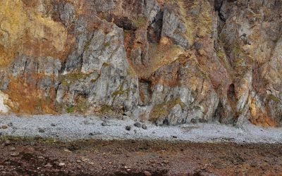
Vindicator Mine, Popof Island
Vindicator is a historical beach placer mine in the Alaska Peninsula Mining District situated on the western shore of Popof Island between Sand Point to the north and Red Cove to the south, about 260 miles (419 km) northeast of Dutch Harbor and 67 miles (108 km) southwest of Perryville, Alaska.
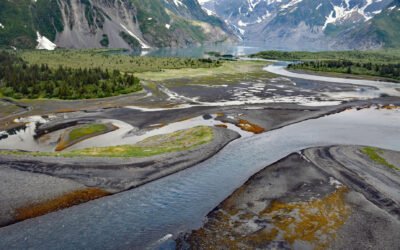
Pedersen Lagoon, Aialik Bay
Pedersen Lagoon receives freshwater from proglacial lakes of the Addison and Pedersen glaciers that descend from the Harding Icefield in Kenai Fjords National Park on the western shore of Aialik Bay, about 64 miles (103 km) east-northeast of Homer and 19 miles (31 km) south-southwest of Seward, Alaska.
Bodfish Island, Simpson Lagoon
Bodfish Island is part of the Jones Island barrier chain between Cottle Island to the east and Bertoncini Island to the west, separating Simpson Lagoon from the Beaufort Sea, about 178 miles (286 km) southeast of Utqiagvik and 30 miles (48 km) northwest of Deadhorse, Alaska.
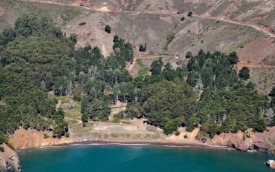
Kirby Cove, Marin Headlands
Kirby Cove is an embayment in the Marin Headlands on the northern shore of the Golden Gate in the Golden Gate National Recreation Area, and the site of a historic military installation, about 5.5 miles (9 km) northwest of downtown San Francisco and 2.3 miles (4 km) south of Sausalito, California.
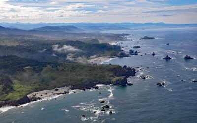
Lone Ranch Beach, Cape Ferrelo
Lone Ranch Beach is a sand and gravel deposit at Cape Ferrelo situated between Lone Ranch Creek to the north and Ram Creek to the south in Samuel H. Boardman State Scenic Corridor, about 22 miles (35 km) south of Gold Beach and 5 miles (8 km) northwest of Brookings, Oregon.
Tongue Point, Crescent Bay
Tongue Point is a rocky ledge in the Strait of Juan de Fuca that projects from a peninsula forming the eastern shore of Crescent Bay on the north coast of the Olympic Peninsula and the site of a historical port and shipwreck, about 44 miles (71 km) east-southeast of Neah Bay and 13 miles (21 km) west-northwest of Port Angeles, Washington.
About the background graphic
This ‘warming stripe’ graphic is a visual representation of the change in global temperature from 1850 (top) to 2019 (bottom). Each stripe represents the average global temperature for one year. The average temperature from 1971-2000 is set as the boundary between blue and red. The colour scale goes from -0.7°C to +0.7°C. The data are from the UK Met Office HadCRUT4.6 dataset.
Click here for more information about the #warmingstripes.