Canneries
Recent Articles
More Articles
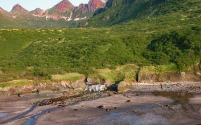
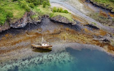
Kaflia Bay, Katmai National Park and Preserve
Kaflia Bay is a funnel-shaped embayment that extends west for 4 miles (6.5 km) from the coast of Shelikof Strait between Cape Ugyak to the north and Cape Gull to the south in Katmai National Park and Preserve, about 93 miles (150 km) southeast of King Salmon and 75 miles (121 km) northwest of Kodiak, Alaska.
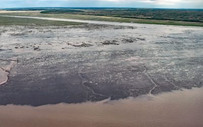
Rolph Slough, Nushagak Point
Rolph, or Ralph Slough is a tidal creek in an area of grass meadows and numerous unnamed sloughs that cut through vast mud flats on the left bank near the mouth of the Nushagak River at Nushagak Point, about 55 miles (89 km) west-northwest of Naknek and 6 miles (10 km) south of Dillingham, Alaska.
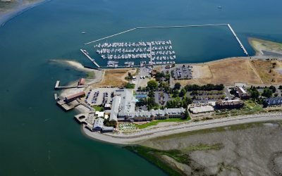
Tongue Point, Semiahmoo Spit
Tongue Point is at the end of Semiahmoo Spit, a sand bar of 125 acres (51 ha) and about 1 mile (1.6 km) long that partially encloses Drayton Harbor, about 21 miles (34 km) northwest of Bellingham and 1 mile (1.6 km) west of Blaine, Washington.
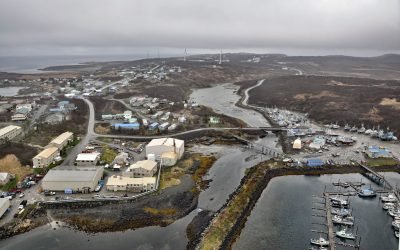
Sand Point, Popof Island
Sand Point is a community situated on Humboldt Harbor on the western shore of Popof Island, one of the Shumagin Islands in the Gulf of Alaska off the southern coast of the Alaska Peninsula, about 262 miles (422 km) northeast of Dutch Harbor and 65 miles (105 km) southwest of Perryville, Alaska.
Village Islands, Uganik Bay
Village Islands is a group of six large islands and many smaller islets that extend for 1.7 miles (2.7 km) along the western shore of Uganik Bay on the northwestern coast of Kodiak Island, about 147 miles (237 km) southwest of Homer and 42 miles (68 km) due west of Kodiak, Alaska.
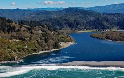
Klamath River, Requa
Klamath River flows for 257 miles (415 km) from a broad patchwork of lakes and marshes at the edge of the Oregon high desert, through the Cascade Range and the Klamath Mountains, and enters the Pacific Ocean at the community of Requa, about 52 miles (84 km) north of Eureka and 16 miles (26 km) south-southeast of Crescent City, California.
Cannery Cove, North Arm Moira Sound
Cannery Cove is on the southeastern shore and near the head of North Arm Moira Sound, about 28 miles (45 km) east-southeast of Hydaburg and 25 miles (40 km) southwest of Ketchikan, Alaska.
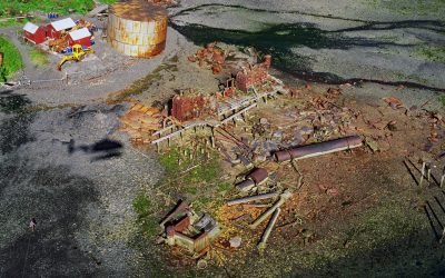
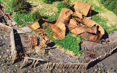
Port Vita, Raspberry Strait
Port Vita is an abandoned herring reduction plant and saltery located on Raspberry Strait, on the northeastern coast of Raspberry Island, about 31 miles (50 km) northwest of Kodiak and 15 miles (24 km) northwest of Port Lions, Alaska.
Port Wakefield, Raspberry Island
Port Wakefield is an abandoned cannery on the east coast of Raspberry Island, about 30 miles (48 km) northwest of Kodiak and 14 miles (23 km) north-northwest of Port Lions, Alaska.
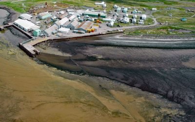
Ekuk Fisheries, Nushagak Bay
Ekuk is a small village located on Ekuk Spit on the eastern shore of Nushagak Bay, a branch of Bristol Bay, about 16 miles (26 km) south-southwest of Dillingham and 1.3 (2.1 km) miles southwest of Clarks Point, Alaska.
About the background graphic
This ‘warming stripe’ graphic is a visual representation of the change in global temperature from 1850 (top) to 2019 (bottom). Each stripe represents the average global temperature for one year. The average temperature from 1971-2000 is set as the boundary between blue and red. The colour scale goes from -0.7°C to +0.7°C. The data are from the UK Met Office HadCRUT4.6 dataset.
Click here for more information about the #warmingstripes.