Canneries
Recent Articles
More Articles
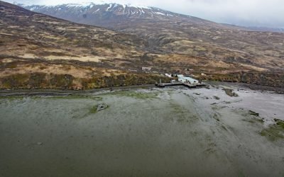
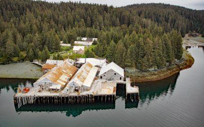
Chignik Fisheries, Chignik Lagoon
Chignik Fisheries is a facility, formerly owned and operated as a cannery by Wards Cove Packing Company, located on the northwest shore of Chignik Lagoon, southwest of Dago Point, about 44 miles (71 km) south of Port Heiden and 36 miles (58 km) northeast of Perryville, Alaska.
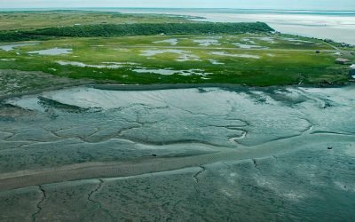
Clarks Point, Nushagak Bay
Clarks Point is the site of a historic community and salmon cannery located on the eastern shore of Nushagak Bay at the mouth of Clark Slough, about 57 miles (92 km) west-northwest of Naknek and 14 miles (23 km) south-southwest of Dillingham, Alaska.
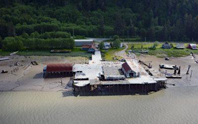
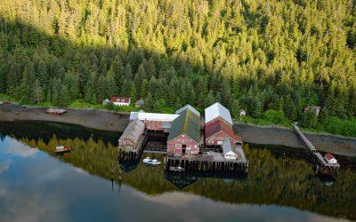
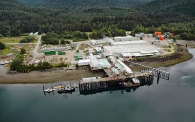
Cassiar Cannery, Skeena River
Cassiar is a historic salmon cannery situated on the northern shoreline of Inverness Passage at the mouth of the Skeena River, about 67 miles (18 km) southwest of Terrace and 11 miles (18 km) southeast of Prince Rupert, British Columbia.
Chomly, Cholmondeley Sound
Chomly is the site of a historic cannery and settlement situated on the south shore of West Arm Cholmondeley Sound on Prince of Wales Island, 28 miles (45 km) west-southwest of Ketchikan and 20 miles (32 km) east-northeast of Hydaburg, Alaska.
Steamboat Bay, Noyes Island
Steamboat Bay is the site of a historic salmon cannery on the north coast of Noyes Island, part of the Prince of Wales Archipelago in the Gulf of Esquibel of Southeast Alaska, about 122 miles (197 km) southeast of Sitka and 77 miles (124 km) west-northwest of Ketchikan, Alaska.
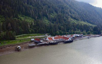
North Pacific Cannery, Inverness Passage
North Pacific Cannery was built in 1889 on 183 acres (74 ha) of Crown land on the north shore of Inverness Passage across from Smith Island and near the mouth of the Skeena River, about 70 miles (113 km) southwest of Terrace and 9 miles (14.5 km) south-southeast of Prince Rupert, British Columbia.
Admiralty Trading Company, Gambier Bay
Gambier Bay is the site of an infamous shipwreck and a historical salmon cannery operated by Admiralty Trading Company near Stephens Passage on the east coast of Admiralty Island, about 61 miles ( km) northwest of Petersburg and 59 miles (km) south-southeast of Juneau, Alaska.
Waterfall Cannery, Ulloa Channel
Waterfall is a historic cannery situated on the west coast of Prince of Wales Island on Ulloa Channel, adjacent to Port Refugio on Suemez Island, approximately 145 miles (234 km) southeast of Sitka and 60 miles (97 km) west of Ketchikan, Alaska.
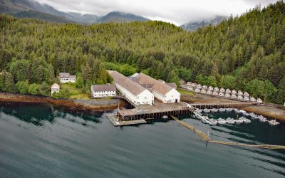
Port William, Shuyak Island
Port William is a historical salmon cannery in an embayment on the southern coast of Shuyak Island that extends 0.5 miles (0.8 km) north from Shuyak Strait, between Port Lawrence to the west and Daylight Harbor to the east, about 88 miles (142 km) southwest of Homer and 50 miles (81 km) north of Kodiak, Alaska.
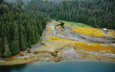
Excursion Inlet, Icy Strait
Excursion Inlet is an embayment that extends 11 miles (18 km) north-northwest from the northern coast of Icy Strait to the mouth of Excursion River, about 38 miles (61 km) west-northwest of Juneau and 9.5 miles (15 km) east of Gustavus, Alaska.
About the background graphic
This ‘warming stripe’ graphic is a visual representation of the change in global temperature from 1850 (top) to 2019 (bottom). Each stripe represents the average global temperature for one year. The average temperature from 1971-2000 is set as the boundary between blue and red. The colour scale goes from -0.7°C to +0.7°C. The data are from the UK Met Office HadCRUT4.6 dataset.
Click here for more information about the #warmingstripes.