LAST MONTH
Leffingwell Camp, Flaxman Island
Leffingwell Camp is situated on Flaxman Island, a shape-shifting barrier island separating the Beaufort Sea to the north and Lion Bay to the south, about 58 miles (94 km) east of Deadhorse and 58 miles (94 km) west of Kaktovik, Alaska.
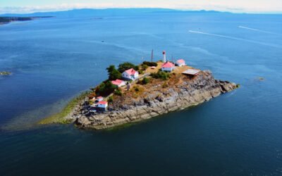
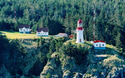
Chrome Island, Baynes Sound
Chrome Island is located 0.15 miles (0.24 km) south of Boyle Point Provincial Park, on the southern tip of Denman Island, and is the site of a historic lighthouse that marks the southern entrance to Baynes Sound, about 72 miles (116 km) west-northwest of Vancouver and 2 miles (3.2 km) east-northeast of Deep Bay, British Columbia.
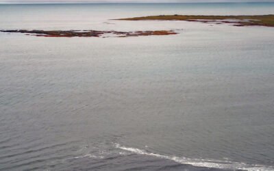
Makarius Bay, Amchitka Island
Makarius Bay is on the southeastern coast of Amchitka Island, the southernmost of the Rat Islands group in the Aleutian Islands of Southwest Alaska, bounded by the Bering Sea to the north and the Pacific Ocean to the south, about 2500 miles (4024 km) north-northwest of Honolulu and 182 miles (293 km) west-southwest of Adak, Alaska.
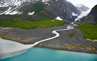
Dinglestadt Glacier, Kenai Fjords National Park
Dinglestadt Glacier has two land terminating lobes that straddle a watershed divide in the Kenai Mountains, with a minor lobe descending southeast for 4 miles (6 km) from an elevation of roughly 3300 feet (1006 m) to a tidal delta on the western shore of McCarty Glacier in Kenai Fjords National Park, about 44 miles (71 km) south-southwest of Seward and 42 miles (68 km) east of Homer, Alaska.
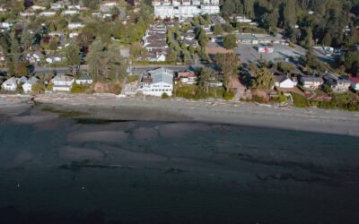
Cordova Bay, Saanich Peninsula
Cordova Bay is a shallow bight and a community located on the eastern shore of the Saanich Peninsula in the municipality of Saanich, one of the 13 cities comprising the Greater Victoria Region on Vancouver Island, about 9 miles (14.5 km) south-southeast of Sidney and 7 miles (11 km) north of downtown Victoria, British Columbia.
Langara Island, Haida Gwaii
Langara is the northernmost island of the Haida Gwaii archipelago and the site of a historic light station that marks the southern boundary of Dixon Entrance, about 94 miles (151 km) southwest of Ketchikan, Alaska and 38 miles (61 km) west-northwest of Masset, British Columbia.
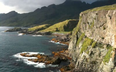
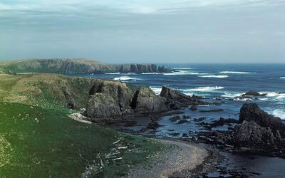
Boot Bay, Adak Island
Boot Bay is 3 miles (5 km) west of Kagalaska Strait on the south coast of Adak Island, the site of intensive military activity from 1942 to 1997, near the western extent of the Andreanof Islands group of the Aleutian Islands, about 443 miles (713 km) southwest of Unalaska and 11 miles (18 km) southeast of the community of Adak, Alaska.