Lighthouses
Recent Articles
More Articles
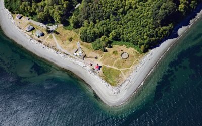
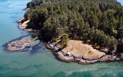
Point Robinson, Maury Island
Point Robinson is the eastern point of Maury Island in Puget Sound and the site of a historic lighthouse, about 15 miles (24 km) south of Seattle and 10 miles (16 km) north-northeast of Tacoma, Washington.
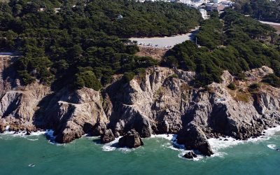
Fort Miley, Lands End
The Marine Exchange Lookout Station is on Fort Miley at Lands End in the Golden Gate National Recreation Area, about 6 miles (10 km) west of downtown San Francisco and 2.7 miles (4.4 km) southwest of the Presidio at the Golden Gate, California.
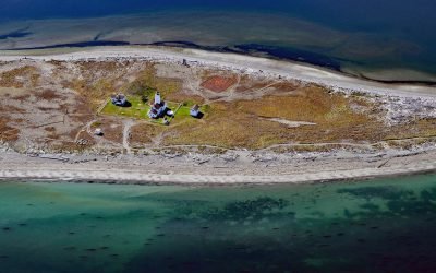
New Dungeness Light Station, Dungeness Spit
New Dungeness Light Station is located on Dungeness Spit in Dungeness National Wildlife Refuge on the southern coast of the Strait of Juan de Fuca, about 17 miles (27 km) west-northwest of Port Townsend and 7 miles (11 km) north of Sequim, Washington.
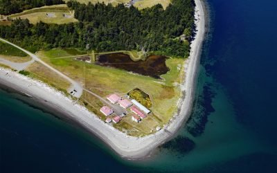
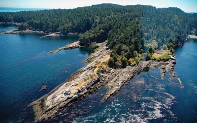
Marrowstone Point, Admiralty Inlet
Marrowstone Point is a low broad spit on Marrowstone Island that marks the entrance to Port Townsend Bay from the Admiralty Inlet, about 38 miles (61 km) north-northwest of Seattle and 3 miles (4.8 km) southeast of Port Townsend, Washington.
Helen Point, Mayne Island
Helen Point is located on the northwestern corner of Mayne Island, and has a light and range marker to aid navigation through Active Pass, about 32 miles (52 km) southwest of Vancouver and 14.5 miles (23 km) north-northeast of Sidney, British Columbia.
Porlier Pass Light, Galiano Island
Porlier Pass separates Galiano and Valdes Islands in the Southern Gulf Islands of Georgia Strait, about 28 miles (45 km) southwest of Vancouver and 10 miles (16 km) east-northeast of Ladysmith, British Columbia.
Lincoln Rock Light, Clarence Strait
Lincoln Rock and Lincoln Island are small islets in Clarence Strait in Southeast Alaska, about 63 miles (102 km) northwest of Ketchikan and 31 miles (50 km) southwest of Wrangell, Alaska.
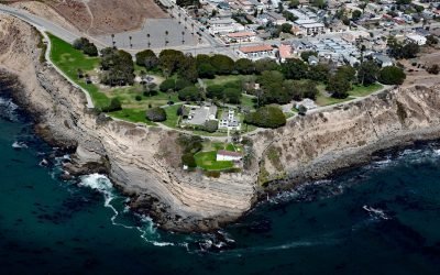
Point Fermin, San Pedro
Point Fermin is the site of a historic lighthouse at the southernmost tip of the Palos Verdes Peninsula in the city of San Pedro, about 25 miles (40 km) southeast of Santa Monica and 7 miles (11 km) southwest of Long Beach, California.
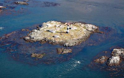
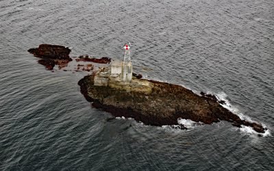
Race Rocks, Strait of Juan de Fuca
Race Rocks is a group of nine islets including North Rock, West Race, Great Race, and Rosedale Rock located about 1 mile (1.6 km) off Cape Calver on the southern tip of Vancouver Island in the Strait of Juan de Fuca, about 12 miles (19 km) southwest of Victoria and 11 miles (18 km) southeast of Sooke, British Columbia.
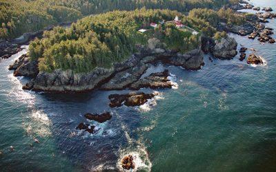
Cape Beale, Barkley Sound
Cape Beale is the site of a historic lighthouse marking the southern entrance to Barkley Sound on the west coast of Vancouver Island in Pacific Rim National Park Reserve, about 89 miles (143 km) west-northwest of Victoria and 4.7 miles (7.6 km) southwest of Bamfield, British Columbia.
About the background graphic
This ‘warming stripe’ graphic is a visual representation of the change in global temperature from 1850 (top) to 2019 (bottom). Each stripe represents the average global temperature for one year. The average temperature from 1971-2000 is set as the boundary between blue and red. The colour scale goes from -0.7°C to +0.7°C. The data are from the UK Met Office HadCRUT4.6 dataset.
Click here for more information about the #warmingstripes.