Shipwrecks
Recent Articles
More Articles
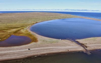
Ipiutak, Tigara Peninsula
Ipiutak is the Iñupiaq name for a prehistorical village that is now an archaeological site and National Historic Landmark on the Tigara Peninsula and the southern shore of Ipiutak Lagoon, about 133 miles (215 km) southwest of Point Lay and 1 mile (1.6 km) northwest of Point Hope, Alaska.
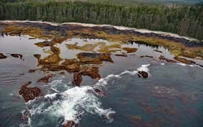
Village Islands, Uganik Bay
Village Islands is a group of six large islands and many smaller islets that extend for 1.7 miles (2.7 km) along the western shore of Uganik Bay on the northwestern coast of Kodiak Island, about 147 miles (237 km) southwest of Homer and 42 miles (68 km) due west of Kodiak, Alaska.
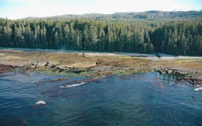
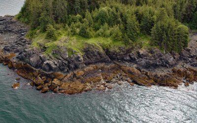
Cape Douglas, Shelikof Strait
Cape Douglas is a point of land at the base of Mount Douglas on the western shore of Shelikof Strait that forms the southern shore of Sukoi Bay in Katmai National Park and Preserve, about 83 miles (134 km) southwest of Homer and 81 miles (131 km) northwest of Kodiak, Alaska.
Neva, Kruzof Island
In 1813, the Russian exploration ship Neva wrecked near Kruzof Island, about 93 miles (150 km) southwest of Juneau and 10 miles (16 km) west of Sitka, Alaska.
Michigan Creek, Pacific Rim National Park Reserve
Michigan Creek starts at an elevation of 1400 feet (427 m) and flows generally south for 4 miles (6.4 km) through the coast mountains on Vancouver Island and enters the Pacific Ocean in the Pacific Rim National Park Reserve 1 mile (1.6 km) east of the Pachena Point Light Station, about 81 miles (130 km) west-northwest of Victoria and 8.5 miles (14 km) southeast of Bamfield, British Columbia.
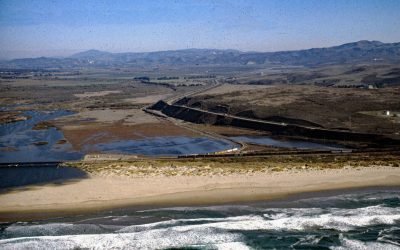
Surf Beach, Santa Ynez River
Surf Beach is within Vandenberg Space Force Base and extends south-southwest for about 4.5 miles (7.3 km) from the mouth of the Santa Ynez River estuary to Spring Canyon, about 31 miles (50 km) south of Pismo Beach and 9 miles (14.5 km) west-northwest of Lompoc, California.
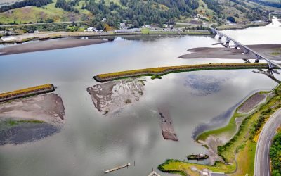
Mary D. Hume, Rogue River
Mary D. Hume sank in 1984 on the south bank of the Rogue River during a restoration effort to convert the vessel to a museum ship for the Curry County Historical Society and now rests on the bottom in shallow water with a portion of the hull and superstructure exposed at low tide near Gold Beach, Oregon.
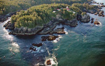
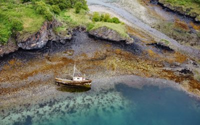
Cape Beale, Barkley Sound
Cape Beale is the site of a historic lighthouse marking the southern entrance to Barkley Sound on the west coast of Vancouver Island in Pacific Rim National Park Reserve, about 89 miles (143 km) west-northwest of Victoria and 4.7 miles (7.6 km) southwest of Bamfield, British Columbia.
Point Lena, Favorite Channel
Point Lena is located on Favorite Channel, between Point Stephens to the north and Point Louisa to the south, and is the site of an infamous historical shipwreck and the present-day Ted Stevens Marine Research Institute, about 63 miles (102 km) south-southeast of Haines and 14 miles (23 km) northwest of Juneau, Alaska.
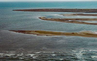
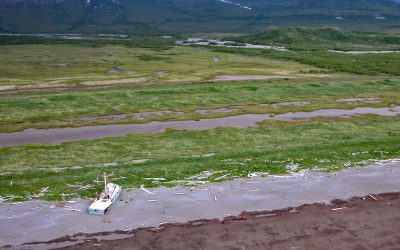
Point Franklin, Peard Bay
Point Franklin is the site of several whaling shipwrecks at the end of a barrier spit that extends 13 miles (21 km) northeast from the Arctic Coastal Plain, and together with the Seahorse Islands, separates Peard Bay from the Chukchi Sea, about 54 miles (87 km) southwest of Utqiaġvik and 33 miles (53 km) northeast of Wainwright, Alaska.
About the background graphic
This ‘warming stripe’ graphic is a visual representation of the change in global temperature from 1850 (top) to 2019 (bottom). Each stripe represents the average global temperature for one year. The average temperature from 1971-2000 is set as the boundary between blue and red. The colour scale goes from -0.7°C to +0.7°C. The data are from the UK Met Office HadCRUT4.6 dataset.
Click here for more information about the #warmingstripes.