by CoastView | Aug 21, 2022 | 2022, Alaska, Biodiversity, Coastal Features, Embayments, Land Use, Natural History, Parks
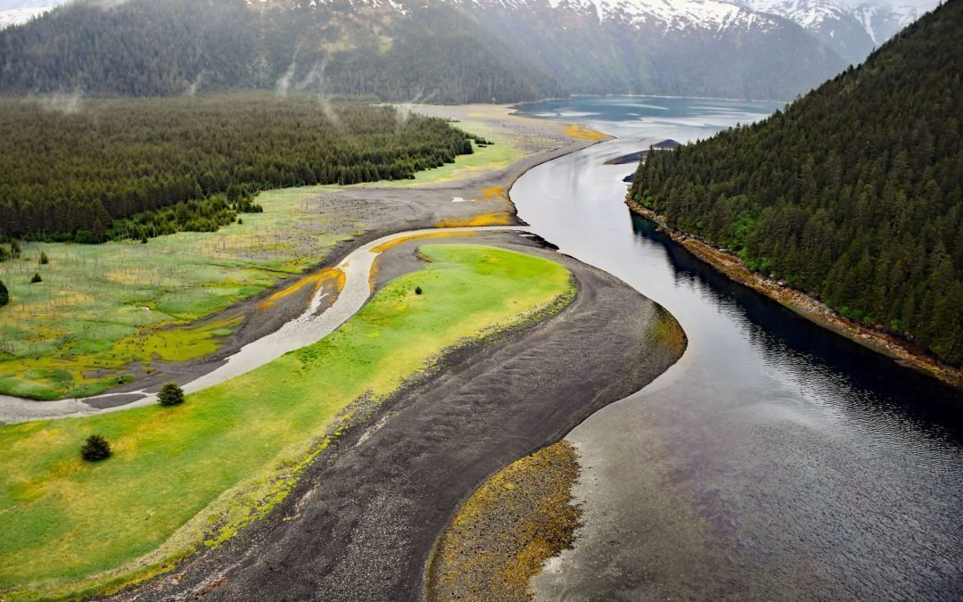
Delight Creek flows generally southwest for 2 miles (3.2 km) from Delight Lake to the entrance of McCarty Lagoon, an embayment about 0.5 miles (0.8 km) wide and 2 miles (3.2 km) long on the eastern shore of McCarty Fjord, on the outer coast of the Kenai Peninsula in...
by CoastView | Aug 20, 2022 | 2022, Alaska, Coastal Features, Islands, Land Use, Natural History
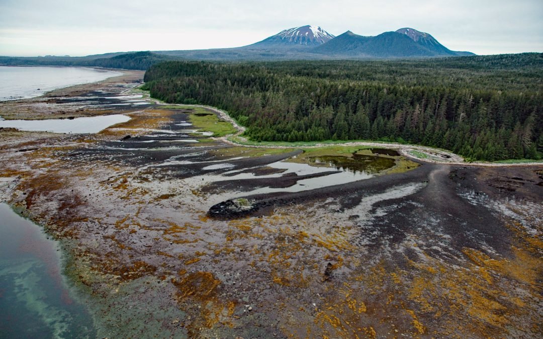
Mount Edgecumbe is a dormant volcano with an elevation of 3,201 feet (976 m) on the southern coast of Kruzof Island, about 100 miles (161 km) southwest of Juneau and 16 miles (26 km) west of Sitka, Alaska. In 1775, the volcano was named Montana de San Jacinto by Don...
by CoastView | Aug 19, 2022 | 2022, Biodiversity, California, Coastal Features, Communities, Historical, Land Use, Parks, Rivers
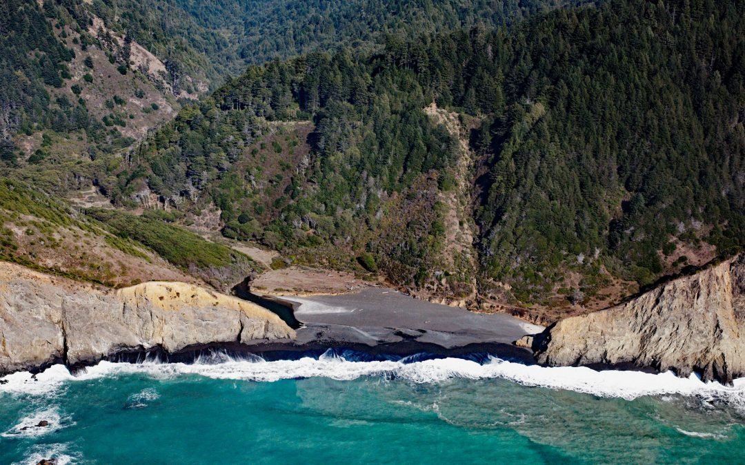
Jackass Creek starts from an elevation of about 1,400 feet (427 m) on the western flank of Jackass Ridge and flows generally west for 2.5 miles (4 km) to the Pacific Ocean draining a watershed of about 3,458 acres (1,400 ha), about 18 miles (30 km) north-northwest of...
by CoastView | Aug 18, 2022 | 2022, Alaska, Biodiversity, Canneries, Coastal Features, Developments, Embayments, Historical, Islands, Land Use, Natural History
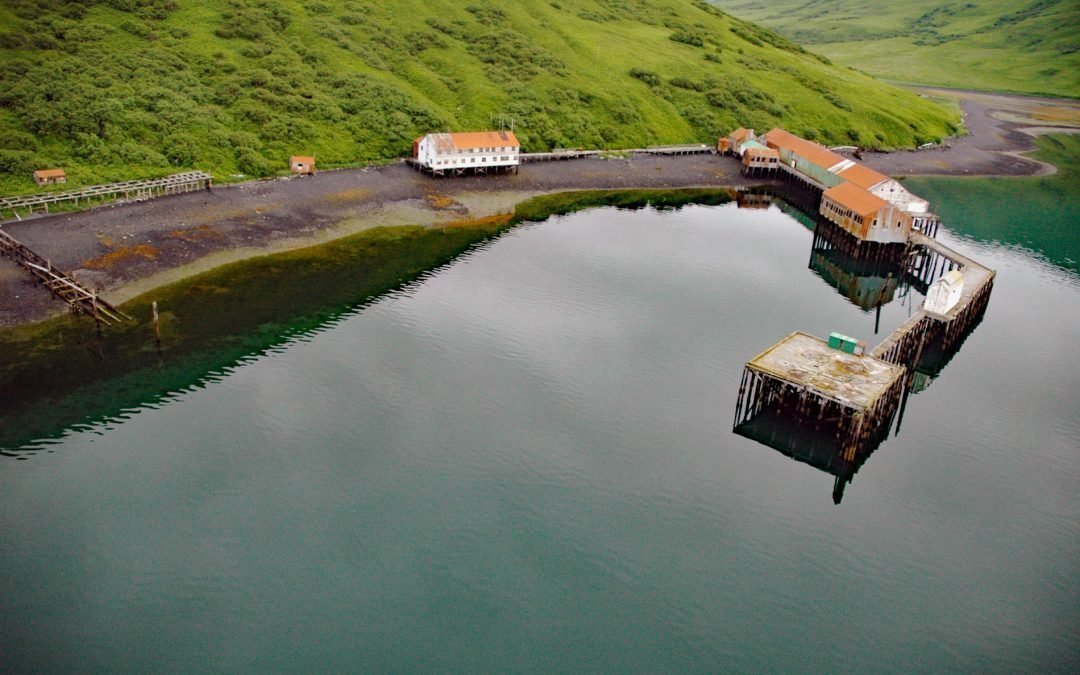
Chip Cove is an embayment between Luchek Mountain to the south and Peak 2001 to the north, and the site of a historical salmon cannery on the western shore of Moser Bay near Olga Narrows on the southwestern coast of Kodiak Island, about 83 miles (131 km) southwest of...
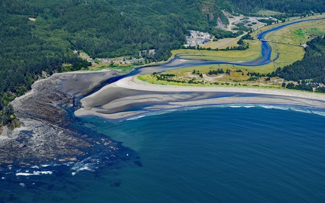
by CoastView | Aug 8, 2022 | 2022, Biodiversity, Coastal Features, Embayments, Historical, Land Use, Natural History, Rivers, Washington
Wa’atch River starts at an elevation of about 1,480 feet (451 m) on the eastern flank of Makah Peaks and flows generally north for 5 miles (8 km) through the Makah Indian Reservation on the Olympic Peninsula to the confluence of Educket Creek and then generally...