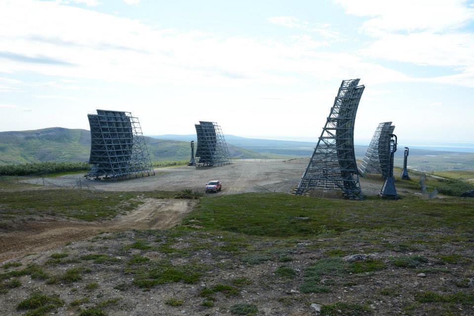
by CoastView | Mar 25, 2022 | 2022, Alaska, Chemical Pollution, Communities, Developments, Historical, Land Use
White Alice is a historical communication station situated on Anvil Mountain at an elevation of 1,134 feet (345 m) on the Seward Peninsula, about 180 miles (290 km) southwest of Kotzebue and 5 miles (6.5 km) north-northeast of Nome, Alaska. Anvil Mountain was named in...
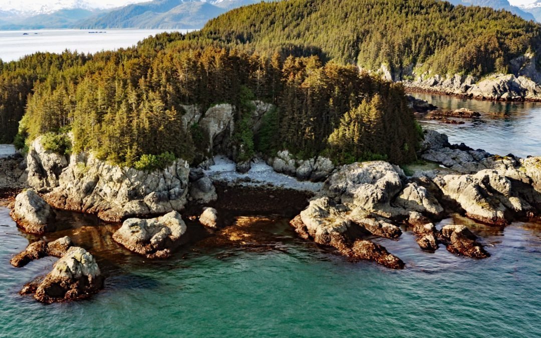
by CoastView | Mar 24, 2022 | 2022, Alaska, Coastal Features, Embayments, Historical, Islands, Land Use
George Island is the largest of the George Islands located at the entrance to Port Althorp, between the Inian and Althorp Peninsulas on northern Chichagof Island and on the southern coast of Cross Sound, about 28 miles (45 km) north-northwest of Sitka and 28 miles (45...
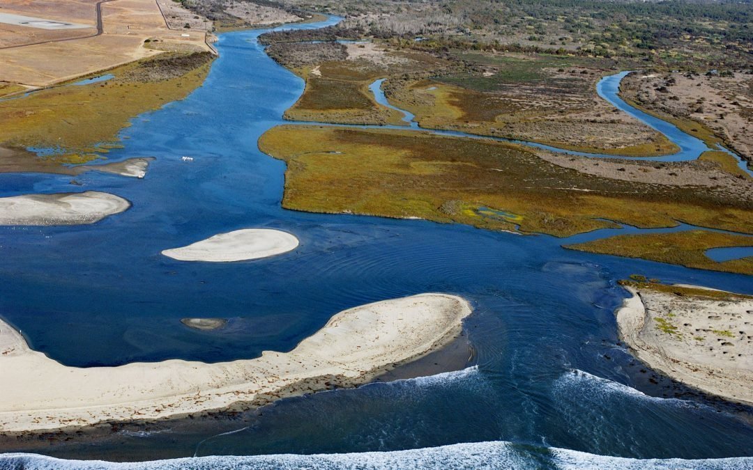
by CoastView | Mar 23, 2022 | 2022, Beaches, Biodiversity, California, Chemical Pollution, Coastal Features, Embayments, Historical, Land Use, Natural History, Parks, Rivers
Tijuana River drains a watershed of 1.1 million acres (450,000 ha) starting from the Sierra de Juárez of northern Baja California and flowing generally west-northwest for 120 miles (195 km) to the Pacific Ocean at the southern city limits of Imperial Beach, about 11...
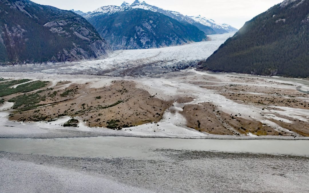
by CoastView | Mar 22, 2022 | 2022, Alaska, Beaches, Climate Change, Coastal Features, Embayments, Glaciers, Historical, Mines, Rivers
Baird Glacier starts in the Stikine Icefield in the Boundary Ranges of the Coast Mountains near the Alaska-British Columbia border, and flows generally southwest for 24 miles (39 km) to its terminus at an outwash plain 2 miles (3.2 km) north of the head of Thomas Bay,...
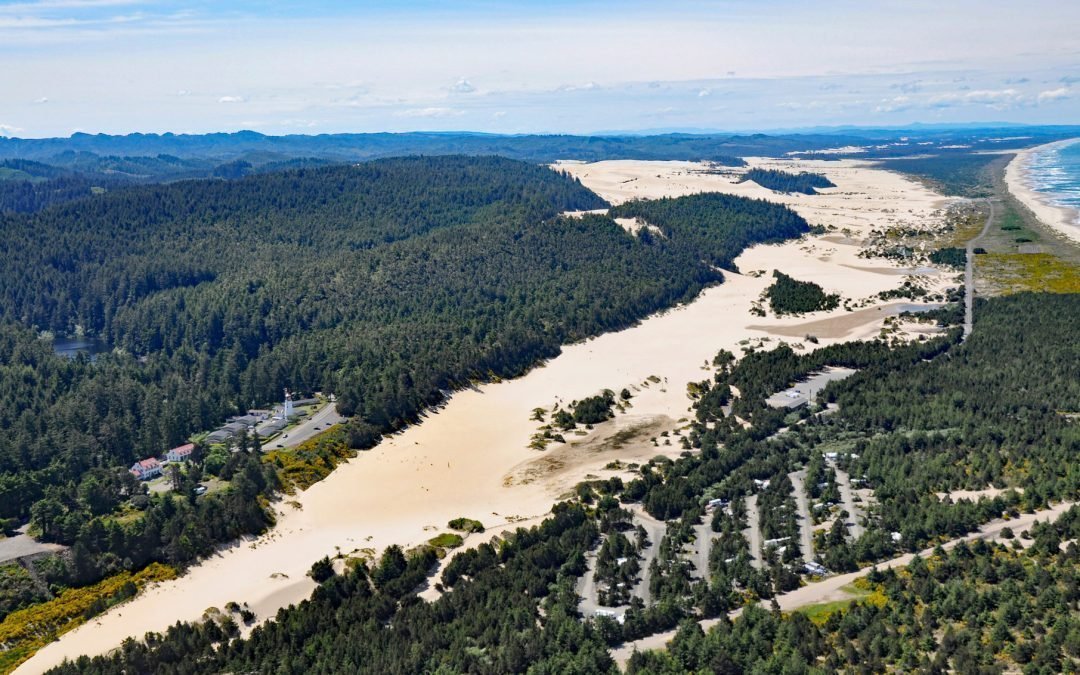
by CoastView | Mar 21, 2022 | 2022, Beaches, Coastal Features, Developments, Embayments, Historical, Land Use, Lighthouses, Oregon, Parks, Rivers
Umpqua River flows generally west-northwest for 111 miles (179 km), draining a watershed of 2.4 million acres (1 million ha), from the Cascade Mountains through the Coast Range to Winchester Bay in the Oregon Dunes, about 20 miles (32 km) north of Coos Bay and 5.5...