Waterfalls
Recent Articles
More Articles
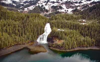
Cliff Falls, Deep Cove
Cliff Falls is the outlet for Cliff Lake situated at the head of Deep Cove, an embayment on the east coast of Baranof Island with an entrance about 1.1 miles (1.8 km) west of Patterson Point, about 41 miles (66 km) south-southeast of Sitka and 17.5 miles (28 km) north-northwest of Port Armstrong, Alaska.
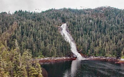
Beaver Falls Creek, George Inlet
Beaver Falls Creek is on Revillagigedo Island, on the western shore of George Inlet, 5.3 miles (8.5 km) northeast of Ketchikan, Alaska.
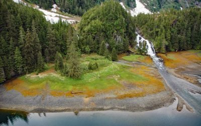
Kasnyku Falls, Waterfall Cove
Kasnyku Falls is a waterfall located on Kasnyku Creek that drains Kasnyku Lake from an elevation of 650 feet (198 m) on the northeast coast of Baranof Island and flows about 1 mile (1.6 km) to Waterfall Cove on Chatham Strait, about 23 miles (37 km) south-southwest of Angoon and 21 miles (34 km) northeast of Sitka, Alaska.
Cascade Falls, Eaglek Bay
Cascade Falls descends to Cascade Bay, an estuary that extends northwest for 1.5 miles (2.4 km) from Eaglek Bay in the Chugach National Forest of northern Prince William Sound, about 52 miles (84 km) west-southwest of Valdez and 32 miles (51.5 km) east-northeast of Whittier, Alaska.
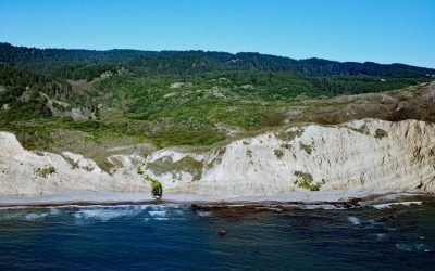
Alamere Falls, Point Reyes National Seashore
Alamere Falls is located about 0.4 miles (0.6 km) north of Double Point where Alamere Creek cascades 40 feet (12 m) over a sea cliff, directly into the ocean at high tides and otherwise onto Wildcat Beach in the Phillip Burton Wilderness of Point Reyes National Seashore, about 6 miles (10 km) south of Olema and 6.4 miles (10.3 km) northwest of Bolinas, California.
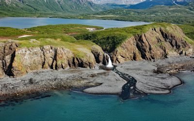
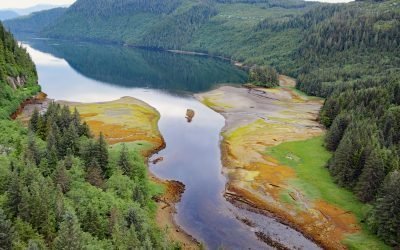
Kirschner Lake, Kamishak Bay
Kirschner Lake is on the western coast of lower Cook Inlet at an elevation of about 80 feet (24 m) and isolated by a waterfall that cascades 40 feet (12 m) to the northern shore of Kamishak Bay, about 110 miles (177 km) northeast of King Salmon and 86 miles (138 km) west-southwest of Homer, Alaska.
Falls Creek, Kachemak Bay
Falls Creek is on the Kenai Peninsula and flows generally south for 3.2 miles (5 km) to the northwestern shore of Kachemak Bay, in the Cottonwood Eastland Unit of Kachemak Bay State Park, about 17 miles (27 km) northeast of Homer and 2.5 miles (4 km) southwest of Kachemak Selo, Alaska.
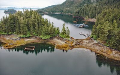
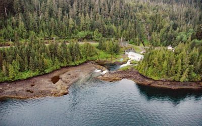
Hidden Falls Hatchery, Kasnyku Bay
The Hidden Falls Fish Hatchery is located in Tongass National Forest on the northeast coast of Baranof Island, at the head of Kasnyku Bay off Chatham Strait, about 22 miles (35 km) south-southeast of Angoon and 21 miles (34 km) northeast of Sitka, Alaska.
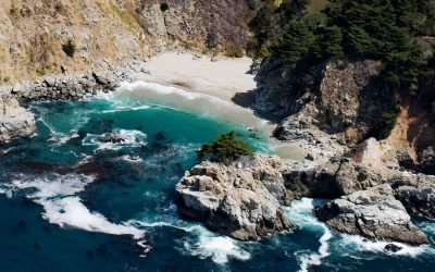
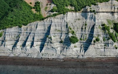
McWay Creek, Julia Pfeiffer Burns State Park
McWay Creek drains a watershed of about 1730 acres (700 ha) and flows generally southwest for 2.5 miles (4.0 km) through Julia Pfeiffer Burns State Park from McWay Canyon to McWay Falls, which cascades 80 feet (24 m) over a sea cliff into a cove on the Big Sur coast, about 30 miles (48 km) south-southeast of Carmel and 12 miles (19 km) northwest of Lucia, California.
Triumph Bay, Gardner Canal
Triumph Bay is a long narrow embayment located on the south side of Alan Reach in Gardner Canal, British Columbia.
About the background graphic
This ‘warming stripe’ graphic is a visual representation of the change in global temperature from 1850 (top) to 2019 (bottom). Each stripe represents the average global temperature for one year. The average temperature from 1971-2000 is set as the boundary between blue and red. The colour scale goes from -0.7°C to +0.7°C. The data are from the UK Met Office HadCRUT4.6 dataset.
Click here for more information about the #warmingstripes.