Waterfalls
Recent Articles
More Articles
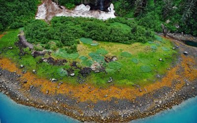
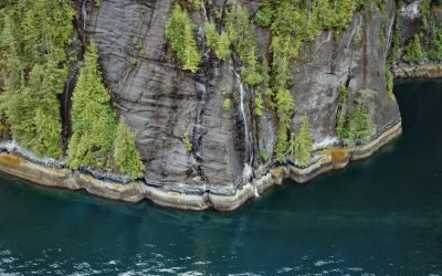
Whale Bay, Prince William Sound
Whale Bay is on the northeastern coast of the Kenai Peninsula in Prince William Sound, and extends northeast for 4 miles (6.5 km) to the southern end of Knight Island Passage, about 88 miles (141 km) west-southwest of Cordova and 45 miles (73 km) east of Seward, Alaska.
Rookery Falls, Passage Canal
Rookery Falls is located on the northern shore of Passage Canal in Prince William Sound, about 50 miles (80 km) southeast of Anchorage and 1.7 miles (1.9 km) north-northeast of Whittier, Alaska.
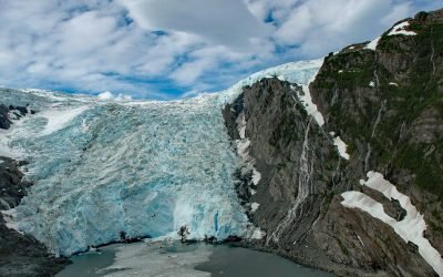
Ultramarine Glacier, Blue Fjord
Ultramarine Glacier is located at the head of Blue Fjord, a glacial estuary that trends generally north for 4.5 miles (7.3 km) to Port Nellie Juan in western Prince William Sound on the east coast of the Kenai Peninsula, about 87 miles (140 km) west of Cordova and 26 miles (42 km) southeast of Whittier, Alaska.
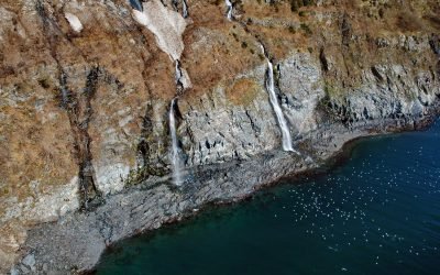
Big Port Walter, Baranof Island
Port Walter is a fjord 3.7 miles (6 km) long that opens into Chatham Strait on the southeast coast of Baranof Island, about 91 miles (146 km) west of Wrangell and 51 miles (82 km) south-southeast of Sitka, Alaska.
Rudyerd Bay, Misty Fjords National Monument
Rudyerd Bay is a deglaciated fjord in the Coast Range of Southeast Alaska in Misty Fjords National Monument, about 89 miles (143 km) north-northwest of Prince Rupert and 39 miles (63 km) northeast of Ketchikan, Alaska.
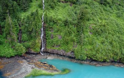
Beloit Glacier, Blackstone Bay
Beloit Glacier flows northeast for about 2 miles (3.2 km) from an unnamed ice field on the Kenai Peninsula to Blackstone Bay in Prince William Sound, about 86 miles (138 km) southwest of Valdez and 9 miles (15 km) south of Whittier, Alaska.
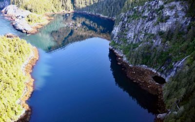
Taz Basin, Granite Island
Taz Basin is a small cove on the west coast of Granite Island, one of the Chiswell Islands on the south coast of Kenai Fjords National Park, about 61 miles (98 km) east of Homer and 34 miles (55 km) south-southwest of Seward, Alaska.

Weeping Wall, Umnak Island
Weeping Wall is a cliff on the northwest side of Okmok Volcano on the northeastern part of Umnak Island, one of the Fox Islands in the Eastern Aleutians, about 73 miles (117 km) west-southwest of Dutch Harbor and 49 miles (79 km) north-northeast of Nikolski, Alaska.
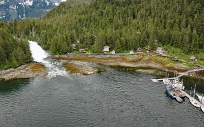
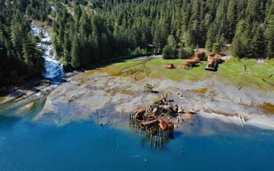
Baranof, Warm Springs Bay
Baranof is a community located at the head of Warm Springs Bay, at the outlet of Baranof Lake, on the Chatham Strait coast of Baranof Island, about 86 miles (139 km) south-southwest of Juneau and 20 miles (32 km) east of Sitka, Alaska.
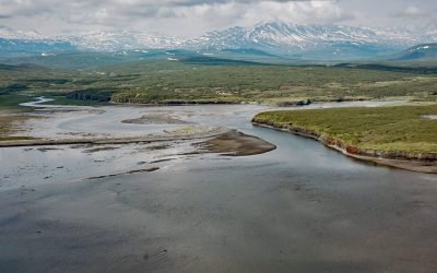
McNeil River, Kamishak Bay
McNeil River starts from glaciers and alpine lakes in the Aleutian Range of the Alaska Peninsula and flows generally northeast for 35 miles (56 km) to McNeil Cove in Kamishak Bay, 103 miles (166 km) southwest of Homer and 101 miles (163 km) northwest of Kodiak, Alaska.
About the background graphic
This ‘warming stripe’ graphic is a visual representation of the change in global temperature from 1850 (top) to 2019 (bottom). Each stripe represents the average global temperature for one year. The average temperature from 1971-2000 is set as the boundary between blue and red. The colour scale goes from -0.7°C to +0.7°C. The data are from the UK Met Office HadCRUT4.6 dataset.
Click here for more information about the #warmingstripes.