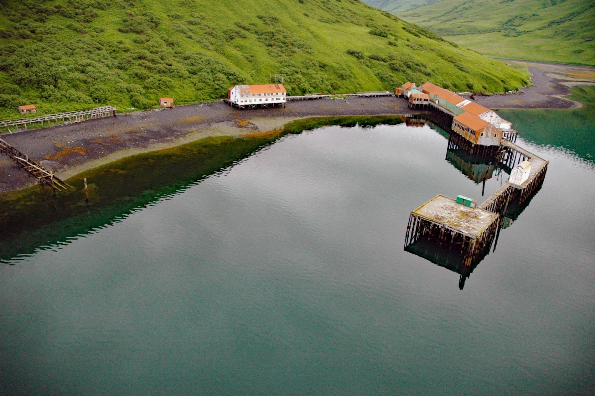
Chip Cove is an embayment between Luchek Mountain to the south and Peak 2001 to the north, and the site of a historical salmon cannery on the western shore of Moser Bay near Olga Narrows on the southwestern coast of Kodiak Island, about 83 miles (131 km) southwest of Kodiak and 6 miles (10 km) north of Akhiok, Alaska. The embayment was originally named Chips Cove in 1900 by Lieutenant Commander Jefferson F. Moser of the U.S. Navy who was in command of the U.S. Fish Commission steamer Albatross that made surveys in this area from 1897 to 1901. Olga Narrows separates Olga Bay to the north from Alitak Bay to the south. Chip Cove and Olga Bay are part of the Alitak Bay Fishing District which has been important for the commercial salmon industry for over a century. The many tributary creeks that drain lakes are an ideal habitat for spawning and rearing sockeye salmon. Beginning in the late 1880s, salmon canneries have operated at Upper Station, Snug Harbor, Akalura, Chip Cove, and Lazy Bay, but only the latter is still in operation. The intricate coastline and geomorphologically complex landscape result from repeated glaciations and weathering of rock called the Kodiak Formation which is part of the Chugach terrane, now also known as the Southern Margin Composite terrane, that extends for about 1,243 miles (2,000 km) along the southern margin of Alaska. The Kodiak Formation is mostly partially metamorphosed sedimentary rocks called turbidites that formed during the Late Cretaceous when sediments accumulated in a deep ocean trench. The trench resulted from the subduction of an oceanic plate underneath the North American continental plate and was subsequently filled with sediments derived from the erosion of the adjacent volcanic arc mountains and uplifted rocks of older terranes.
Kodiak Island is the home of the Koniag, an Alutiiq people also known as the Kaniagmiut, who occupied the whole island and portions of the adjacent Alaska Peninsula. Archaeological investigations show that at an earlier time at least two other groups of people who were culturally distinct occupied the area. Kasukuak was historically a village at Humpy Cove about 12 miles (15 km) south-southeast from Chip Cove and across Alitak Bay. Kasukuak was a sea otter hunting settlement established by Russian fur traders in the 18th century. The abandonment of several neighboring villages after a smallpox epidemic in 1837 helped to build the population of Kasukuak. Starting in 1840, survivors of the epidemic from 65 small villages were concentrated in larger communities. People from Kaguyak, Sitkinak, Ubachvik, Tugidak, and Kashkak were sent to Aiaktalik Island off the southern tip of Kodiak Island. People from Aiakolik and Paiskoe were sent to Kasukuak at Humpy Cove. After the Alaska Purchase in 1867, the sea otter fur industry waned and fishing gained economic importance. In 1878, the village of Akhiok was founded with the construction of the Holy Trinity Church by people coming from Tigalda, and Chulka village on Akun Island. With the collapse of the fur trade and a devastating influenza epidemic in 1918, many families from Aiaktalik and Kasukuak moved to Akhiok to be closer to the new Alitak Packing Company salmon cannery at Lazy Bay that provided employment. During World War II, the U.S. Postal Service briefly renamed the community Alitak, to avoid confusing it with Akiak, a Yup’ik village in western Alaska. The residents of Akhiok include the descendants of several families from Kaguyak, a village destroyed by the tsunamis that followed the 1964 Alaska Earthquake. Today, Akhiok is home to the federally recognized Alaska Native Village corporation of Akhiok-Kaguyak.
In 1937, Richard D. Suryan of Anacortes, Washington came to Moser Bay with a floating cannery to pack salmon. Suryan had purchased the Commander, formerly a passenger ferry named General Frisbie that operated on San Francisco Bay and later in Puget Sound, and had it converted to house canning equipment and workers. The newly configured Commander sailed north to Alaska on May 25, 1937, operated all summer, and returned to Puget Sound in the fall to sell the canned fish. A fleet of powered skiffs and two small seiners supplied the salmon for the operation that was later incorporated as the Far North Packing and Shipping Company. In 1939, the company beached the Commander and built a warehouse, fish house, and cold storage facility onshore at Chip Cove. The Commander was part of the cannery operations until she was broken up in 1950. In 1946, the cannery was sold to Libby, McNeil and Libby. In 1951 a fire destroyed the fish house but most of the other buildings were saved. In 1959, Libby, McNeil and Libby withdrew from the Kodiak fishing district, selling the Moser Bay cannery to Columbia Wards Fisheries. Today, the facility no longer processes salmon but is used as a station for net repair and obtaining supplies. Read more here and here. Explore more of Chip Cove and Moser Bay here:

