
Hatcheries
Recent Articles
More Articles
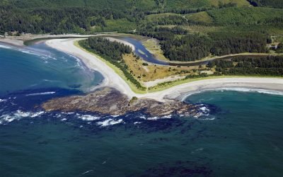
Sooes River, Makah Bay
Sooes River, also known as the Tsoo-Yess River, originates in the northwest foothills of the Olympic Mountains and flows for 16 miles (26 km) through private timberlands and the Makah Reservation until it reaches Makah Bay, about 120 miles (194 km) northwest of Seattle and 4 miles (6.5 km) southwest of Neah Bay, Washington.
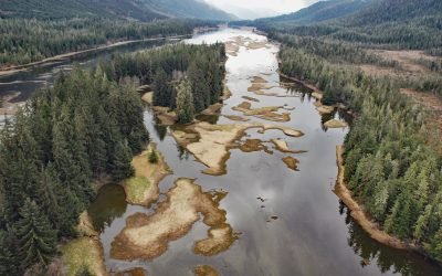
Blind Slough, Mitkof Island
Blind Slough is an estuary about 4 miles (6.5 km) long forming the lower course of the Blind River, that flows northwest on Mitkof Island to Wrangell Narrows, about 24 miles (39 km) northwest of Wrangell and 12 miles (19 km) south of Petersburg, Alaska.
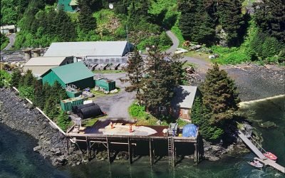
Kitoi Bay Hatchery, Afognak Island
Kitoi Bay is a cove about 0.5 miles (0.8 km) across, located on the west side of Izhut Bay on the southeast coast of Afognak Island, about 105 miles (169 km) southwest of Homer and 28 miles (45 km) north of Kodiak, Alaska.

Main Bay, Prince William Sound
Main Bay is an estuary on the Kenai Peninsula fed by a watershed of 3,795 acres (1,536 ha) mostly draining from an unnamed lake at an elevation of 205 feet (62 m) on the northern flank of Eshamy Peak in Prince William Sound, between Port Nellie Juan to the west and Knight Island Passage to the east, about 81 miles (131 km) west of Cordova and 28 miles (45 km) southeast of Whittier, Alaska.
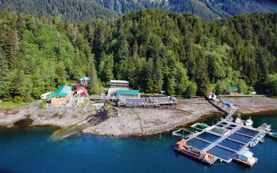
Port Armstrong, Baranof Island
Port Armstrong is an embayment on the southeast coast of Baranof Island, that extends west-southwest for 1.6 miles (2.6 km) from Point Eliza on Chatham Strait, and the site of a historical whaling station and present-day salmon hatchery, about 59 miles (95 km) south-southeast of Sitka and 4 miles (6.5 km) north of Port Alexander, Alaska.
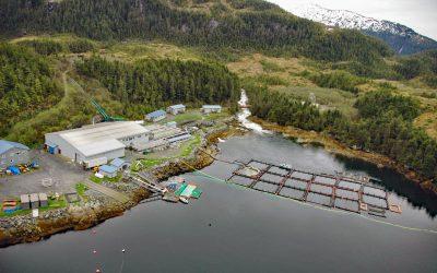
Lake Bay, Esther Island
Lake Bay is the site of a salmon hatchery on the southern coast of Esther Island in northwestern Prince William Sound, and the deglaciated fjord extends 1.5 miles (2.4 km) northwest from Wells Passage, about 63 miles (101 km) west-southwest of Valdez and 20 miles (32 km) east of Whittier, Alaska.
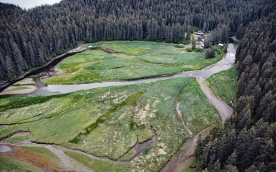
Tutka Bay Lagoon, Kachemak Bay State Park
Tutka Bay Lagoon is the site of a fish hatchery located about 4 miles (6.5 km) inside and on the southern shore of Tutka Bay in Kachemak Bay State Park, about 10 miles (16 km) east of Seldovia and 15 miles (24 km) south-southeast of Homer, Alaska.
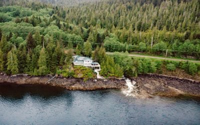
Whitman Creek, Revillagigedo Island
Whitman Creek is on the southeast coast of Revillagigedo Island, about 14 miles (23 km) north of Metlakatla and 7 miles (11 km) east-southeast of Ketchikan, Alaska.
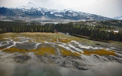
Cannery Creek, Unakwik Inlet
Cannery Creek is the site of a salmon hatchery on the eastern shore of Unakwik Inlet in Prince William Sound and the Chugach National Forest, about 42 miles (68 km) northeast of Whittier and 41 miles (66 km) west-southwest of Valdez, Alaska.
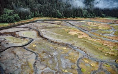
Limestone Inlet, Stephens Passage
Limestone Inlet, 0.25 miles (0.4 km) wide, extends about 2 miles (3.2 km) into the mainland from the eastern shore of Stephens Passage, approximately 84 miles (135 km) northeast of Sitka and 25 miles (40 km) southeast of Juneau, Alaska.
About the background graphic
This ‘warming stripe’ graphic is a visual representation of the change in global temperature from 1850 (top) to 2019 (bottom). Each stripe represents the average global temperature for one year. The average temperature from 1971-2000 is set as the boundary between blue and red. The colour scale goes from -0.7°C to +0.7°C. The data are from the UK Met Office HadCRUT4.6 dataset.
Click here for more information about the #warmingstripes.