
Rivers
Recent Articles
More Articles
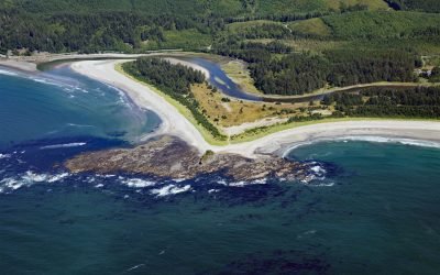
Sooes River, Makah Bay
Sooes River, also known as the Tsoo-Yess River, originates in the northwest foothills of the Olympic Mountains and flows for 16 miles (26 km) through private timberlands and the Makah Reservation until it reaches Makah Bay, about 120 miles (194 km) northwest of Seattle and 4 miles (6.5 km) southwest of Neah Bay, Washington.
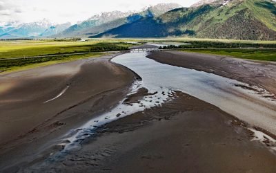
Twentymile River, Turnagain Arm
Twentymile River starts from a series of small unnamed glaciers and snowfields in the western Chugach Mountains and flows generally south for 10 miles (16 km) where it joins Glacier River, and then flows another 5 miles (8 km) southwest to Turnagain Arm, about 12 miles (19 km) northwest of Whittier and 9 miles (15 km) southeast of Girdwood, Alaska.
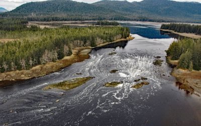
North Arm Salt Chuck, Duncan Canal
North Arm Salt Chuck is near the head of North Arm, an estuary about 5 miles (8 km) long at the head of Duncan Canal on Kupreanof Island, about 110 miles (177 km) southeast of Juneau and 13 miles (21 km) west of Petersburg, Alaska.
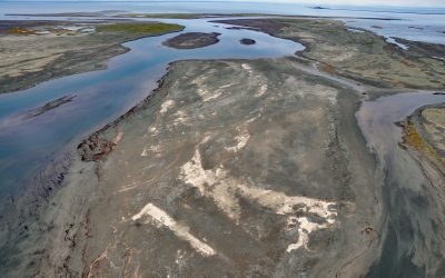
Sagavanirktok River, Beaufort Sea
Sagavanirktok River, also known as the Sag River, starts between Endicott and Philip Smith Mountains in the Brooks Range and flows north for 110 miles (180 km) to the Beaufort Sea, about 105 miles (170 km) west of Kaktovik and 12 miles (19 km) northeast of Deadhorse, Alaska.
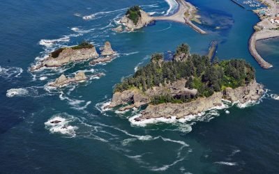
James Island, Quillayute River
James Island has an elevation of over 160 feet (50 m) and is located at the mouth of the Quillayute River, about 32 miles (52 km) south of Neah Bay and 0.6 miles (1 km) west of La Push, Washington.
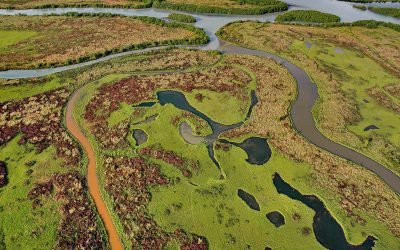
Dam Creek, Chinitna Bay
Dam Creek flows south for 5 miles (8 km) from the southwest flank of Mount Iliamna to merge with West Glacier Creek near the head of Chinitna Bay, about 62 miles (100 km) northwest of Homer and 44 miles (71 km) southeast of Port Alsworth, Alaska.
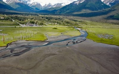
Glacier Creek, Girdwood
Glacier Creek starts from an unnamed glacier on the south flank of Goat Mountain in the Chugach Mountains and flows southwest for 10 miles (16 km) to Turnagain Arm near Girdwood, about 31 miles (50 km) southeast of Anchorage and 20 miles (32 km) northwest of Whittier, Alaska.
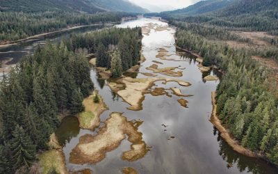
Blind Slough, Mitkof Island
Blind Slough is an estuary about 4 miles (6.5 km) long forming the lower course of the Blind River, that flows northwest on Mitkof Island to Wrangell Narrows, about 24 miles (39 km) northwest of Wrangell and 12 miles (19 km) south of Petersburg, Alaska.
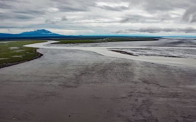
Beluga River, Cook Inlet
Beluga River starts at Beluga Lake and flows southeast for about 30 miles (48 km) to Cook Inlet, about 46 miles (74 km) north-northeast of Kenai and 35 miles (57 km) west of Anchorage, Alaska.
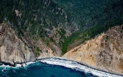
Anderson Gulch, Lost Coast
Anderson Gulch is a small watershed on the Lost Coast of Northern California, between Northport Gulch and Dark Gulch, about 9 miles (15 km) west of Leggett and 2.6 miles (4 km) south-southeast of Wheeler, California.
About the background graphic
This ‘warming stripe’ graphic is a visual representation of the change in global temperature from 1850 (top) to 2019 (bottom). Each stripe represents the average global temperature for one year. The average temperature from 1971-2000 is set as the boundary between blue and red. The colour scale goes from -0.7°C to +0.7°C. The data are from the UK Met Office HadCRUT4.6 dataset.
Click here for more information about the #warmingstripes.