
Glaciers
Recent Articles
More Articles

South Sawyer Glacier, Tracy Arm
South Sawyer Glacier starts in British Columbia and flows northwest for 31 miles (50 km) to the head of Tracy Arm, about 73 miles (118 km) north of Petersburg and 56 miles (90 km) southeast of Juneau, Alaska.
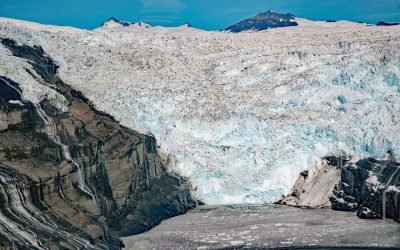
Tsaa Glacier, Icy Bay
Tsaa Glacier flows about 8 miles (13 km) southeast from the northeast flank of the Robinson Mountains and terminates in Tsaa Fjord, on the western coast of Icy Bay, about 147 miles (237 km) east-southeast of Cordova and 75 miles (121 km) northwest of Yakutat, Alaska.
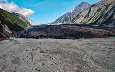
Lituya Glacier, Gilbert Inlet
Lituya Glacier starts on the south flank of Mount Wilbur in the Fairweather Range and flows west for 8 miles (13 km) to the Desolation Valley, and then turns southeast and flows for 2.6 miles (4 km) to Gilbert Inlet, about 100 miles southeast of Yakutat and 68 miles (110 km) northwest of Gustavus, Alaska.
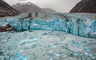
Dawes Glacier, Endicott Arm
Dawes Glacier originates from the Stikine Icefield near the Alaska-Canada boundary and flows northwest for 20 miles (32 km) to tidewater in Endicott Arm, about 100 miles (161 km) northeast of Sitka and 80 miles (129 km) southeast of Juneau, Alaska.
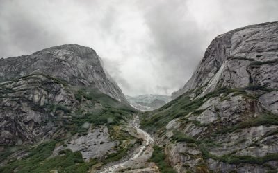
Cirque Glacier, Endicott Arm
An unnamed glacier hangs above a cirque on the southern shore of Endicott Arm, a fjord in the Coast Mountains of Southeast Alaska that extends northwest for 33 miles (53 km) from the terminus of the Dawes Glacier to Holkham Bay, 80 miles (129 km) southeast of Juneau and 47 miles (76 km) north of Petersburg, Alaska
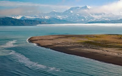
Mount Saint Elias, Icy Bay
Mount Saint Elias is situated at the head of Icy Bay on the Alaska-Canada boundary in the Saint Elias Range, about 165 miles (266 km) east-southeast of Cordova and 67 miles (108 km) northwest of Yakutat, Alaska.
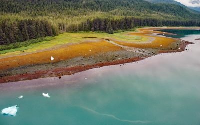
Tracy Arm, Tracy Arm-Fords Terror Wilderness
Tracy Arm is a fjord in the Coast Mountains of Southeast Alaska about 85 miles (137 km) northeast of Sitka and 42 miles (67.7 km) southeast of Juneau, Alaska.
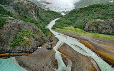
Falling Glacier, Kings Bay
Falling Glacier starts at the northwest end of the Sargent Icefield in the Chugach Mountains and flows northwest for 3 miles (4.8 km) to the eastern shore of Kings Bay, about 39 miles (63 km) northeast of Seward and 20 miles (32 km) south-southeast of Whittier, Alaska.

Princeton Glacier, Nassau Fjord
Princeton Glacier is on the east side of the Kenai Peninsula, about 37 miles (60 km) south-southeast of Whittier and 38 miles (61 km) east-northeast of Seward, Alaska.
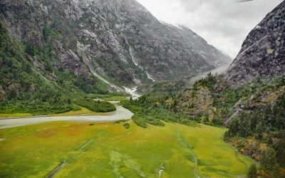
North Dawes Glacier, Endicott Arm
North Dawes Glacier starts from the Stikine Icefield at an elevation of about 5,200 feet (1,585 m) on the western flank of Sheppard Peak and flows generally southwest for 15 miles (24 km) to a proglacial lake at an elevation of 1000 feet (305 m) which is 2 miles (3.2 km) long and drained by a stream 1.3 miles (2.1 km) long at the head of an inlet extending north from Endicott Arm, about 74 miles (119 km) southeast of Juneau and 51 miles (82 km) north of Petersburg, Alaska.
About the background graphic
This ‘warming stripe’ graphic is a visual representation of the change in global temperature from 1850 (top) to 2019 (bottom). Each stripe represents the average global temperature for one year. The average temperature from 1971-2000 is set as the boundary between blue and red. The colour scale goes from -0.7°C to +0.7°C. The data are from the UK Met Office HadCRUT4.6 dataset.
Click here for more information about the #warmingstripes.