
Alaska

;

Recent Articles

Kustatan, West Foreland

Kustatan is a historical Dena’ina community on West Foreland, on the west side of Cook Inlet near the mouth of the Kustatan River, about 71 miles (115 km) southwest of Anchorage and 20 miles (32 km) northwest of Kenai, Alaska.

Scammon Bay, Kun River

Scammon Bay is a small community at the base of the Askinuk Mountains, on the left bank and about 1 mile (1.6 km) upstream from the mouth of the Kun River in the Yukon-Kuskokwim Delta, about 147 miles (237 km) northwest of Bethel and 73 miles (118 km) southwest of Emmonak, Alaska.

Shepard Point, Orca Inlet

Shepard Point is an alluvial fan on the eastern shore of Orca Inlet in Prince William Sound at Nelson Bay, which is an estuary mostly formed by the Rude River, about 41 miles (66 km) southeast of Valdez and 7 miles (11.3 km) north-northeast of Cordova, Alaska.

More Articles

Bird Creek, Turnagain Arm

Bird Creek, Turnagain Arm

Bird Creek starts in the Chugach Mountains and flows southwest for 16 miles (26 km) to Turnagain Arm, about 22 miles (35 km) southeast of Anchorage and 12 miles (19 km) west of Girdwood, Alaska.

Golden Mine, Port Wells

Golden Mine, Port Wells

Golden is a historical mining community on Port Wells, a fjord in northwestern Prince William Sound, about 60 miles (97 km) southwest of Valdez and 27 miles (44 km) northeast of Whittier, Alaska.

Cape Fanshaw, Frederick Sound

Cape Fanshaw, Frederick Sound

Cape Fanshaw is a low wooded point at the junction of Stephens Passage and Frederick Sound, about 83 miles (134 km) south of Juneau and 68 miles (110 km) east-northeast of Sitka, Alaska.

Cirque Glacier, Endicott Arm

Cirque Glacier, Endicott Arm

An unnamed glacier hangs above a cirque on the southern shore of Endicott Arm, a fjord in the Coast Mountains of Southeast Alaska that extends northwest for 33 miles (53 km) from the terminus of the Dawes Glacier to Holkham Bay, 80 miles (129 km) southeast of Juneau and 47 miles (76 km) north of Petersburg, Alaska

Kincaid Park, Point Campbell

Kincaid Park, Point Campbell

Kincaid Park is 1,517 acres (614 ha) located on Point Campbell between Knik and Turnagain Arms of Cook Inlet, 5.2 miles (8 km) southwest of downtown Anchorage, Alaska.

The Salt Chuck, Hobart Bay

The Salt Chuck, Hobart Bay

The Salt Chuck is a lagoon at the head of Hobart Bay on the eastern shore of Stephens Passage, about 71 miles (115 km) southeast of Juneau and 46 miles (74 km) north-northwest of Petersburg, Alaska.

Claybluff Point, Icy Cape

Claybluff Point, Icy Cape

Claybluff Point is a low headland at the base of the Robinson Mountains, 1 mile (1.6 km) east of Icy Cape, about 34 miles (55 km) east-southeast of Yakataga and 69 miles (111 km) northwest of Yakutat, Alaska.

Mount Saint Elias, Icy Bay

Mount Saint Elias, Icy Bay

Mount Saint Elias is situated at the head of Icy Bay on the Alaska-Canada boundary in the Saint Elias Range, about 165 miles (266 km) east-southeast of Cordova and 67 miles (108 km) northwest of Yakutat, Alaska.

Mount Douglas, Katmai National Park and Preserve

Mount Douglas, Katmai National Park and Preserve

Mount Douglas is a stratovolcano with an elevation of 7,000 feet (2134 m) located on Kamishak Bay, near the northern part of the Alaska Peninsula and within Katmai National Park and Preserve, about 113 miles (182 km) east of King Salmon and 91 miles (147 km) southwest of Homer, Alaska.

Neva, Kruzof Island

Neva, Kruzof Island

In 1813, the Russian exploration ship Neva wrecked near Mount Edgecumbe on Kruzof Island, about 93 miles southwest of Juneau and 10 miles west of Sitka, Alaska.

About the background graphic

This ‘warming stripe’ graphic is a visual representation of the change in global temperature from 1850 (top) to 2019 (bottom). Each stripe represents the average global temperature for one year. The average temperature from 1971-2000 is set as the boundary between blue and red. The colour scale goes from -0.7°C to +0.7°C. The data are from the UK Met Office HadCRUT4.6 dataset. 

Click here for more information about the #warmingstripes.

Every coastline holds a story layered across time.

.


Field notes, photography, history and science from the shores of Alaska, the Pacific northwest, and California.

— written by explorers.


— 55.763000 N, -133.248959 W — Winter Harbor
Start exploringOpen the map

Examples of recent dispatches

From the field log

Shipwrecks

Aug 01, Washington

What the Peter Iredale left behind

A century-old wreck, still surfacing  from the sand.

Glaciers

Aug 08, Alaska

The retreat of Mendenhall Glacier, mapped over 40 years

How satellite records and field photography tell one glacier’s story.

Lighthouses

Aug 05, Oregon

Heceta Head and the keepers who stayed

A history of the light, and the families who tended it.

Beaches

Jul 27, California

Glass Beach’s slow-motion transformation

From dump site to tourist draw — and what’s left to find.
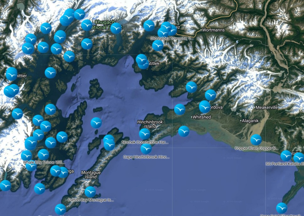
— Interactive

Map Explorer

Browse every place Coastview has visited and documented.

  • Over 1,000 documented locations with more continually added
  • Do a deep dive into each place to learn more.

Coastview is reader-supported.

We’re a nonprofit — subscriptions and donations fund the science reporting and photography that make this project possible.

Article suggestions?

Use the contact form to a make a request.