LAST MONTH
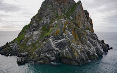
Fairway Rock, Bering Strait
Fairway Rock is located about 10 miles southeast of Little Diomede Island, and 15 miles west of Cape Prince of Wales, at the west end of the Seward Peninsula, Alaska.
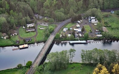
Taylors Landing, Alsea River
Taylors Landing is a small community near the head of the tide on the Alsea River in the Coast Range, about 17.4 miles (28 km) west of Alsea and 6.4 miles (10 km) east-southeast of Waldport, Oregon.
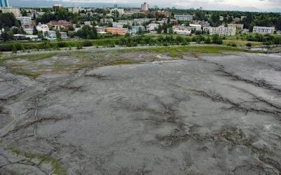
Bootleggers Cove, Anchorage
Bootleggers Cove is a coastal neighborhood located along the tidal flats of Cook Inlet between Westchester Lagoon and downtown Anchorage, Alaska.
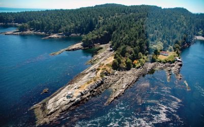
Porlier Pass, Galiano Island
Porlier Pass separates Galiano and Valdes Islands in the Southern Gulf Islands of Georgia Strait, about 28 miles (45 km) southwest of Vancouver and 10 miles (16 km) east-northeast of Ladysmith, British Columbia.
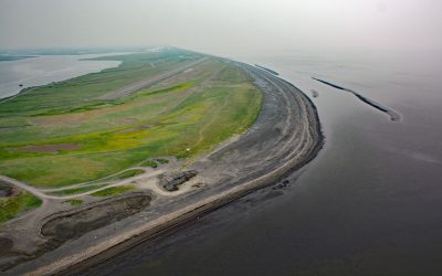
Shaktoolik, Norton Sound
Shaktoolik is a small community now located on a spit forming Shaktoolik Bay, on the eastern shore of Norton Sound, about 56 miles (90 km) southeast of Golovin and 35 miles (56 km) north-northwest of Unalakleet, Alaska.
Tracy Arm, Tracy Arm-Fords Terror Wilderness
Tracy Arm is a fjord in the Coast Mountains of Southeast Alaska about 85 miles (137 km) northeast of Sitka and 42 miles (67.7 km) southeast of Juneau, Alaska.
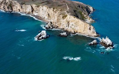
Chimney Rock, Point Reyes
Chimney Rock is an islet that lies off the eastern headland of the Point Reyes Peninsula, connected only at low tide, about 3 miles (4.8 km) east of the Point Reyes Light and 10 miles (16 km) southwest of Inverness, California.
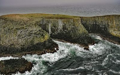
Sandman Reefs, Aleutian Islands
Sandman Reefs are a group of islets, reefs, and wave-washed rocks between the Pavlof Islands and Deer Island in the north, and extending south almost to the Sanak Islands, about 78 miles (126 km) southwest of Sand Point and 24 miles (39 km) south of King Cove, Alaska.
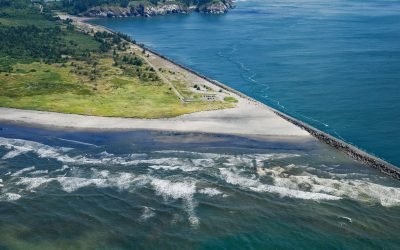
Peacock Spit, Columbia River Bar
Peacock Spit is the northern portion of a mostly submerged sand bar at the mouth of the Columbia River, about 12 miles (19 km) northwest of Astoria and 2.5 miles (4 km) south of Ilwaco, Washington.
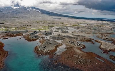
Burr Point, Augustine Volcano
Burr Point is a headland on Augustine Volcano in Cook Inlet, about 108 miles (174 km) north-northwest of Kodiak and 69 miles (111 km) southwest of Homer, Alaska.
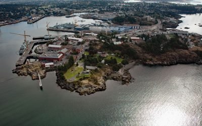
Esquimalt Harbour, Vancouver Island
Esquimalt Harbour is a sheltered embayment on the southern tip of Vancouver Island, about 21 miles (34 km) north of Port Angeles, Washington and 3 miles (4.8 km) west-northwest of downtown Victoria, British Columbia.
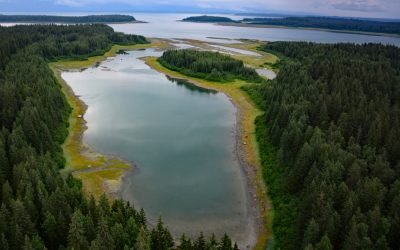
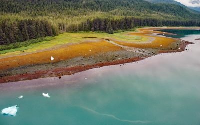
Berg Bay, Glacier Bay National Park and Preserve
Berg Bay is in Glacier Bay National Park and Preserve, and extends west for 4 miles (6.5 km) off Sitakaday Narrows near the mouth of Glacier Bay, about 38 miles (61 km) northwest of Hoonah, and 18 miles (29 km) northwest of Gustavus, Alaska.