by CoastView | Jul 31, 2026 | 2026, Alaska, Historical, Islands, July 2026
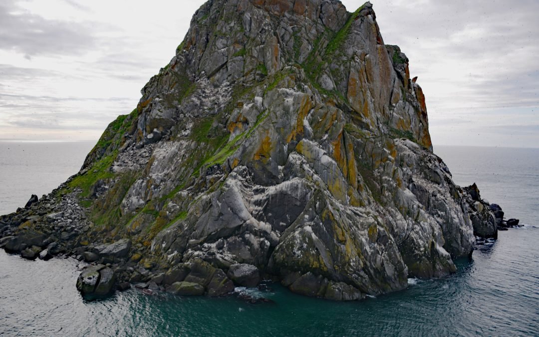
Listen to the article here https://coastview.org/wp-content/uploads/2026/03/FairwayRock.mp3 Fairway Rock is located in the Bering Strait, 17 miles (27 km) offshore from Cape Prince of Wales at the western end of the Seward Peninsula, about 11 miles (18 km)...
by CoastView | Jul 29, 2026 | 2026, Alaska, Communities, Historical, July 2026
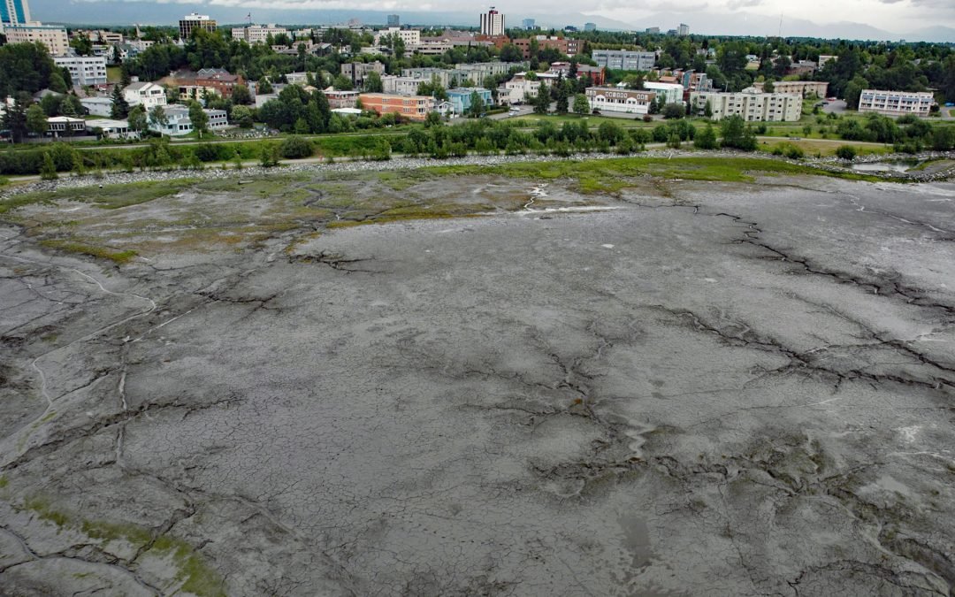
Listen to the article here https://coastview.org/wp-content/uploads/2026/03/BootleggersCove.mp3 Bootleggers Cove is a coastal neighborhood along the tidal flats of Cook Inlet, about 0.73 miles (1.2 km) northeast of Westchester Lagoon and 0.5 miles (0.8 km)...
by CoastView | Jul 27, 2026 | 2026, Alaska, Communities, Developments, Embayments, Historical, July 2026, Land Use, Natural History
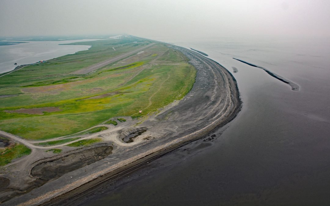
Listen to the article here https://coastview.org/wp-content/uploads/2026/03/Shaktoolik.mp3 Shaktoolik is a small community on a spit forming Shaktoolik Bay, on the eastern shore of Norton Sound, about 56 miles (90 km) southeast of Golovin and 35 miles (56 km)...
by CoastView | Jul 26, 2026 | 2026, Alaska, Biodiversity, Climate Change, Embayments, Glaciers, July 2026, Land Use, Natural History, Parks
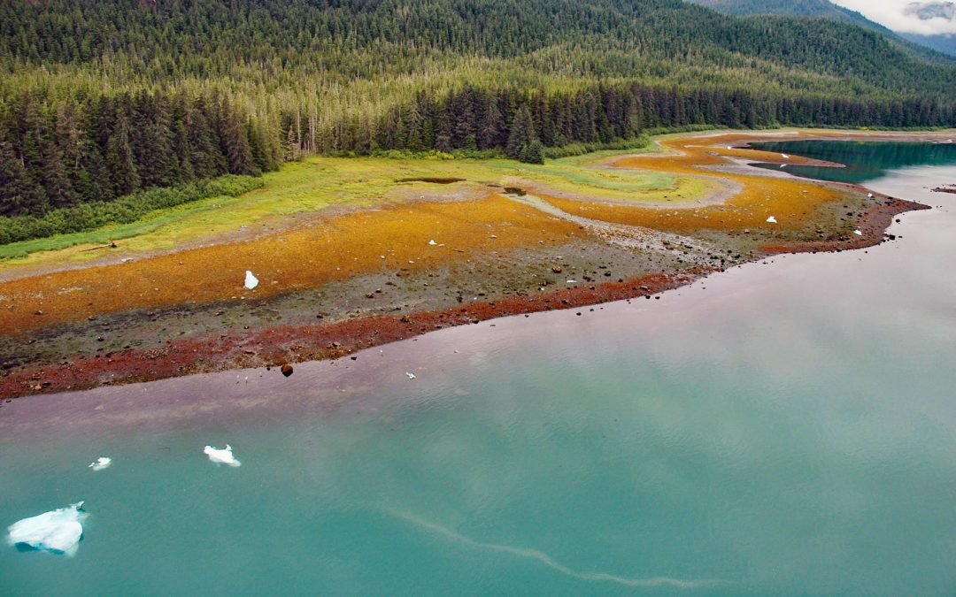
Listen to the article here https://coastview.org/wp-content/uploads/2026/03/TracyArm.mp3 Tracy Arm is a glaciated fjord in the Tracy Arm–Fords Terror Wilderness of Tongass National Forest, about 85 miles (137 km) northeast of Sitka and 42 miles (68 km) southeast of...
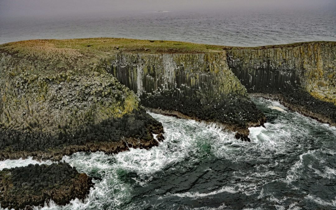
by CoastView | Jul 24, 2026 | 2026, Alaska, Biodiversity, Coastal Features, Islands, July 2026, Land Use, Natural History
Listen to the article here https://coastview.org/wp-content/uploads/2026/03/SandmanReefs.mp3 The Sandman Reefs are a group of islets, reefs, and wave-washed rocks in the Eastern Aleutian Islands near the western end of the Alaska Peninsula, about 78 miles (126 km)...
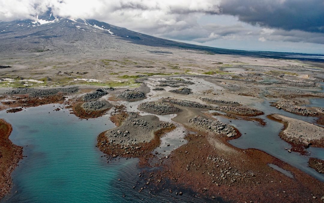
by CoastView | Jul 22, 2026 | 2026, Alaska, Coastal Features, Islands, July 2026, Natural History
Listen to the article here https://coastview.org/wp-content/uploads/2026/03/AugustineVolcano.mp3 Burr Point is a headland on Augustine Island in Kamishak Bay, on the western margin of lower Cook Inlet, about 108 miles (174 km) north-northwest of Kodiak and 69 miles...