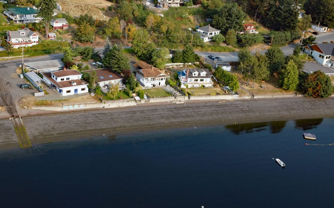
by CoastView | Jul 7, 2026 | 2026, Beaches, British Columbia, Communities, Embayments, Historical, July 2026, Land Use, Natural History
Listen to the article here https://coastview.org/wp-content/uploads/2026/03/MapleBay.mp3 Maple Bay is a community located on Sansum Narrows, an inlet in the Salish Sea that separates Vancouver Island from Salt Spring Island, about 29 miles (47 km) northwest of...
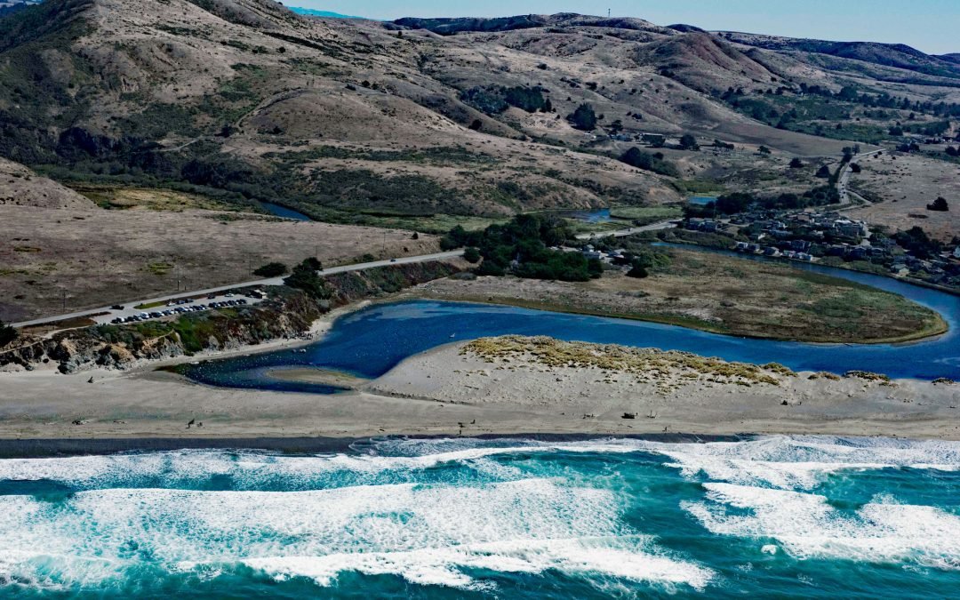
by CoastView | Jul 4, 2026 | 2026, Beaches, Best of 2023, Biodiversity, California, Communities, July 2026, Land Use, Natural History, Parks, Rivers
Listen to the article here https://coastview.org/wp-content/uploads/2026/03/SalmonCreek.mp3 Salmon Creek starts at an elevation of 570 feet (174 m) and flows generally southwest for 19 miles (31 km), draining a watershed of 22,487 acres (9,100 ha) between the Northern...
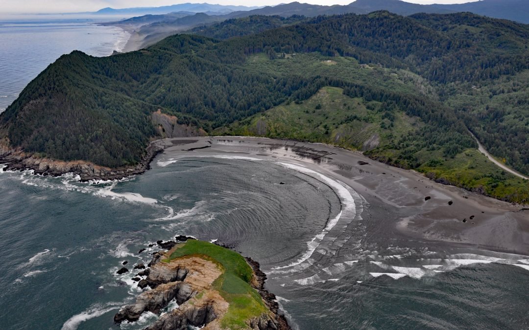
by CoastView | Jul 2, 2026 | 2026, Beaches, Coastal Features, Embayments, Headlands, July 2026, Land Use, Natural History, Oregon
Listen to the article here https://coastview.org/wp-content/uploads/2026/03/HuntersCove.mp3 Hunters Cove lies on the south side of Cape Sebastian, a prominent headland in Cape Sebastian State Scenic Corridor, about 20 miles (32 km) north-northwest of Brookings and 6.3...
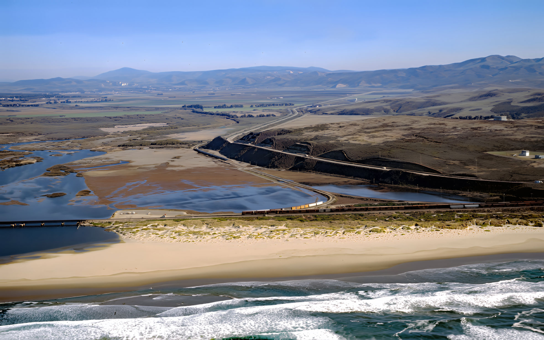
by CoastView | Jun 27, 2026 | 2026, Beaches, Biodiversity, California, Coastal Features, Historical, June 2026, Land Use, Natural History, Rivers, Shipwrecks
Listen to the article here https://coastview.org/wp-content/uploads/2026/03/SurfBeach.mp3 Surf Beach lies within Vandenberg Space Force Base, extending south-southwest roughly 4.5 miles (7.3 km) from the mouth of the Santa Ynez River estuary to Spring Canyon, about 31...
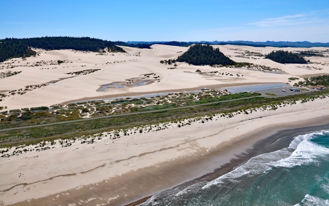
by CoastView | Jun 19, 2026 | 2026, Beaches, Best of 2024, Coastal Features, June 2026, Land Use, Natural History, Oregon, Parks
Listen to the article here https://coastview.org/wp-content/uploads/2026/02/OregonDunes.mp3 Umpqua Beach is in the Oregon Dunes National Recreation Area that extends for about 35 miles (56 km) along the coast from the Siuslaw River at Florence in the north to the Coos...
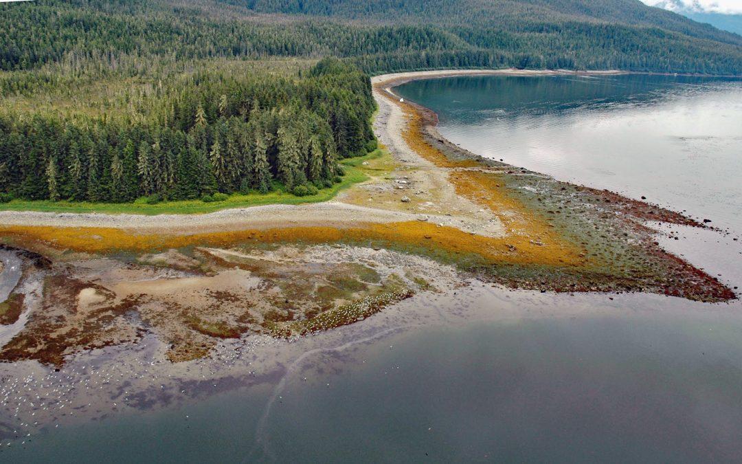
by CoastView | Jun 16, 2026 | 2026, Alaska, Beaches, Coastal Features, Embayments, Historical, June 2026, Land Use, Natural History, Parks
Listen to the article here https://coastview.org/wp-content/uploads/2026/02/SumdumVillage.mp3 Sumdum is a historical Tlingit village of the S’awdaan Kwáan located north of Powers Creek at the northern end of Endicott Arm where it meets Holkham Bay in Tracy Arm-Fords...