by CoastView | Jul 8, 2026 | 2026, Alaska, Biodiversity, Coastal Features, Embayments, July 2026, Land Use, Natural History, Parks, Rivers
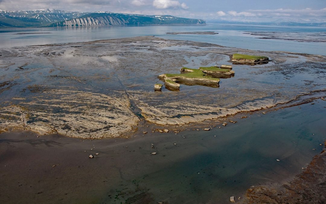
Listen to the article here https://coastview.org/wp-content/uploads/2026/03/DouglasRiver.mp3 Douglas River flows north for 28 miles (45 km) on the Alaska Peninsula to extensive tidal flats in Kamishak Bay, about 108 miles (174 km) northeast of King Salmon and 89 miles...
by CoastView | Jul 6, 2026 | 2026, Alaska, Best of 2023, Biodiversity, Canneries, Communities, Embayments, July 2026, Land Use, Natural History, Rivers
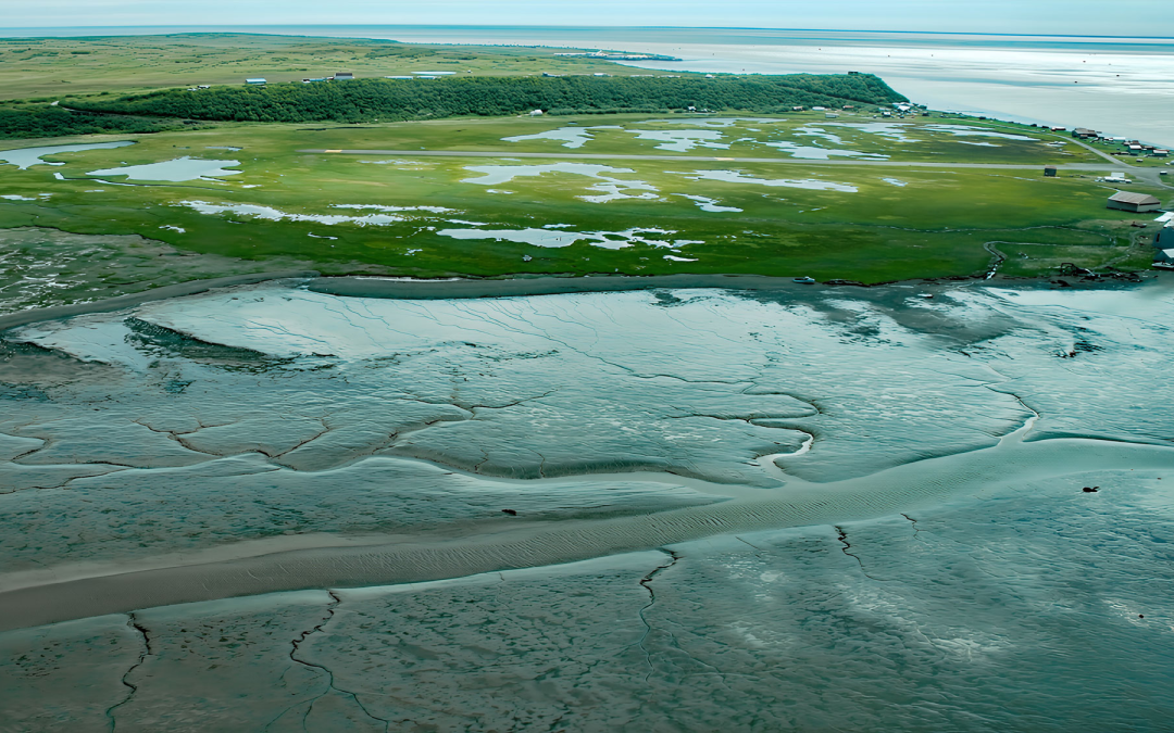
Listen to the article here https://coastview.org/wp-content/uploads/2026/03/ClarksPoint.mp3 Clark’s Point is a historic community and former salmon-cannery site on the eastern shore of Nushagak Bay, at the mouth of Clark Slough, about 57 miles (92 km)...
by CoastView | Jul 4, 2026 | 2026, Beaches, Best of 2023, Biodiversity, California, Communities, July 2026, Land Use, Natural History, Parks, Rivers
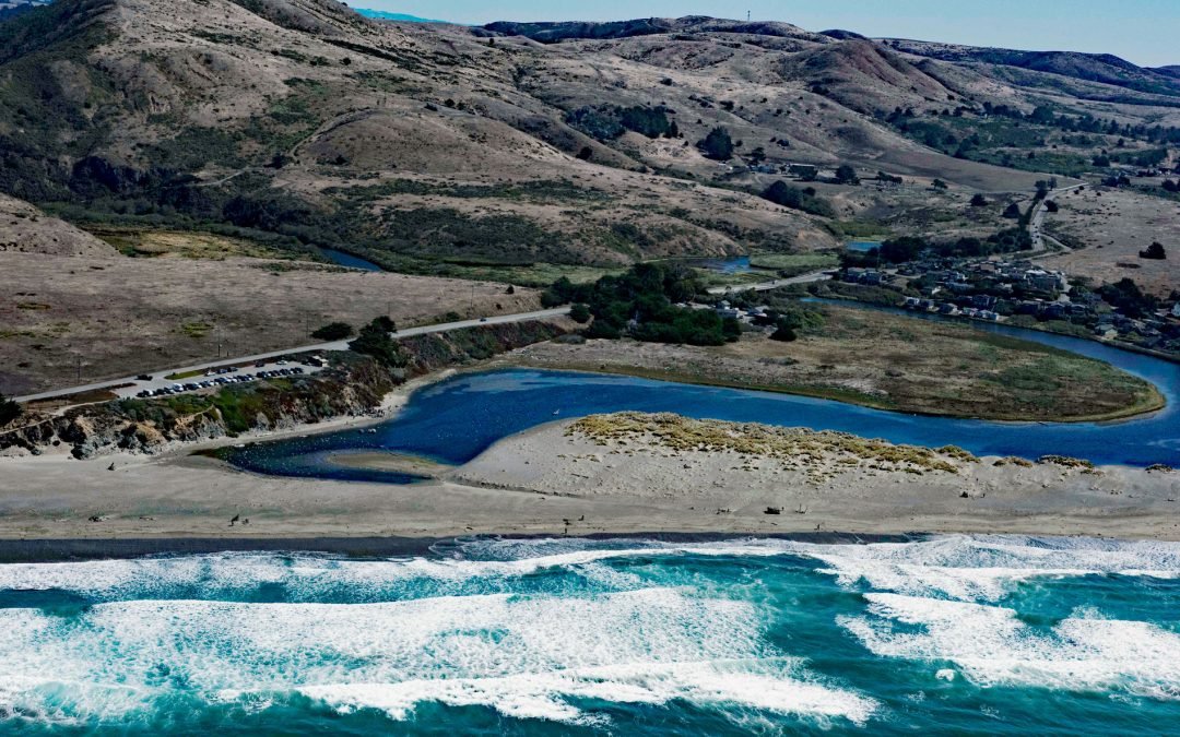
Listen to the article here https://coastview.org/wp-content/uploads/2026/03/SalmonCreek.mp3 Salmon Creek starts at an elevation of 570 feet (174 m) and flows generally southwest for 19 miles (31 km), draining a watershed of 22,487 acres (9,100 ha) between the Northern...
by CoastView | Jun 27, 2026 | 2026, Beaches, Biodiversity, California, Coastal Features, Historical, June 2026, Land Use, Natural History, Rivers, Shipwrecks
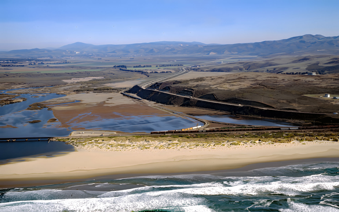
Listen to the article here https://coastview.org/wp-content/uploads/2026/03/SurfBeach.mp3 Surf Beach lies within Vandenberg Space Force Base, extending south-southwest roughly 4.5 miles (7.3 km) from the mouth of the Santa Ynez River estuary to Spring Canyon, about 31...

by CoastView | Jun 24, 2026 | 2026, Biodiversity, British Columbia, Coastal Features, Embayments, Islands, June 2026, Natural History, Waterfalls
Listen to the article here https://coastview.org/wp-content/uploads/2026/02/SaltLagoon.mp3 Salt Lagoon sits at the southwestern base of the Spiller Range on Porcher Island, connected by a tidal channel 1.8 miles (2.9 km) long to Porcher Inlet, which extends 11 miles...
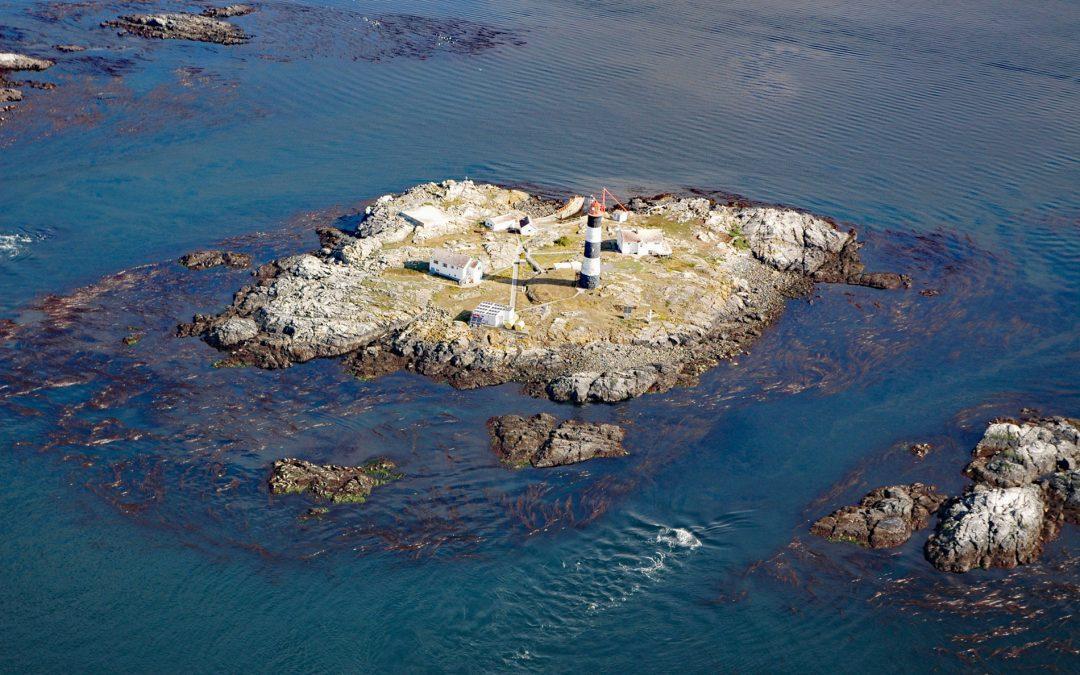
by CoastView | Jun 17, 2026 | 2026, Biodiversity, British Columbia, Coastal Features, Historical, Islands, June 2026, Land Use, Lighthouses, Natural History
Listen to the article here https://coastview.org/wp-content/uploads/2026/02/RaceRocks.mp3 Race Rocks is a group of nine islets, including North Rock, West Race, Great Race, and Rosedale Rock, located about 1 mile (1.6 km) off Cape Calver on the southern tip of...