by CoastView | Jul 30, 2026 | 2026, Communities, July 2026, Oregon, Rivers
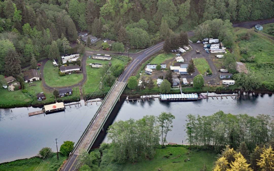
Listen to the article here https://coastview.org/wp-content/uploads/2026/03/TaylorsLanding.mp3 Taylors Landing is a boat landing and small community near the head of the tide on the Alsea River, in the Coast Range, about 17.4 miles (28 km) west of Alsea and 6.4 miles...
by CoastView | Jul 29, 2026 | 2026, Alaska, Communities, Historical, July 2026
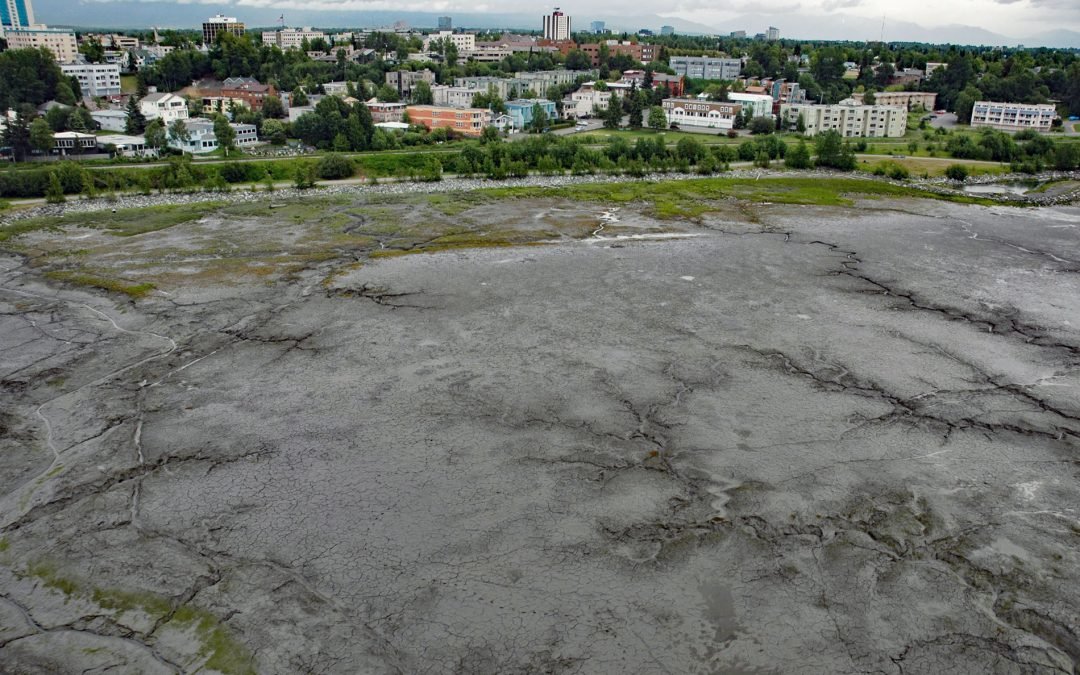
Listen to the article here https://coastview.org/wp-content/uploads/2026/03/BootleggersCove.mp3 Bootleggers Cove is a coastal neighborhood along the tidal flats of Cook Inlet, about 0.73 miles (1.2 km) northeast of Westchester Lagoon and 0.5 miles (0.8 km)...
by CoastView | Jul 27, 2026 | 2026, Alaska, Communities, Developments, Embayments, Historical, July 2026, Land Use, Natural History
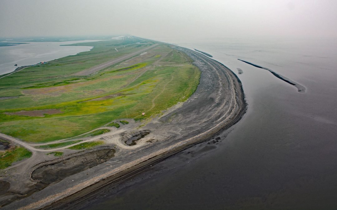
Listen to the article here https://coastview.org/wp-content/uploads/2026/03/Shaktoolik.mp3 Shaktoolik is a small community on a spit forming Shaktoolik Bay, on the eastern shore of Norton Sound, about 56 miles (90 km) southeast of Golovin and 35 miles (56 km)...
by CoastView | Jul 19, 2026 | 2026, Alaska, Biodiversity, Canneries, Communities, Embayments, July 2026, Natural History
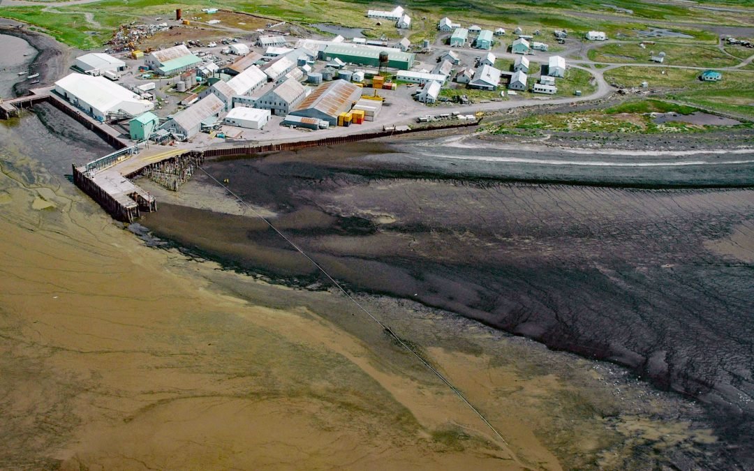
Listen to the article here https://coastview.org/wp-content/uploads/2026/03/EkukFisheries.mp3 Ekuk Fisheries is a historic salmon cannery on Ekuk Spit, on the eastern shore of Nushagak Bay at Ekuk Cape, about 16 miles (26 km) south-southwest of Dillingham and 1.4...
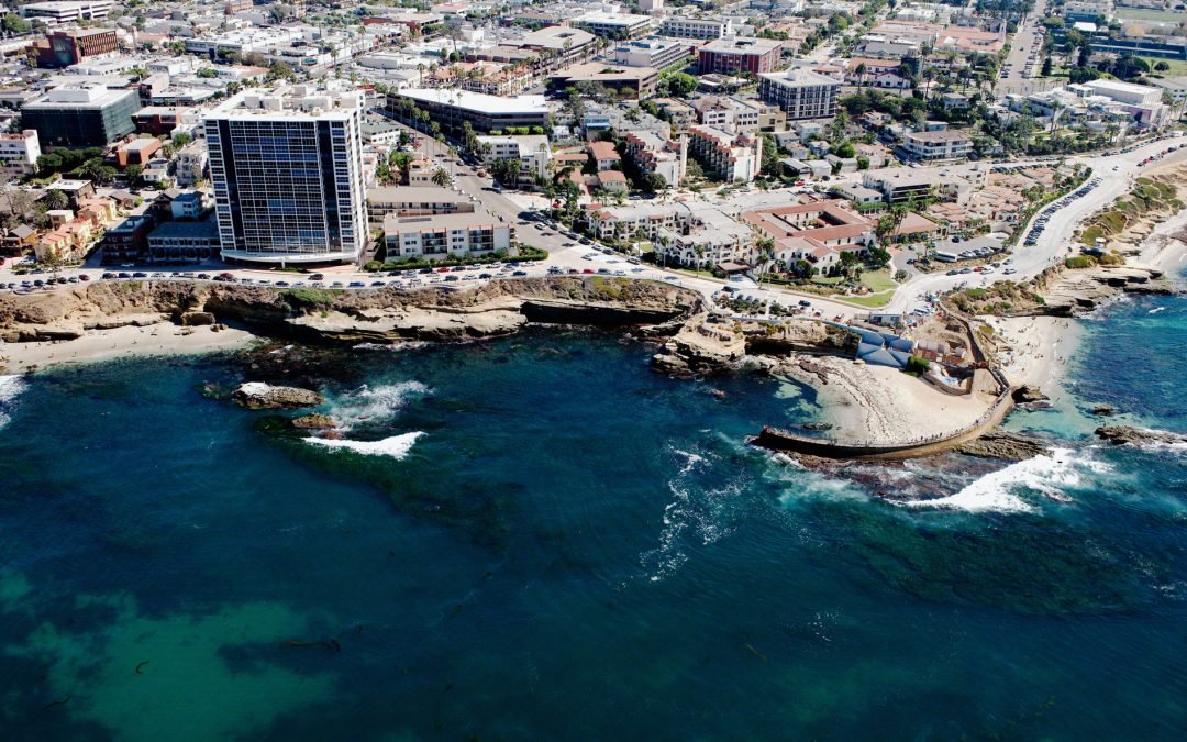
by CoastView | Jul 18, 2026 | 2026, Beaches, Biodiversity, California, Coastal Features, Communities, Developments, July 2026, Land Use, Natural History
Listen to the article here https://coastview.org/wp-content/uploads/2026/03/ChildrensPool.mp3 Children’s Pool is a rocky cove partially enclosed by a seawall, located in La Jolla, about 13 miles (21 km) south of Encinitas and 11 miles (18 km) northwest of...
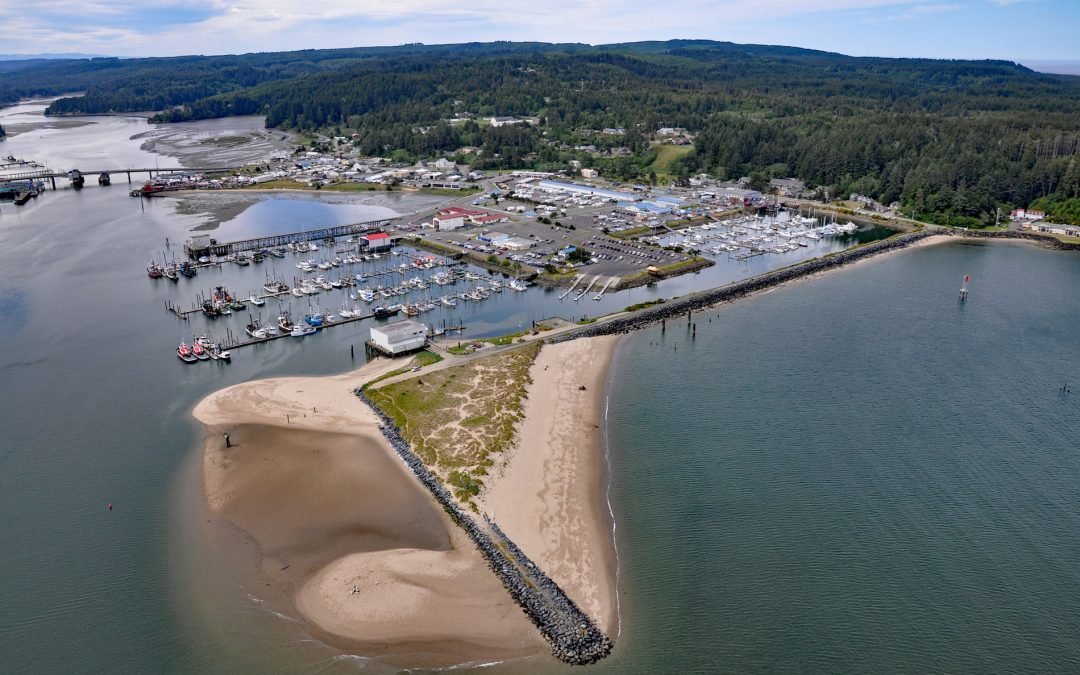
by CoastView | Jul 16, 2026 | 2026, Communities, Embayments, July 2026, Land Use, Natural History, Oregon
Listen to the article here https://coastview.org/wp-content/uploads/2026/03/OregonInstitute-1.mp3 Oregon Institute of Marine Biology is the marine research field station of the University of Oregon, situated on South Slough adjacent to Coos Bay about 7 miles southwest...