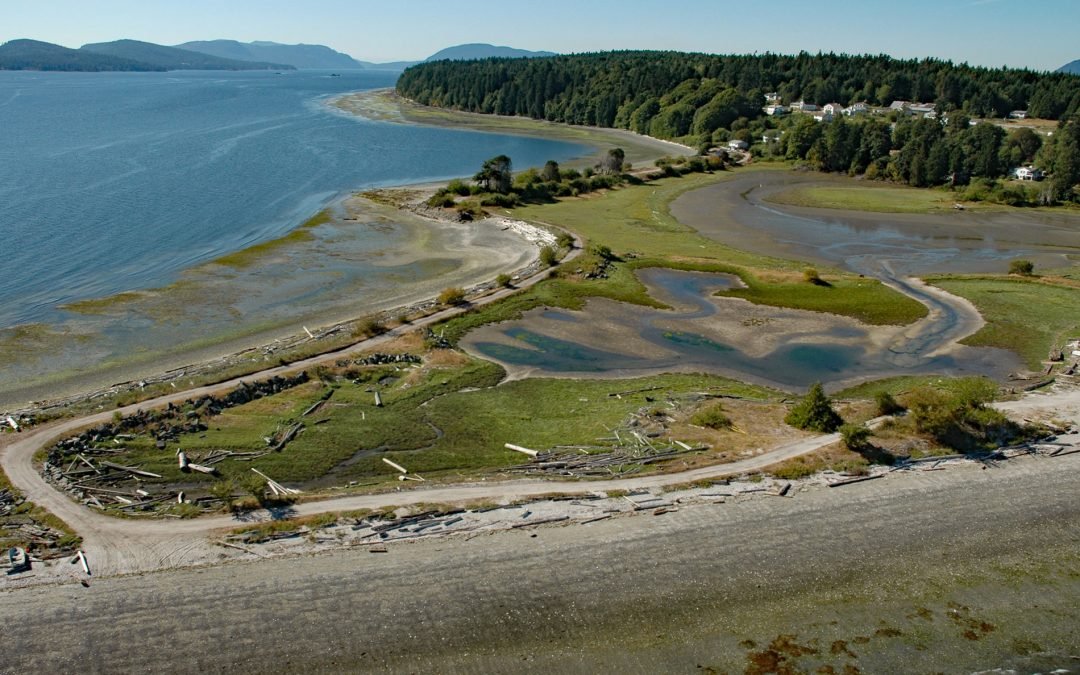
by CoastView | Jul 14, 2026 | 2026, British Columbia, Communities, Embayments, Historical, Islands, July 2026, Land Use, Natural History
Listen to the article here https://coastview.org/wp-content/uploads/2026/03/Penelakut.mp3 Penelakut Island lies between Stuart Channel to the west and Trincomali Channel to the east in the southern Gulf Islands, about 40 miles (65 km) north-northwest of Victoria and...
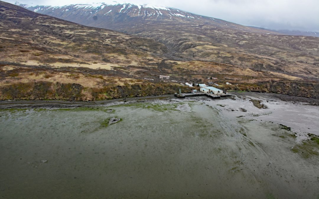
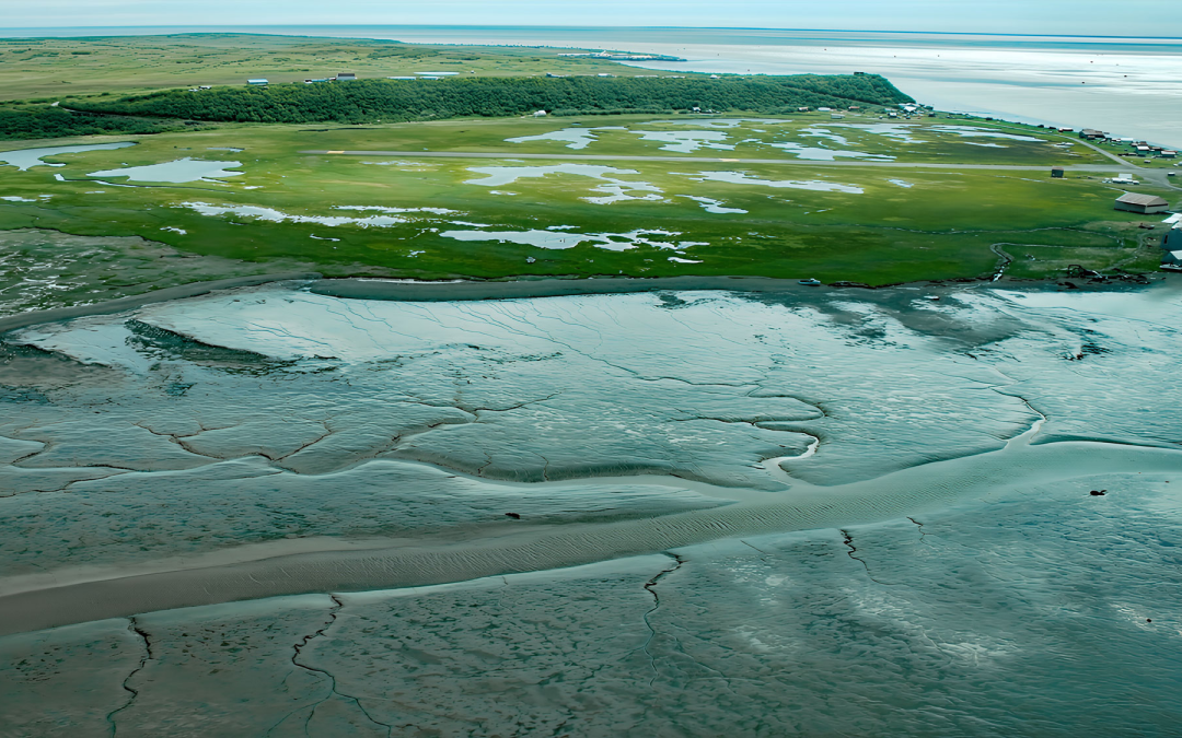
by CoastView | Jul 13, 2026 | 2026, Alaska, Canneries, Communities, Historical, July 2026, Natural History
Listen to the article here https://coastview.org/wp-content/uploads/2026/03/ChignikFisheries.mp3 Chignik Fisheries is a historic salmon canning facility on the northwest shore of Chignik Lagoon, southwest of Dago Point, about 44 miles (71 km) south of Port Heiden and...
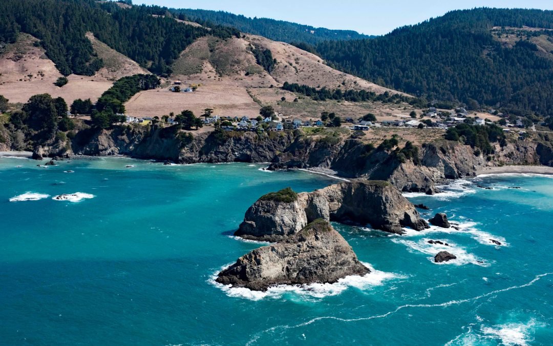
by CoastView | Jul 11, 2026 | 2026, California, Coastal Features, Communities, Developments, Historical, Islands, July 2026, Land Use, Natural History
Listen to the article here https://coastview.org/wp-content/uploads/2026/03/CasketRock.mp3 Casket Rock is the outermost of three large rocks west of Elk, a community about 22 miles (35 km) south-southeast of Fort Bragg and 13 miles (21 km) north of Point Arena,...
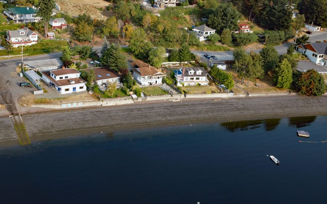
by CoastView | Jul 7, 2026 | 2026, Beaches, British Columbia, Communities, Embayments, Historical, July 2026, Land Use, Natural History
Listen to the article here https://coastview.org/wp-content/uploads/2026/03/MapleBay.mp3 Maple Bay is a community located on Sansum Narrows, an inlet in the Salish Sea that separates Vancouver Island from Salt Spring Island, about 29 miles (47 km) northwest of...
by CoastView | Jul 6, 2026 | 2026, Alaska, Best of 2023, Biodiversity, Canneries, Communities, Embayments, July 2026, Land Use, Natural History, Rivers
Listen to the article here https://coastview.org/wp-content/uploads/2026/03/ClarksPoint.mp3 Clark’s Point is a historic community and former salmon-cannery site on the eastern shore of Nushagak Bay, at the mouth of Clark Slough, about 57 miles (92 km)...
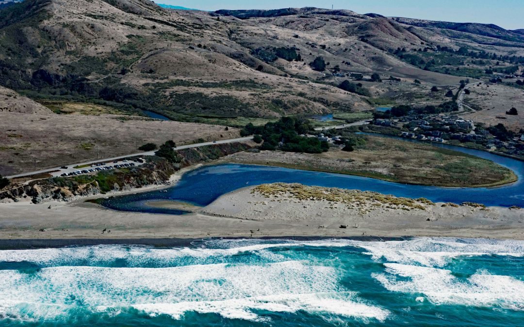
by CoastView | Jul 4, 2026 | 2026, Beaches, Best of 2023, Biodiversity, California, Communities, July 2026, Land Use, Natural History, Parks, Rivers
Listen to the article here https://coastview.org/wp-content/uploads/2026/03/SalmonCreek.mp3 Salmon Creek starts at an elevation of 570 feet (174 m) and flows generally southwest for 19 miles (31 km), draining a watershed of 22,487 acres (9,100 ha) between the Northern...